


April 19-20, 2010
Air Temperatures – The following maximum temperatures were recorded across the state of Hawaii Monday afternoon:
Lihue, Kauai – 77
Honolulu, Oahu – 83
Kaneohe, Oahu – 79
Kaunakakai, Molokai – 78
Kahului, Maui – 83
Hilo, Hawaii – 81
Kailua-kona – 77
Air Temperatures ranged between these warmest and coolest spots near sea level around the state – and on the highest mountains…at 5pm Monday evening:
Kahului, Maui – 78F
Princeville, Kauai – 70
Haleakala Crater – 52 (near 10,000 feet on Maui)
Mauna Kea summit – 39 (near 14,000 feet on the Big Island)
Precipitation Totals – The following numbers represent the largest precipitation totals (inches) during the last 24 hours on each of the major islands, as of Monday afternoon:
0.46 Mount Waialaele, Kauai
0.06 Palolo Fire Station, Oahu
0.00 Molokai
0.00 Lanai
0.00 Kahoolawe
0.29 Puu Kukui, Maui
0.51 Kawainui Stream, Big Island
Marine Winds – Here’s the latest (automatically updated) weather map showing a 1028 millibar high pressure system to the north of the islands….moving east-northeast. This pressure configuration will keep our local trade winds blowing through Wednesday.
Satellite and Radar Images: To view the cloud conditions we have here in Hawaii, please use the following satellite links, starting off with this Infrared Satellite Image of the islands to see all the clouds around the state during the day and night. This next image is one that gives close images of the islands only during the daytime hours, and is referred to as a Close-up visible image. This next image shows a larger view of the Pacific…giving perspective to the wider ranging cloud patterns in the Pacific Ocean. Finally, here’s a Looping IR satellite image, making viewable the clouds around the islands 24 hours a day. To help you keep track of where any showers may be around the islands, here’s the latest animated radar image.
Hawaii’s Mountains – Here’s a link to the live webcam on the summit of near 14,000 foot Mauna Kea on the Big Island of Hawaii. The tallest peak on the island of Maui is the Haleakala Crater, which is near 10,000 feet in elevation. These two webcams are available during the daylight hours here in the islands…and when there’s a big moon rising just after sunset for an hour or two! Plus, during the nights and early mornings you will be able to see stars, and the sunrise too…depending upon weather conditions.
Tropical Cyclone activity in the eastern and central Pacific – Here’s the latest weather information coming out of the National Hurricane Center, covering the eastern north Pacific. You can find the latest tropical cyclone information for the central north Pacific (where Hawaii is located) by clicking on this link to the Central Pacific Hurricane Center. Here’s a tracking map covering both the eastern and central Pacific Ocean. A satellite image, which shows the entire ocean area between Hawaii and the Mexican coast…can be found here. Of course, as we know, our hurricane season won’t begin again until June 1st here in the central Pacific.
Aloha Paragraphs

Trade wind weather pattern
The trade winds will remain active through most of the upcoming week, that is…with slight changes to strength, although remaining generally from the east-northeast to east most of the time. This wind direction has brought back our normal warm tropical weather, after a cooler than normal week last week. As this weather map now shows, we have a 1030 millibar high pressure system to the north of our islands, up around 33 degrees north latitude…and 155 degrees west longitude. This trade wind producing high pressure system is moving east-northeast, with ridges of high pressure extending out to the east and west of the center. We can also see that by looking at those black lines surrounding the high pressure cell, called isobars [and knowing that the circulation is clockwise] – that our winds are now classically easterly trades.
The computer forecast models show that we’ll have a couple of high pressure systems moving by in the middle latitudes this week, or up in what we call the prevailing westerly wind flow…north of 30 degrees latitude. These will keep our trade winds blowing, again with those minor fluctuations in between the migrating high’s most direct influences. Most folks won’t notice these fairly subtle ups and downs in wind speeds, not unless one is riding those colorful sails…meaning the windsurfers and kiteboarders, and the sail boats too. Moderately strong is how we can think about this wind flow for the most part. The computer models continue to point out a change happening right around Friday, into the upcoming weekend. A trough of low pressure both aloft, which may dig down towards the surface, would help put a dent in our local trade wind speeds then. If this were to manifest as some of the models are expecting, we could change over into a light winded, convective weather pattern rather quickly.
As our overlying atmosphere begins to moisten some over the next several days, we should see some increase in windward biased showers going forward. This isn’t expected to be very pronounced over the next day or so, although thereafter we could be looking at a wetter trade wind weather pattern lasting into Thursday. As the winds calm down around Friday, and that trough brings colder air over the state, we could be in for a more significant interruption to our trade wind pattern. Some of the forecast tools at the NWS forecast office in
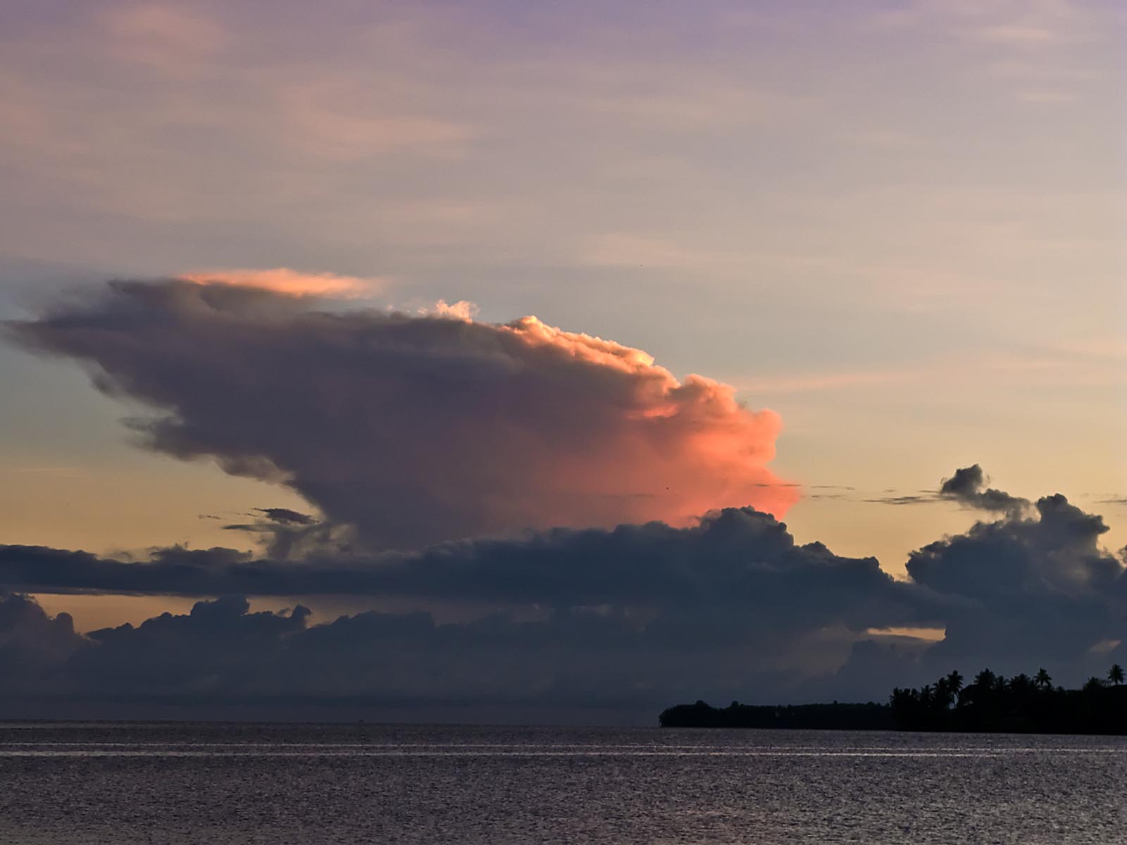
It’s Monday evening as I begin writing this last section of today’s narrative. The weather here in the islands Monday was really nice. There were some clouds around in places, although many areas were basking in total sunshine. Our afternoon high temperatures reflect this quite well, with several airport weather stations reporting 80F+ degree readings. Rainfall was pretty much absent, at least for the most part. There were some showers, but most of them fell last night, and will again perhaps after dark again tonight. As noted in the paragraph above, there’s a better chance for increased shower activity, at least along the windward sides, around mid-week onwards. ~~~ Looking out the window here in Kihei, Maui, before I leave for the drive back upcountry to Kula, it’s still mostly clear. This was a good start back into the work week, with most of the daily news centered around the Iceland volcano. The question on many of our minds, is whether the ash will be able to navigate its way here to Hawaii? At the current level of ash emission, I would doubt whether we would see any influence. Although, I should say that, if there were further eruptions, or more volcanoes coming online, my opinion could easily change. I hope you have a great Monday night, and perhaps we can meet here again on Tuesday, I’ll certainly be here, and hope to see you again as well. Aloha for now…Glenn.
Extra: Excellent illustration of the volcanic ash cloud in Iceland – no scale given for the colors – and nothing to indicate what level in the atmosphere the ash & particulates are. Yet the time sequence to cover that much of northern Europe is quite stunning.
~~~ Thanks to Eliza, Haiku, Maui
Extra2: Facebook pictures of the volcano
Interesting: Airline executives have attacked the flight ban and dispute whether the ash plume unleashed by the volcano in Iceland is still a threat to flight safety. But researchers counter that while the ash cloud may not be visible, it does exist, can even be smelled, and has already damaged aircraft. Airline industry executives are outraged.
"In Germany, a weather balloon hasn’t even been sent up to measure whether and how much volcanic ash is in the air," lambasted Joachim Hunold, CEO of Germany’s second largest airline, Air Berlin. His colleague at Lufthansa, Wolfgang Mayrhuber, seconded him. "No one would fly through a cloud of volcanic ash, but what we have seen over the past three days did not pose any kind of potential danger," he said.
Lufthansa spokesman Klaus Walther said the airlines demanded that "reliable measurements" be used as the basis for any bans on flights. It is true that scientific measurements of the ash plume have been slow to get going. It is barely visible to the naked eye. But a large number of scientists have detected the malicious cloud, and some are irritated that airlines have indirectly accused them of failing to take action.
The volcanic ash plume, they claim, definitely exists. Albert Ansmann of the Leipnitz Institute for Tropospheric Research in Leipzig said it was a "baseless impertinence" to claim that "measurement isn’t taking place in Europe. From the Netherlands to Romania, we know where and how thick the ash cloud is." With a Europe-wide network of laser instruments set up at the start of the decade, "we have been measuring like crazy since Thursday," Ansmann told Spiegel online..
"We measured the cloud for the first time on Sunday night," said Volker Wulfmeyer, an atmospheric physicist at Germany’s University of Hohenheim. "We see a structure at an altitude of eight kilometres, otherwise everything looks very clean." Hohenheim’s measuring devices are located near the Stuttgart Airport. At the Leibniz Institute of Atmospheric Physics in Kühlungsborn on the far north of Germany on the Baltic Sea, scientists have also confirmed the existence of the ash plume.
"We know that it is something solid," said institute director Franz-Josef Lübken. And scientists at the Forschungszentum Jülich research center in the western state of North Rhine-Westphalia said they had also been observing the cloud. Atmospheric researchers are able to detect the cloud using a special measuring device that functions a lot like the laser pistols used by police.
So-called light detection and ranging systems (Lidar) send laser signals straight up into the sky, which are then reflected back by the airborne particles in the atmosphere, so-called aerosols. Using the lidar signals, scientists can determine the type, dimension and the elevation at which the ash cloud is moving — at least where sensors are in place.
Compared to other types of aerosols, ash tends to absorb considerably more light. For the areas between the Lidar points the German Aerospace Center (DLR) is now using a special aircraft to provide further information. On Monday, a modified Falcon 20E jet, registration D-CMET, took off from Oberpfaffenhofen research center in Bavaria and did a round flight over Leipzig, Hamburg, Cologne and Stuttgart.
The aircraft spent three hours at different altitudes. There were two experienced pilots on board the 18-meter long blue and white jet as well as two scientists and a flight mechanic.
Interesting2: There seems to have been a rash of high magnitude earthquakes and volcanic eruptions recently on planet Earth. One begs to know if there is an underlying cause behind it, or if it is all merely coincidental. Can the Earth be undergoing severe seismic shifts? Are the poles reversing? Is our planet stable or should we start building our doomsday caves and space ships? When it seems like there is something abnormal about all this tectonic activity, one needs to defer to the experts on the matter, and they are saying that it is, in fact, nothing unusual. Taking it from the top of this year, Earth has seen some very devastating earthquakes of magnitude 7.0 and higher.
January
The Solomon Islands, an island chain on the border of the Australian and Pacific plates, was hit with a magnitude 7.1 earthquake on January 3rd leaving many homeless but causing no deaths. The epicenter was the sea floor, so the result was a tsunami approximately 10 feet high. 1,000 people were left homeless and 200 homes were destroyed. This quake was the largest in a series of earthquakes to rock the islands. The tremors finally ceased on January 9th.
Haiti’s magnitude 7.0 earthquake on January 12th was by far the most devastating, hitting the impoverished capital of Port-au-Prince and surrounding areas, leaving an astonishing death toll of over 230,000 people and affecting millions of survivors. In terms of damage, it is perhaps the worst natural disaster in the western hemisphere, and the worst since Hurricane Katrina hit New Orleans. The aftermath was an enormous challenge because the earthquake was so catastrophic. Relief aid is still critical and will be for some time to come.
February
The nation of Chile suffered the largest earthquake of the year on February 27th. It had a magnitude of 8.8, and centered just off the coast of the Maule Region of Chile. The 90 second earthquake was felt strongly in six of Chile’s regions, containing over 80% of the population. It was detected north to Peru, and as far east as Buenos Aires in Argentina. The earthquake caused 486 deaths, widespread damage and chaos in the streets. It also triggered a tsunami that devastated several coastal towns in Chile and around the Pacific.
March
The Ryukyu Islands in Japan experienced a 7.0 earthquake on March 8th. This under-reported event caused minimal damage and just a large wave. People were evacuated, but the only damage was a few pipes.
April
The Mexicali Valley in Baja California of Mexico was struck on April 4th with a 7.2 magnitude quake that was felt across the western United States and northwest Mexico. It was the strongest to rock Southern California since the 1992 Landers earthquake. Fortunately, the death toll was low, but there was damage in cities as far as San Diego, California as well as widespread power outages.
On April 7th, the Indonesian island of Sumatra was hit with a 7.7 magnitude earthquake off its west coast. However, unlike the apocalyptic earthquake in 2004 that caused the great Indian Ocean Tsunami that reached heights of 100 feet and killed over 230,000 people, this recent quake caused merely a 40 cm surge and 62 injuries. The 2004 quake was the second largest ever recorded on a seismograph at 9.3 magnitude. It vibrated the whole planet as much as 1 cm and triggered earthquakes as far away as Alaska.
Western China suffered a tragic 6.9 magnitude earthquake on April 13th that killed nearly 2,000 people and injuring another 15,000. The epicenter was on rough terrain in a sparsely populated part Yushu County, near the Tibet Autonomous Region. The Chinese government has mobilized the army to oversee the aftermath and recovery.
Finally, even though it was not an earthquake, the Iceland volcanic eruption still deserves mention as it is an event triggered by seismic activity. The volcano, Eyjafjallajokull, blew its top on April 14th and caused a vast cloud of dust and ash to cover Europe and the North Atlantic. This has led to widespread disruption of air travel in Europe. Air travelers and the airline industry are still reeling from the aftermath of the eruption. Red sunsets have also been seen across all of Europe.
So what are scientists saying at the US Geological Survey? They say 2010 is not showing signs of unusually high earthquake activity. Since 1990, there have been on average 16 magnitude 7.0 earthquakes per year, with a low of 6 and high of 32. So far in April, standing at 6 magnitude 7.0 quakes, this year is on pace to be average.
"While the number of earthquakes is within normal range, this does not diminish the fact that there has been extreme devastation and loss of life in heavily populated areas," said USGS Associate Coordinator for Earthquake Hazards Dr. Michael Blanpied.
Interesting3: A moderate earthquake of 5.3 magnitude shook central and northern Afghanistan early Monday, killing at least seven people and injuring 30. Officials say scores of homes have been damaged in the quake, which has affected three districts. Afghan authorities say access to some areas has been blocked because of damage caused by the quake.
The U.S. Geological Survey says the quake was centered about 190 kilometers northwest of the capital, Kabul, at a depth of 10 kilometers. The earthquake was felt in Kabul, as well as in the neighboring countries of Uzbekistan and Tajikistan.
Afghan President Hamid Karzai issued a statement, saying he is deeply saddened by the casualties. Mr. Karzai ordered relief teams to reach out to those needing aid and called for an immediate report on the earthquake’s damage.
Calvin Says:
Aloha Glenn, glad to see you’re out in the sunshine again. We’re back on the mainland after a wonderful West Maui vacation, and I’ll be checking back frequently to read about the great weather we’re now missing….Calvin~~~Hi Calvin, thanks for your note, glad you had a great vacation to Maui. I trust this time of year, you will have decent weather there on the mainland too. Take care, Aloha, Glenn