Air Temperatures – The following high temperatures (F) were recorded across the state of Hawaii Tuesday…along with the low temperatures Tuesday:
81 – 73 Lihue, Kauai
84 – 72 Honolulu, Oahu
83 – 70 Molokai AP
85 – 65 Kahului AP, Maui
80 – 71 Kona AP, Hawaii
80 – 66 Hilo, Hawaii
Here are the latest 24-hour precipitation totals (inches) for each of the islands Tuesday evening:
1.69 Mount Waialeale, Kauai
1.05 Manoa Lyon Arboretum, Oahu
0.40 Molokai
0.00 Lanai
0.00 Kahoolawe
0.68 West Wailuaiki, Maui
0.52 Pahoa, Big Island
The following numbers represent the strongest wind gusts (mph) Tuesday evening:
22 Waimea Heights, Kauai
25 Kii, Oahu
25 Molokai
21 Lanai
42 Kahoolawe
24 Kahului AP, Maui
25 Puu Mali, Big Island
Hawaii’s Mountains – Here’s a link to the live webcam on the summit of our tallest mountain Mauna Kea (nearly 13,800 feet high) on the Big Island of Hawaii. Here’s the webcam for the 10,000+ feet high Haleakala Crater on Maui. These webcams are available during the daylight hours here in the islands, and at night whenever there’s a big moon shining down. Also, at night you will be able to see the stars, and the sunrise and sunset too…depending upon weather conditions.
Aloha Paragraphs

A cold front northwest of the state
(click on the images to enlarge them)

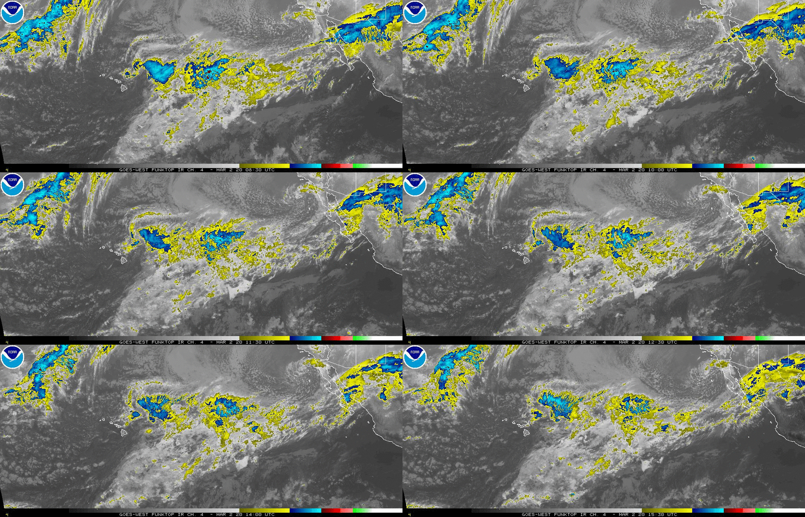
Deep clouds well south and southeast of the islands

Mostly clear to partly cloudy…some cloudy areas

Showers focusing along the windward slopes…on this first day of 2019
Looping image
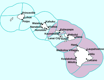
Small Craft Advisory…pink color below
High Surf Advisory…purple color below

~~~ Hawaii Weather Narrative ~~~
Broad Brush Overview: Weather maps show wo high pressure systems far northeast of the state, with an associated ridge to our north, which will keep the gusty trade winds blowing across the state through the week. Clouds and showers will favor windward and mountain areas, with just brief showers expected over some leeward locations. Trade winds will weaken later this coming weekend into early next week…as a ridge of high pressure moves closer to the state.
Details: A cold front will pass north of the state Wednesday, resulting in a slight decrease in the wind speeds. A new high will pass north of the area Thursday and Friday, leading to the trade winds increasing back to rather strong levels. Meanwhile, an upper level ridge of high pressure will persist over the state, keeping the atmosphere stable. Moisture from the passing front may eventually reach the islands toward the weekend.
Looking Ahead: A more pronounced change in our local weather may occur Sunday into early next week, as another front from the northwest will likely approach the islands. A surface ridge from the north may edge closer to the state ahead of the approaching front. This will lead to the weakening of trade winds across the area. Winds may become light enough early next week…for local land and sea breezes to become possible.
Here’s a near real-time Wind Profile of the Pacific Ocean – along with a Closer View of the islands / Here’s the latest Weather Map
Marine Environmental Conditions: A ridge of high pressure north of the state will keep moderate to strong trade winds in place across the marine area through Friday. The trades are then expected to ease over the weekend as a cold front passes by to our north. A Small Craft Advisory (SCA) remains in effect for all Hawaiian waters through Thursday for winds, seas or a combination of the two. A moderate northwest swell, combined with elevated wind swell, will bring seas at or above the SCA threshold across exposed waters.
A moderate northwest swell will build and peak just above advisory levels tonight through Thursday. This swell will gradually taper off with several small reinforcements expected through the weekend. Persistent moderate to strong trades will result in elevated surf along east facing shores through much of the week, with advisory level surf expected.
World-wide Tropical Cyclone Activity
Here’s the latest Pacific Disaster Center (PDC) Weather Wall Presentation covering the western Pacific Ocean, the Indian Ocean, and the Arabian Sea, including Tropical Cyclone 08P (Penny), Tropical Cyclone 36W (Pabuk), and three tropical disturbances being referred to as Invest 94P, Invest 98P, and Invest 99P
>>> Atlantic Ocean: The 2019 hurricane season begins June 1, 2019
Here’s a satellite image of the Atlantic
>>> Gulf of Mexico: The 2019 hurricane season begins June 1, 2019
>>> Caribbean Sea: The 2019 hurricane season begins June 1, 2019
Here’s a satellite image of the Caribbean Sea…and the Gulf of Mexico
>>> Eastern Pacific: The 2019 hurricane season begins May 15, 2019
Here’s the link to the National Hurricane Center (NHC)
>>> Central Pacific: The 2019 hurricane season begins June 1, 2019
Here’s the link to the Central Pacific Hurricane Center (CPHC)
>>> Northwest Pacific Ocean:
Tropical Cyclone 36W (Pabuk)
JTWC textual advisory
JTWC graphical track map
>>> South Pacific Ocean:
Tropical Cyclone 08P (Penny)
JTWC textual advisory
JTWC graphical track map
>>> North and South Indian Oceans / Arabian Sea: No active tropical cyclones
Here’s a link to the Joint Typhoon Warning Center (JTWC)


 Email Glenn James:
Helen Says:
Aloha & hau’oli makahiki to you & your family Glenn!
Mahalo for all you do to keep us safe & informed.
Mahalo,
Helen
~~~ Hi Helen, thanks so much for your New Years well wishes, I appreciate your kind words!
Aloha, Glenn
Diane Says:
Dear Glenn,
Hau’oli Makahiki Hou 🎊
I am so happy that I found your website nearly 10 yrs. ago!!
I want to ditto what Woody said…you are “My Hawaiian” connection!
Hoping my daughter and I will be coming to “your” beautiful islands in 2019❤️
Mahalo, Diane
~~~ Hi Diane, I’m so happy that you found my website as well…wow…10 years ago!
Here’s wishing you and your daughter a wonderful 2019…and best of luck in getting back to paradise!
Happy New Year!
Aloha, Glenn
Nancy Says:
Happy 2019 wishes for all.
Wondering if the vog is no longer an issue?
Mahalo for this wonderful site.
Nancy
~~~ Hi Nancy, my impression is that the vog issue has cleared up for the most part on the Big Island…what a relief!
You are very welcome, I’m happy that you find my website so useful…thanks for your positive feedback!
Happy New Year!
Aloha, Glenn
Maggie Says:
Our rain gauge over here at Giggle Hill in Haiku showed an annual 2018 rainfall total of 88.5″. Although still quite soggy, the 2018 total was considerably (roughly 15%) drier than each of the preceding two years.
Much Aloha for the New Year, Glenn, and thank you for all the support throughout the year.
~~~ Hi Maggie, despite the 15% less than the last couple of years, 88.5o” is still pretty impressive…certainly a lot more than Kihei or Lahaina!
You are very welcome, I greatly enjoy keeping this website going, and have since 1996!
Happy New Year!
Aloha, Glenn
Eliza Says:
Aloha Glenn –
Best wishes to you and yours this New Year’s Eve afternoon. May peace prevail this year. Mahalo nui loa for all your care for us via this site. A hui hou – Eliza
~~~ Hi Eliza, thanks for your New Years well wishes, and I’m with you…may peace prevail.
You are very welcome, I’m so happy to keep this weather website up and current as best I can.
Aloha, Glenn