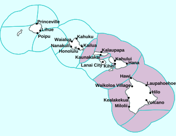
Air Temperatures – The following high temperatures (F) were recorded across the state of Hawaii Thursday…along with the low temperatures Thursday:
83 – 73 Lihue, Kauai
83 – 71 Honolulu, Oahu
84 – 70 Molokai AP
89 – 67 Kahului AP, Maui
83 – 70 Kailua Kona, Hawaii
81 – 69 Hilo, Hawaii
Here are the latest 24-hour precipitation totals (inches) for each of the islands Thursday evening:
3.65 Mount Waialeale, Kauai
3.65 Poamoho RG 1, Oahu
0.56 Molokai
0.02 Lanai
0.01 Kahoolawe
1.33 West Wailuaiki, Maui
1.94 Saddle Quarry, Big Island
The following numbers represent the strongest wind gusts (mph) Thursday evening:
20 Moloaa Dairy, Kauai
27 Oahu Forest NWR, Oahu
27 Molokai
14 Lanai
38 Kahoolawe
21 Maalaea Bay, Maui
31 South Point, Big Island
Hawaii’s Mountains – Here’s a link to the live webcam on the summit of our tallest mountain Mauna Kea (nearly 13,800 feet high) on the Big Island of Hawaii. Here’s the webcam for the 10,000+ feet high Haleakala Crater on Maui. These webcams are available during the daylight hours here in the islands, and at night whenever there’s a big moon shining down. Also, at night you will be able to see the stars, and the sunrise and sunset too…depending upon weather conditions.
Aloha Paragraphs

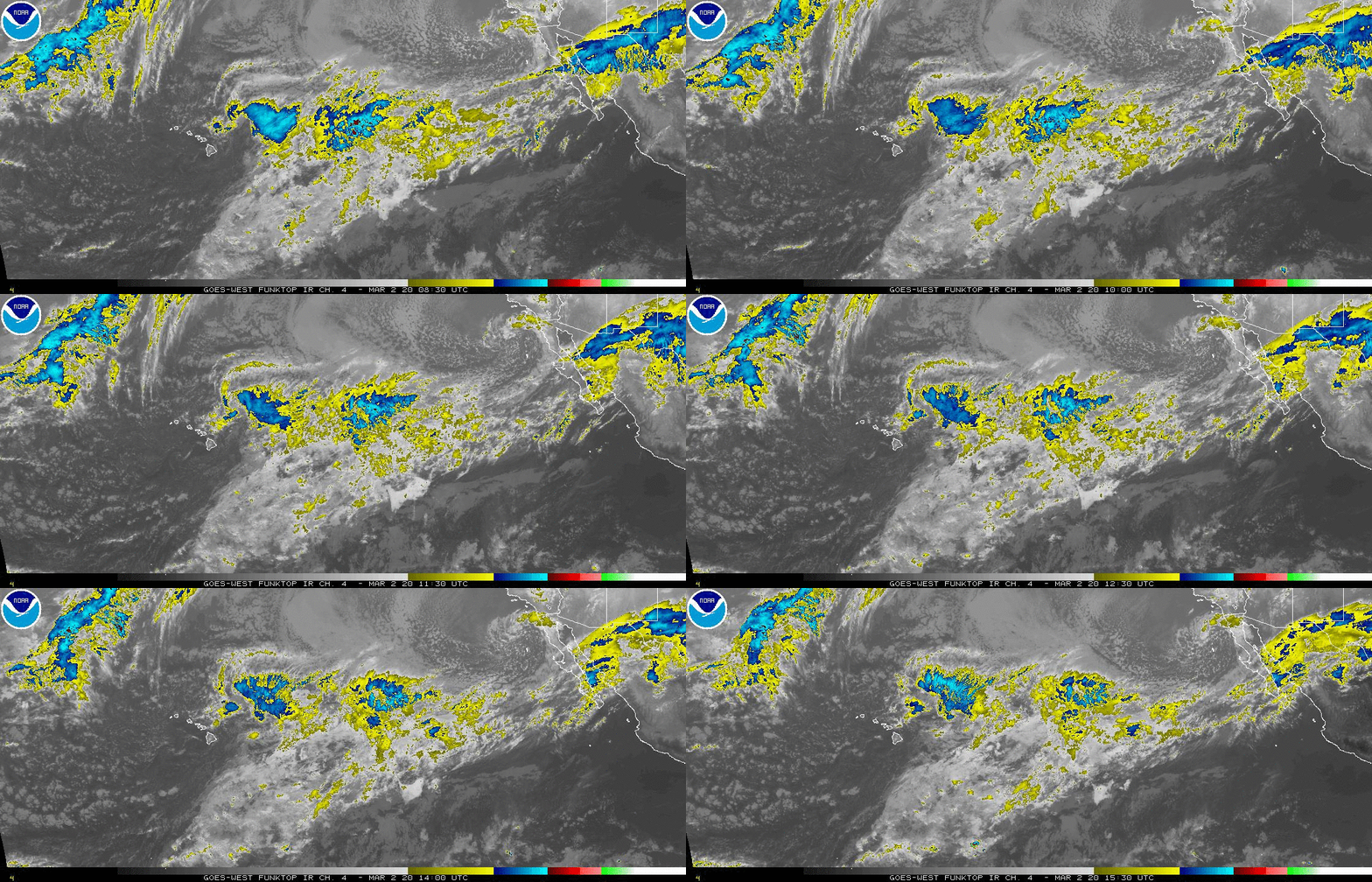
More high level clouds on the horizon…to the west
(click on the images to enlarge them)

There’s a temporary clearing…until more clouds arrive

Partly to mostly cloudy…some clear areas too

Just a few showers
Looping image
There are no warnings or advisories

~~~ Hawaii Weather Narrative ~~~
Broad Brush Overview: The trade winds are beginning to weaken, and will shift to the east-southeast and southeast tonight. Look for light and variable winds with local afternoon sea breezes and nighttime land breezes Friday through the weekend. Showers will remain focused over the windward sides of the islands, especially during nights and mornings. In addition, the afternoon sea breezes may allow clouds and a few showers to develop over some leeward and interior sections. High clouds will stream across most of the state into the weekend. Light winds and mostly dry conditions are expected early next week.
Details: The models indicate that the winds will continue to shift around to the east-southeast and southeast into tonight into Friday, as the surface high moves rapidly away from the state. This will place most of the smaller islands in the lee of the Big Island, leading to lighter winds over most areas. This will likely allow the development of local afternoon sea breezes and nighttime land breezes Friday into the weekend. Despite the lighter winds, it appears some moisture will linger over the windward sides of the islands, which may produce showers through Sunday.
Looking Ahead: The long-range forecast shows that a strong polar jet stream will shift the subtropical ridge southward into the vicinity of the islands. This will likely result in a rather dry and stable weather pattern, with light winds into the middle of next week. Later next week, it’s possible that big changes to the weather pattern may occur, as an upper-level trough and a cold front move toward the state. There are significant differences in the latest guidance from the GFS and ECMWF models however…none-the-less look for likely wetter conditions starting next Thursday.
Here’s a near real-time Wind Profile of the Pacific Ocean – along with a Closer View of the islands / Here’s the latest Weather Map / Here’s the latest Vog Forecast Animation / Here’s the Vog Information website
Marine Environmental Conditions: Moderate to strong trades will continue, and then shift southeast and weaken tonight through the weekend, as cold fronts pass by to the north. An associated ridge will shift southward into the area Friday, which should translate to more of a light and variable wind pattern setting up for this weekend into early next week.
Rough surf is expected to continue along east facing shores, with a gradual downward trend Friday into the weekend as the trades weaken.
For the extended, a northwest swell should begin to fill in locally by the end of the day Saturday, then peak Saturday night into Sunday.
The broad low will be reinforced Friday through Saturday which will bring overlapping large northwest swells Sunday through early next week for north and west facing shores.
Forerunners are expected to arrive Sunday night, then peak through the day Monday, likely driving surf along exposed north and west facing shores well above warning levels. A combination of the large surf and peak monthly tides could lead to additional beach erosion and increase the overwash potential for the typically vulnerable low-lying coastal areas.
Small surf will continue along south facing shores.
World-wide Tropical Cyclone Activity
Here’s the last Pacific Disaster Center (PDC) Weather Wall Presentation covering the Gulf of Mexico, the Caribbean Sea…and the Atlantic Ocean
Here’s the last Pacific Disaster Center (PDC) Weather Wall Presentation covering the Pacific and Indian Oceans, including Tropical Cyclone 33W, Tropical Cyclone 34W (Min-yi)
>>> Atlantic Ocean: No active tropical cyclones
Here’s a satellite image of the Atlantic
>>> Gulf of Mexico: No active tropical cyclones
>>> Caribbean Sea: No active tropical cyclones
Here’s a satellite image of the Caribbean Sea…and the Gulf of Mexico
>>> Eastern Pacific: No active tropical cyclones
Here’s the link to the National Hurricane Center (NHC)
>>> Central Pacific: No active tropical cyclones
Here’s the link to the Central Pacific Hurricane Center (CPHC)
>>> Northwest Pacific Ocean:
Tropical Cyclone 33W (Usagi)
JTWC textual advisory
JTWC graphical track map
Tropical Cyclone 34W (Min-yi)
JTWC textual advisory
JTWC graphical track map
Here’s what the computer models show
>>> South Pacific Ocean: No active tropical cyclones
>>> North and South Indian Oceans / Arabian Sea: No active tropical cyclones
Here’s a link to the Joint Typhoon Warning Center (JTWC)
Interesting: There’s Something Hot Hidden Under East Antarctica – There’s something hot hidden under East Antarctica, and scientists aren’t sure precisely what it is — though they have a pretty good guess.
East Antarctica is a craton, a big continent-size chunk of Earth’s crust. It’s solid, and thick. It’s not supposed to let heat through from inside the Earth. (That makes it different from the thinner crust of West Antarctica, where magma is, in some places, quite close to the surface.)
That craton means that East Antarctica shouldn’t have much melted water at the bottom of its ice sheet. And yet, as researchers revealed in a paper published Nov. 14 in the journal Scientific Reports, there is an unusually high amount of melted water down there. This melt isn’t related to climate change, which causes intense melting at the fringes of the continent; it’s an old, and separate, warm spot in the ice, insulated and kept far away from the atmosphere. Scientists were able to detect it thanks to a survey using specialized, ice-penetrating radar.
It’s not entirely clear what causes the warmth down there. The craton should protect the ice from the Earth’s inner heat. But the research team offered an educated guess: hydrothermal energy. A fault in the crust down there might be full of water, pulsing up and down between the warm depths of the Earth and the bottom of the ice. It provides a conduit for heat to escape and triggers melting.
This hidden heat source is of course interesting, in its own right, but the researchers wrote that it’s especially important because it might influence data used to understand the planet’s deep past.
“This is an area of particular interest,” they wrote in the paper, “as models suggest it [East Antarctica] may contain some of the planet’s oldest ice, preserving records of important climatic transitions.”
Researchers take core samples of that old ice and use them to understand how the planet’s atmosphere has changed over time. Each layer of ice functions as a sort of record of the planet’s air from the period when it formed. Understanding the circumstances under which that ice sat over the millennia since can help researchers improve their understanding of that data.


 Email Glenn James:
tom hughes Says:
Aloha Glenn,
Hoping you have a wonderful Thanksgiving and many mahalo’s for keeping us weather
informed all these years.
Happy Holidays
~~~ Hi Tom, thanks for your Thanksgiving well wishes, and for for positive comment about keeping this website going for all these years…23 years as a matter of fact!
Happy Thanksgiving to you as well!
Aloha, Glenn