


Air Temperatures – The following maximum temperatures were recorded across the state of Hawaii Saturday afternoon:
Lihue, Kauai – 85
Honolulu airport, Oahu – 87
Molokai airport – 84
Kahului airport, Maui – 87
Kona airport – 86
Hilo airport, Hawaii – 84
Air Temperatures ranged between these warmest and coolest spots near sea level – and on the highest mountain tops around the state…as of 830pm Saturday evening:
Barking Sands, Kauai – 79
Hana airport, Maui – 73
Haleakala Summit – 48 (near 10,000 feet on Maui)
Mauna Kea Summit – 36 (near 13,800 feet on the Big Island)
Hawaii’s Mountains – Here’s a link to the live web cam on the summit of near 13,800 foot Mauna Kea on the Big Island of Hawaii. This web cam is available during the daylight hours here in the islands…and when there’s a big moon shining down during the night at times. Plus, during the nights you will be able to see stars, and the sunrise and sunset too…depending upon weather conditions. Here's the Haleakala Crater webcam on Maui…although this webcam is not always working correctly.
Tropical Cyclone activity in the eastern and central Pacific – Here’s the latest weather information coming out of the National Hurricane Center, covering the eastern north Pacific. You can find the latest tropical cyclone information for the central north Pacific (where Hawaii is located) by clicking on this link to the Central Pacific Hurricane Center. A satellite image, which shows the entire ocean area between Hawaii and the Mexican coast…can be found here.
Aloha Paragraphs
Strengthening trades…showers increasing on the
windward sides tonight into Sunday, some elsewhere
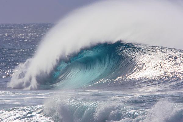
Rising north-northwest swell, high surf advisory
north and some west shores on Kauai to
Maui…through Monday morning
As this weather map shows, we have a near 1026 millibar high pressure system located to the northeast of the islands. At the same time, we find an early season cold front moving by to the north of the islands. Our local winds will gradually become stronger trades Sunday into Monday.
The following numbers represent the most recent top wind gusts (mph), along with directions as of Saturday evening:
24 Port Allen, Kauai – NE
39 Kuaokala, Oahu – NE
30 Molokai – ENE
35 Kahoolawe – NE
33 Kahului, Maui – NE
39 Lanai – NE
29 Kealakomo, Big Island – NNE
We can use the following links to see what’s going on in our area of the north central Pacific Ocean. Here's the latest NOAA satellite picture – the latest looping satellite image…and finally the latest looping radar image for the Hawaiian Islands.
Here are the latest 24-hour precipitation totals (inches) for each of the islands as of Saturday evening:
0.19 Mount Waialeale, Kauai
0.22 Kahana, Oahu
0.11 Molokai
0.00 Lanai
0.00 Kahoolawe
0.33 Puu Kukui, Maui
0.16 Kawainui Stream, Big Island
~~ Hawaii Sunset Commentary ~~
Our local winds will be gradually increasing through Monday. We find a near 1026 millibar high pressure system (weather map), located to the northeast of the islands this evening. As the associated high pressure ridge from this high will be moving northward soon and strengthening, our winds will be on the increase in turn. Already, we find that the NWS office in Honolulu has hoisted small craft wind advisory flags in those windiest areas around Maui County and the Big Island. There will be increasing showers along our windward sides and elsewhere at times too…later this evening through Monday morning.
As we look at this satellite image, it shows a large area of showery clouds, which will bring moisture our way over the next 24-36 hours. This area is what's left of a retired tropical cyclone called Lane, which was active in the eastern Pacific earlier this week. It will arrive later this evening, and bring an increase in showers to our windward sides into Sunday…with a few stretching over into the leeward sides on the strengthening trade winds. Drier weather will present by Monday afternoon, and on for several days.
Friday evening film: I took the drive down to Kahului to meet some friends for dinner Friday evening. Then afterwards we all went to see a new dramatic film called Arbitrage, starring Richard Gere, Susan Sarandon, Brit Marling, Tim Roth, Laetitia Casta, and Nate Parker…among many others. The synopsis: when we first meet New York hedge-fund magnate Robert Miller on the eve of his 60th birthday, he appears the very portrait of success in American business and family life. But behind the gilded walls of his mansion, Miller is in over his head, desperately trying to complete the sale of his trading empire to a major bank before the depths of his fraud are revealed. Struggling to conceal his duplicity from loyal wife Ellen and brilliant daughter and heir-apparent Brooke, Miller's also balancing an affair with French art-dealer Julie Cote. Just as he's about to unload his troubled empire, an unexpected bloody error forces him to juggle family, business, and crime with the aid of Jimmy Grant, a face from Miller's past. One wrong turn ignites the suspicions of NYPD Detective Michael Bryer, who will stop at nothing in his pursuits. Running on borrowed time, Miller is forced to confront the limits of even his own moral duplicity. Will he make it out before the bubble bursts? ~~~ I've always liked Richard Gere and Susan Sarandon, and the critics are being quite kind to this film for the most part, so I was interested in seeing it. As usual, I enjoyed the film, and was entertained without a doubt. It was fun to stick my head into what its like to be in a very rich lifestyle in New York City, driving around in limousines and such. It was also very interesting to see all the things that can go wrong when you stick your neck out there too far! This particular group of friends that I was with were a little reluctant to give grades, although it seemed like a B grade fit pretty well for most of us, and for me, I would give it a good strong B grade…perhaps edging up very near a B+. Here's the trailer if you're interested in taking a peek.
Here in Kula, Maui at 545pm Saturday evening, it was clear overhead and calm…with an air temperature of 75.9F degrees. Our trade winds will increase in strength over the next couple of days, likely peaking out Sunday into Monday, and then begin to ease up some by the middle of the new work week ahead. As mentioned above, we'll see an increase in windward showers this evening, which will stretch into Sunday night and Monday morning as well. Here's a looping radar image so we can keep track of those incoming showers during the next 24 hours. As the winds will be strong and gusty, and this area of showers will be quite large, the leeward sides will get wet at times. There won't be any low pressure trough over the islands as this area of showery clouds moves through, so that most of the precipitation will be in the light to moderately heavy range. ~~~ Well, we made it through another summer season without seeing any tropical cyclones, thank goodness! Saturday was our first day of autumn 2012, with still no signs of tropical cyclone activity anywhere near us. The hurricane season here in the central Pacific lasts until the end of November, so that there is still a chance of something developing with time. Interestingly enough however, much earlier this week, over in the eastern Pacific, we had a tropical cyclone called Lane that was active. It lost all of its associated winds as it crossed over into our central Pacific, although the remnant moisture has been carried our way on the low level trade wind flow. This area of showers is taking aim on our islands, and will arrive pretty soon, and move through our chain of islands Sunday into early Monday. This isn't going to be all that big a deal, although it will bring some wetting rains to our windward sides, and elsewhere at times too, carried our way on the strengthening trade wind flow.
One more thing, since it's fall now, this is the season that I take my vacation, as many of you know. This year is no exception, and I'll be leaving for California on October 4th. I'll spend time in both the northern and southern parts of that state, along with a week long jaunt to Colorado this year as well. I'll be back to Hawaii in November, refreshed and ready to start up these weather narratives again then. You will be able to come to this site however, in my absence, for all your current daily forecasts for all the islands, and for news of my travels along the way too. I'll be telling you more about my trip over the next few weeks. Back to the present, I'll be back in the morning with your next new weather narrative, I hope you enjoy your Saturday night wherever you happen to be spending it! Aloha for now…Glenn.
Extra: youtube music video, Simply Red…You've Got it
World-wide tropical cyclone activity:
Atlantic Ocean/Caribbean Sea: Tropical storm Nadine has spun up again, after being dismissed a few days ago. She is located about 515 miles south of the Azores. Sustained winds were 60 mph, with the center moving west at a very slow 2 mph. The forecast calls for Nadine to become a hurricane by Wednesday morning. Here's the NHC graphical track map, along with the satellite image showing Nadine's position in the upper right hand corner.
Gulf of Mexico: There are no active tropical cyclones
Eastern Pacific Ocean: Tropical storm Miriam (13E) remains active in the eastern Pacific…located about 505 miles south of the southern tip of Baja California. Sustained winds are 65 mph, moving northwest at 8 mph. The NHC forecast this tropical storm to become a hurricane later today. Here's the NHC graphical track map, and a satellite image of Miriam.
Central Pacific Ocean: There are no active tropical cyclones
Western Pacific Ocean: Typhoon Jelawat (19W) is active in the Philippine Sea, located about 470 NM east-southeast of Manila. This tropical cyclone currently has sustained winds of 120 knots, with gusts to near 145 knots. The JTWC shows Jelawat strengthening over the next several days, becoming a super typhoon as early as later today. Here's a graphical track map, along with a satellite image.
South Pacific Ocean: There are no active tropical cyclones
North and South Indian Oceans: There are no active tropical cyclones
Interesting: September 21 was the "International Day of Struggle against Monoculture Tree Plantations", an annual event organized by a coalition of social and environmental groups. Isaac Rojas, a Costa Rican, who is Friends of the Earth International coordinator of its Forest and Biodiversity Program, expresses his view point on industrial plantations. Public environmental awareness has come a long way since September 1962, when Rachel Carson's 'Silent Spring' was published, stimulating the birth of the environmental movement.
This movement may be fifty years old, but nowadays you can feel 'green' by helping destroy forests instead of protecting them, for instance by clicking online a 'plant a tree' button on a seemingly well-meaning website. The reality is that timber plantations have a negative impact on biodiversity, communities, and local economies.
Large-scale plantations are not a solution to climate change nor to biodiversity loss. They are simply a huge concern and cause numerous problems in many countries, for instance in Indonesia. Most people are not aware of these problems. In fact many people, including some 'environmentalists', seem to believe that large-scale tree plantations heavily sprayed with chemicals are desirable or even sustainable.
For these reasons, Friends of the Earth International, together with many social movements around the world, were raising awareness about the problems associated with timber plantations during an 'International Day Against Monoculture Tree Plantations' on September 21st.