


March 12-13, 2010
Air Temperatures – The following maximum temperatures were recorded across the state of Hawaii Friday afternoon:
Lihue, Kauai – 76
Honolulu, Oahu – 82
Kaneohe, Oahu – 78
Kaunakakai, Molokai – 79
Kahului, Maui – 81
Hilo, Hawaii – 77
Kailua-kona – 82
Air Temperatures ranged between these warmest and coolest spots near sea level around the state – and on the highest mountains…at 4pm Friday afternoon:
Barking Sands, Kauai – 80F
Hilo, Hawaii – 68
Haleakala Crater – 50 (near 10,000 feet on Maui)
Mauna Kea summit – 43 (near 14,000 feet on the Big Island)
Precipitation Totals – The following numbers represent the largest precipitation totals (inches) during the last 24 hours on each of the major islands, as of Friday afternoon:
0.45 Mount Waialaele, Kauai
0.37 Oahu Forest NWR, Oahu
0.01 Molokai
0.00 Lanai
0.00 Kahoolawe
0.92 Puu Kukui, Maui
0.47 Kawainui Stream, Big Island
Marine Winds – Here’s the latest (automatically updated) weather map showing high pressure systems to the northeast of Hawaii. At the same time we have a cold front pushing in our direction from the northwest. The winds are gradually losing strength into Sunday.
Satellite and Radar Images: To view the cloud conditions we have here in Hawaii, please use the following satellite links, starting off with this Infrared Satellite Image of the islands to see all the clouds around the state during the day and night. This next image is one that gives close images of the islands only during the daytime hours, and is referred to as a Close-up visible image. This next image shows a larger view of the Pacific…giving perspective to the wider ranging cloud patterns in the Pacific Ocean. Finally, here’s a Looping IR satellite image, making viewable the clouds around the islands 24 hours a day. To help you keep track of where any showers may be around the islands, here’s the latest animated radar image.
Hawaii’s Mountains – Here’s a link to the live webcam on the summit of near 14,000 foot Mauna Kea on the Big Island of Hawaii. The tallest peak on the island of Maui is the Haleakala Crater, which is near 10,000 feet in elevation. These two webcams are available during the daylight hours here in the islands…and when there’s a big moon rising just after sunset for an hour or two! Plus, during the nights and early mornings you will be able to see stars, and the sunrise too…depending upon weather conditions.
Tropical Cyclone activity in the eastern and central Pacific – Here’s the latest weather information coming out of the National Hurricane Center, covering the eastern north Pacific. You can find the latest tropical cyclone information for the central north Pacific (where Hawaii is located) by clicking on this link to the Central Pacific Hurricane Center. Here’s a tracking map covering both the eastern and central Pacific Ocean. A satellite image, which shows the entire ocean area between Hawaii and the Mexican coast…can be found here.
Aloha Paragraphs
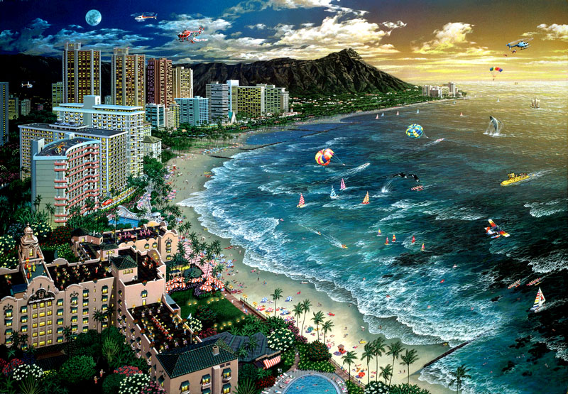
Waikiki water front…artistically portrayed
The trade winds will remain active Friday, although will be trending down in strength as we move into the weekend. The
The computer models show this frontal boundary arriving over
As stated above, and confirmed by looking out the window early this afternoon, the islands are in good shape today, with gradually diminishing trade wind speeds, and a fairly dry and stable atmosphere overhead. The blustery winds of earlier this week are just about done with us, and most of the windward showers will be limited now as well. Here’s a IR satellite image showing the nature of the clouds out and around the islands early Friday afternoon.
It’s Friday evening, as I begin writing the last section of today’s narrative.
As noted above, our weather will remain nicely settled Saturday, and most of Sunday as well. The winds are on the way down, and the rainfall will be generally light. This leaves us in good shape as we head into the weekend. ~~~ I have a good friend whose visiting from California now. This is that long term friend who I went to college with, and is my main weather nut friend in the world. He and I always get together when I go to the mainland on vacation. He’s taking this vacation on his own, leaving his wife and kids behind for a change. At any rate, I’m sure that his presence will influence my personal schedule some during the next 10 days. I’ll be working as usual, although here may be times that I’ll be the tour guide, and this may affect my narrative updates along the way. ~~~ This afternoon Bob and I went to lunch at a restaurant in Wailea, along with a friend from work, who was having a birthday. A last minute decision has us going to a music concert at the Maui Arts and Cultural Center in Kahului. The preformers are Boz Scaggs, and Michael McDonald. These are artists who I’ve listened to for many, many years. Bob and I will have dinner at the MACC, a glass of wine, and then just enjoy the show, put on by these well seasoned performers. ~~~ I’ll catch up with you again on Saturday, I hope you have a great Friday night! Aloha for now…Glenn.
Interesting: Gerard Fryer got paged about 20 times early Thursday morning Hawaii time, signaling a large earthquake had occurred in Chile and there was a potential for a tsunami. The 7.2-magnitude aftershock today, linked to the initial 8.8-magnitude quake that struck the area on Feb. 27, did more than shake the ground. It seemed to send some people into a state of panic, according to Fryer, a geophysicist with the Pacific Tsunami Warning Center (PTWC). "Since then I’ve pretty much been calming people’s ragged nerves," Fryer told LiveScience.
"Private citizens in Chile were calling us because they are alarmed. They are really very nervous about the state of earthquakes. This was a very large aftershock." While the National Emergency Office issued a tsunami alert for areas of Chile, the PTWC said there was "no real tsunami threat," issuing a tsunami information bulletin. Tell that to the people who felt the aftershock. "This was a really a big earthquake in anyone’s book, and clearly it was felt throughout Chile and Argentina, because we were getting quite a few calls from there," Fryer said.
"They ask if there is a tsunami and they actually called while we’re still in the middle of working up the event and figuring out what is going on." They even got calls from Hawaii. "A lot of people sign up for earthquake pages from the U.S. Geological Survey, and so their cell phone wakes them up in the middle of the night and they check it and the next thing they do is call us. Our job is to tell them what they need to know," Fryer said. Fryer’s pages came from seismographs set up all over the world.
A seismograph is a device for measuring the movement of the earth, and consists of a ground-motion detection sensor called a seismometer, coupled with a recording system. The seismic waves that are recorded get sent to computers, which can look at each signal. "Whenever it sees a big signal it will raise a flag," Fryer said. When there are enough "red flags" in close proximity, that’s a sign of a possible tsunami.
The Chilean aftershock was first picked up by a seismometer in South America, then North America and Antarctica, and then out into the wider Pacific Ocean, Fryer said. "Then we look to see if a tsunami has been generated. We look at tide gauges along the shoreline," he added. Indeed a tsunami had occurred, albeit a baby one. The gauges showed a 7.9-inch (20 centimeter) increase in tides above average at Valparaiso, Chile. Though the tsunami threat is over, Fryer said, he feels "sorry for the people."
Interesting2: When we get out the rags and the wash buckets, we have the best of intentions. Cleanliness is a virtue, right? And healthy too! Well, if you use conventional cleaning products, perhaps not. Have you ever cleaned your shower or oven and then had teary eyes, burning nasal tissues, an itchy throat, a headache, or dizziness? Guess what? All of these symptoms and more could have been caused by chemicals commonly found in household cleaners.
Some cleaners even contain suspected carcinogens and reproductive and developmental poisons. Some are thought to cause asthma. According to the American Thoracic Society, using conventional household cleaning sprays once a week may increase the risk of developing adult asthma, and may be responsible for one in every seven adult asthma cases.
The higher the concentration of cleaning products in indoor air, the greater the risk that a child will develop asthma. Some conventional household cleaners also sully the environment with ingredients that can contaminate the air, water, and soil when they are manufactured, used, and thrown away.
Cleaning products with phosphates, for example, can cause "dead zones" in lakes and streams. Triclosan, a chemical used in antibacterial cleaners that has been shown to interfere with thyroid function in animals, is now polluting more than 60% of U.S. streams.
Interesting3: The White House is finalizing rules on the first U.S. greenhouse gas emission standard for automobiles, which would raise average fuel economy 42 percent by 2016 in a bid to slash oil imports and fight climate change. The Environmental Protection Agency and the Transportation Department sent the final rules this week to the White House’s Office of Management and Budget, according to a notice posted on the OMB website.
The higher mileage requirements will reduce U.S. greenhouse gas emissions by 900 million metric tons and save 1.8 billion barrels of oil over the life of vehicles built during the 2012-2016 model years, according to the EPA. The vehicle emissions standards will be phased in starting with the 2012 model year, raising fuel economy to an average 35.5 miles per gallon by the time the 2016 models are ready — up 42 percent from the current 25 miles per gallon.
Lower U.S. gasoline consumption could make more crude supplies available in the world market, which in turn could put downward pressure on oil prices. Phil Flynn, an analyst with PFGBest Research in Chicago, said the new standards will definitely lower U.S. oil demand, but that could be offset with higher fuel use in other countries.
"We can save it here, but are these cars going to be marketable in China, where all the demand growth is going to come from?" he asked. The rules follow an EPA finding that greenhouse gas emissions from new vehicles contribute to air pollution, a danger to public health.
Interesting4: More 12 year olds have used potentially lethal inhalants than have used marijuana, cocaine and hallucinogens combined, according to data released March 11 by the Substance Abuse and Mental Health Services Administration (SAMHSA) in conjunction with the 18th annual National Inhalants & Poisons Awareness Week. The National Inhalant Prevention Coalition (NIPC) and SAMHSA kicked off National Inhalants and Poisons Awareness Week at a press conference featuring information and personal stories about the dangers of inhalant use or "huffing."
One of the leading participants in this year’s event was the American Osteopathic Association (AOA), which represents more than 67,000 osteopathic physicians (DOs). The organization urged its members to take continuing education programs designed to help enhance physician awareness of this risk to youth. The need to increase awareness of this public health risk among physicians, parents and others cannot come too soon for Kevin Talley, the father of Amber Ann Suri, who died in February 2009 after huffing.
Her parents suspected something was going on when they noticed she had a pungent smell, glassy eyes, and complained about sinus problems. Although she was taken to a doctor, her real problem was not identified and she was treated only for her sinus symptoms. She died shortly thereafter. Ashley Upchurch, a 17 year-old recovering from addiction to inhalants and other drugs, spoke at the press conference about the consequences of huffing, the importance of identifying and treating inhalant abuse and the hope of recovery.
"Inhalants were a cheap, legal, and an intense high that would also enhance the feeling I would get from other drugs," she said. "These highs nearly destroyed my life." In recovery for two years, Ashley now participates in a recovery program and is "giving back by sharing my story of hope with others." Young people sniff products such as refrigerant from air conditioning units, aerosol computer cleaners, shoe polish, glue, air fresheners, hair sprays, nail polish, paint solvents, degreasers, gasoline or lighter fluids.
Youngsters intentionally inhale these substances to get high. Most parents are not aware that use of inhalants can cause "Sudden Sniffing Death" — immediate death due to cardiac arrest — or lead to addiction and other health risks. SAMHSA data from the 2006-2008 National Surveys on Drug Use and Health show a rate of lifetime inhalant use among 12 year olds of 6.9 percent, compared to a rate of 5.1 percent for nonmedical use of prescription type drugs; a rate of 1.4 percent for marijuana; a rate of 0.7 percent for use of hallucinogens; and a 0.1 rate for cocaine use.
"We continue to face the challenge of increasing experimentation and intentional misuse of common household products among the youngest and most vulnerable segments of our population — 12 year olds. The data are ominous and their implications are frightening because of the toxic, chemical effects of these legal products on growing minds and bodies.
One of the front-line defenses against inhalant use is the family health care provider. This is why the action of the American Osteopathic Association is so important and why we are so proud that they are joining us and our partners in this public health campaign," Harvey Weiss, NIPC executive director, said.
Interesting5: A network of ancient rivers and streams that once flowed beneath Australia’s Simpson desert – famed for its dune fields – has been mapped in a new study. The map could lead the way to valuable minerals and water resources in this drying continent. Michael Hutchinson and John Stein of the Australian National University in Canberra extracted data from previous ground surveys to map an ancient river system 35 meters below the surface of the desert.
They think the channels are among the world’s oldest at 50 million years old, when the now barren land would have been lush and well watered. The dead rivers are a reminder of the great climate changes that have taken place in the continent, says Robert Craddock of the Smithsonian Institute in Washington, a co-author on the paper.
Thanks to data from remote sensing satellites, mapping buried waterways has become fairly commonplace worldwide. But Hutchinson says the Simpson desert rivers are too deep to detect using standard satellite techniques. And the massive sand dunes, towering up to 20 meters high and hundreds of kilometers in length, interfere with this kind of analysis.
So the team took ground surveys of the desert’s surface contours and used software developed by Hutchinson to join all the lower points on the map to devise a complete river system. To remove the distortions caused by the sand dunes – which appeared just 1 million years ago, long after the ancient river channels formed – the team used only points between the dunes to give an accurate picture of the underlying topography.
"We removed the data recorded over the sand dunes," says Hutchinson, and the final results "looked sensible". "They naturally connect with the current streams of the Simpson desert, and they are all draining toward the lowest point in the landscape," he says. The ancient waterways of the Simpson are still influencing the landscape, says Craddock.
They provide pathways for groundwater, so dictating the location of desert lakes. The map may also aid petroleum and mineral exploration, he adds, because the location of deposits is associated with underground streams. Because there is no way to detect directly water systems this far underground, the results cannot be validated, says Hutchinson.
But despite this, James Bowler of the University of Melbourne believes the methodology is "very accurate". "The data is telling us a whole new story about the ancient face of the land often obscured by the Simpson desert dunes, and this is a very powerful tool," he says. "It’s going to give us a tremendous amount of applied value in terms of mining and groundwater."
But Elisabeth Bui, an expert in environmental modeling of earth surfaces at CSIRO Land and Water in Canberra, doubts the practical usefulness of this study. "I doubt that there is heaps of underground water stored in these palaeochannels in the Simpson desert," she says.
Interesting6: A mold-resistant bean, a German pink tomato and a wild strawberry plucked from the flanks of a Russian volcano are just some of the crops whose seeds are being tucked away this week in a giant vault dug out of a mountainside of the Norwegian island Svalbard. With these new deposits, the so-called Svalbard "Doomsday" Global Seed Vault will reach its half-million mark of seed varieties. The giant icebox of sorts, which was officially opened on Feb. 26, 2008, is meant to protect the world’s crop diversity from natural or manmade disasters.
"Reaching the half million mark brings mixed emotions, because while it shows that the vault at Svalbard is now the gold standard for diversity, it comes at a time when our agriculture systems are really sitting on a knife’s edge," said Cary Fowler, executive director of the Global Crop Diversity Trust, which partners with the Norwegian government and the Nordic Genetic Resource Center in Sweden in operating the vault. Fowler added, "If crops and agriculture don’t adapt to climate change, neither will humanity."
The Vault is dug into the Platåberget mountain, which means "plateau mountain," and is located near the village of Longyearbyen, Svalbard – a group of islands north of mainland Norway. The arctic permafrost offers natural freezing for the seeds, while additional cooling brings the temperatures down to minus 0.4 degrees Fahrenheit (minus 18 degrees Celsius). And if the mountain of snow enshrouding the storage rooms isn’t enough protection, what better body guard than one of nature’s biggest beasts.
"The region on Svalbard surrounding the Seed Vault is remote, severe, and inhabited by polar bears," according to the Global Crop Diversity Trust, which helps to support the vault’s operations. The preciousness of such seeds is reflected in the inaccessible nature of the vault. "Anyone seeking access to the seeds themselves will have to pass through four locked doors: the heavy steel entrance doors, a second door approximately 115 meters down the tunnel and finally the two keyed air-locked doors," the Trust writes.
"Keys are coded to allow access to different levels of the facility. Not all keys unlock all doors." Like all seeds coming to the vault, the new ones are duplicates of those from other collections. Material directly acquired by plant breeders to develop disease-resistant and "climate-ready" crops, and to meet the challenge of rapidly growing populations, is maintained by gene banks, not the seed vault.
"Svalbard is a fail-safe backup to be used whenever a depositing seed bank loses part or all of its collection, but we should focus equally on averting the disasters in the first place," Fowler said. Other seeds shipped to the doomsday vault include: semi-dwarf wheat and rice from the early 1960s; disease-resistant soybeans; and the German pink tomato, a hardy sweet-flavored tomato transported to Iowa in 1883 by a Bavarian immigrant.
"We’re seeing in several of the soybean varieties intriguing traits that could allow farmers to confront such problems as drought or extreme heat, shorter or longer growing seasons, or higher levels of CO2 [carbon dioxide]," said Dave Ellis, curator at the U.S. Department of Agriculture, National Center for Genetic Resources Preservation.
Gayle Lundquist Says:
Hi Glenn~
Our dear friends Steve and Lori turned us on to you. They have a home in Kapalua and we are currently visiting. We rely on your reports AM and PM and appreciate your site very much. I would love to suggest including water temps around the island as well, if that is possible. We return to CA on Tues…wish we had another 10 days like your good friend just arriving. Have fun…we’ve had a blast! Thanks again!! Gayle from Carmel, CA~~~Hi Gayle, so nice to read your note, thanks for taking the time, towards the end of your stay here in Kapalua, to write a few words! First of all, the water temperatures are given on the Beach Page of this website. I trust you’ve had an excellent visit, and perhaps you’ll return a few times after getting back in CA, to rekindle the Maui afterglow? Thanks for enjoying my website, feedback like yours makes it all worth doing. Aloha, Glenn.
Jimmy Says:
We are going with my wife on Maui. And we just want to say a big THANK YOU for all your advice and help!!!~~~You are very welcome Jimmy! I trust you will have a great time here, Aloha, Glenn