Air Temperatures – The following maximum temperatures were recorded across the state of Hawaii Thursday afternoon: Lihue, Kauai – 79
Honolulu, Oahu – 85 Kaneohe, Oahu – 80 Kahului, Maui – 87 Hilo, Hawaii – 82 Kailua-kona – 84 Air Temperaturesranged between these warmest and coolest spots near sea level, and on the highest mountains…at 5 p.m. Thursday evening: Port Allen, Kauai – 81F Hilo, Hawaii – 76
Haleakala Crater – 45 (near 10,000 feet on Maui)
Mauna Kea summit – 32 (near 14,000 feet on the Big Island) Precipitation Totals – The following numbers represent the largest precipitation totals (inches) during the last 24 hours on each of the major islands, as of Thursday afternoon: 1.45 Mount Waialaele, Kauai
0.32 Poamoho 2, Oahu
0.00 Molokai
0.00 Lanai
0.00 Kahoolawe 0.29 Puu Kukui, Maui
0.35 Kealakekua, Big Island Weather Chart – Here’s the latest (automatically updated) weather mapshowing a high pressure system remaining in place far northeast of the islands. A trough of low pressure has formed and will linger near Kauai into Sunday. A large high far northwest of the state will settle north of the islands late Saturday into Sunday. The high will drift slowly eastward Monday as the trough drifts westward and weakens. Our local winds will remain quite light and from the south to southeast.
Satellite and Radar Images: To view the cloud conditions we have here in Hawaii, please use the following satellite links, starting off with theInfrared Satellite Image of the islands to see all the clouds around the state during the day and night. This next image is one that gives close images of the islands only during the daytime hours, and is referred to as a Close-up visible image. This next image shows a larger view of the Pacific…giving perspective to the wider ranging cloud patterns in the Pacific Ocean. To help you keep track of where any showers may be around the islands, here’s the latest animatedradar image.
Hawaii’s Mountains – Here’s a link to the live webcam on the summit of near 14,000 footMauna Kea on the Big Island of Hawaii. The tallest peak on the island of Maui is theHaleakala Crater, which is near 10,000 feet in elevation. These two webcams are available during the daylight hours here in the islands…and when there’s a big moon rising just after sunset for an hour or two! Plus, during the nights and early mornings you will be able to see stars, and the sunrise too…depending upon weather conditions.
Aloha Paragraphs
Rain heading our way…first on Kauai Photo Credit: Flikr.com
Winds slowed down Thursday, and began turning south and southeast. As we move through the next several days, perhaps through the rest of this week, our local winds will arrive from more southerly latitudes, which will bring deep tropical moisture into the state. These winds are expected to be on the light side, but there may be some localized gusty conditions, especially in the vicinity of thunderstorms. The trade winds are expected to return early next week, that is until around Thanksgiving…when another batch of lighter southeast winds arrives.
The weather here in the islands…will turn wetter soon. The latest computer model runs continue to show a cold front approaching from the northwest. At the same time, we’ll soon find an upper air trough of low pressure, with its cold air aloft, destabilizing our atmosphere. These two influences will set the stage for more localized heavy rains early Friday into the weekend. Windward biased showers will return as we move into early next week…with hopefully more of our famous Hawaiian sunshine returning to the leeward beaches then! The forecast heavy rains will ride in on south to southeast winds, providing the chance of a flooding precipitation event here in Hawaii. The seriousness of this threat has been captured by the issuance of a flash flood watch across the entire Hawaiian Island chain Thursday evening. This will very likely change to a flash flood warning, as the heavy precipitation begins Friday…first on Kauai. This rainfall will vary in its intensity, but there will be heavy downpours, which will cause localized flooding in many areas.
It’s early Thursday evening here in Kihei, Maui, as I begin writing this last paragraph. We continue onward towards what looks like a very wet period of weather, which looms right around the corner. Here’s the latest satellite imagery, which will help you see what’s coming our way. Our weather will turn wetter, after what was a nice day Thursday. Actually, other than quite a bit of high cirrus clouds, skies were mostly dry for a change. Here’s the looping radar image, which will show where the heaviest rains will be falling…and already was showing some increase to the west of Kauai. ~~~ So, everything seems to be set in place now, or will be soon, as all the necessary components of the upcoming wet weather period move in our direction. Kauai will see the rain first, then Oahu on Friday, with the other islands getting into the heart of this wet period during the day Saturday into the night. ~~~ I’ll be back very early Friday morning with your next new weather narrative, be well until then! Aloha for now…Glenn.
Interesting:
Close to 16,000 citizens from 149 countries have signed up to join numerous restaurants, retailers and chefs in boycotting Mediterranean bluefin tuna — until stocks have recovered and the fishery is properly controlled and managed. WWF has presented the petition, on behalf of 15,941 concerned individuals, to top fisheries decision-makers today in Marrakech, Morrocco where the 46 Contracting Parties of the International Commission for the Conservation of Atlantic Tunas (ICCAT) are meeting to decide the future of bluefin tuna in the Mediterranean. “Thousands of consumers from across the world are voting with their wallets by not buying or eating endangered Mediterranean bluefin tuna,” said Dr Sergi Tudela, Head of Fisheries at WWF Mediterranean. “WWF hopes ICCAT acts on this strong plea from global citizens.” As increasing numbers of responsible consumers say no to bluefin, the list of chefs, restaurants and retailers around the world that have stopped serving and selling bluefin is also growing.
The trailblazers — Auchan in France, Carrefour in Italy, Coop in Italy and Switzerland, ICA in Norway, Moshi Moshi in the UK, and Memento in Spain — have now been joined by many others in taking bluefin off their menus and shelves. These are Benoît Delbasserue French chef; Casino French supermarket; Coop Norwegian supermarket; Deutsche See German processor; Elior French restaurant chain; Gottfried Friedrichs German processor; M&J UK seafood supplier; Migros Swiss supermarket; Relais du Parc French restaurant; Sergi Arola, Dario Barrio, Karel Bell — Spanish chefs; and over 50 restaurants in Monaco. “Bluefin tuna was one of the star items on our menu, but the critical situation of the stocks made me take it off the plates so that diners can keep enjoying it in years to come,” said Sergi Arola, Spanish celebrity chef. “I believe it’s my duty to take care of the sustainability of a dish as well as its taste.” “ICCAT members are under pressure from numerous countries, international institutions, scientists and even their own review to close this fishery and allow it to recover,” said Dr Tudela. “Now they are also coming under pressure from more and more of their own citizens, their noted chefs, their leading restaurants and their leading marketers.
Interesting2:
The rapid ice melt and temperature rise in the Arctic region has been widely reported, with a record summer ice melt occurring last year in the Arctic ocean, and a near-record this year (the volume of sea ice, if not the extent, did reach a record low this year, with autumn temperatures in the Arctic 9 degrees Fahrenheit above normal). The February 2007 report from the Intergovernmental Panel on Climate Change (IPCC) stated that humanity’s impact on climate is felt on every continent on the globe except Antarctica. A recent study by researchers from the U.K. Meteorological Office’s Hadley Center and Environment Canada have compared over fifty years of data records from Antarctic weather station and a century’s worth of weather data from the Arctic. By comparing the data between the Arctic and Antarctic, as well as against several computer climate simulations, the researchers have determined that natural influences, such as amount of sunlight or volcanic eruptions, could not account for the warming trends.
The data didn’t match the measured temperature change until increasing levels of greenhouse gases were added to the equation. Peter Stott, climate modeler for the Hadley Centre and co-author of the study published in the journal Nature Geoscience says “We have detected the human fingerprint in both the Arctic and Antarctic regions." In the past few decades average temperatures in the Arctic have risen by about 3.6 degrees Fahrenheit, in Antarctica a bit less than 1.8 degrees Fahrenheit. The collapse of the Larson B and Wilkins ice shelves on the Antarctic Peninsula, which scientists say has warmed more than any other part of the world, has already been linked to human-caused global warming. Some researchers fear they may have actually underestimated the temperature change by giving equal weight to readings from the cold continental interior (made even cooler in the spring and summer by the ozone hole over the region) and coastal regions where warming is more pronounced.
Interesting3:
Turtles nesting along the Mississippi River and other areas are altering their nesting dates in response to rising temperatures, says a researcher from Iowa State University. Fred Janzen, a professor in ecology, evolution and organismal biology, has studied turtle nesting habits and also accumulated research going back decades in order to track the habits of the turtles to find out when they make nests and lay eggs. "The results have been astonishing," says Janzen. "In some cases such as regional populations of red-eared sliders, they are now nesting three weeks earlier than they did in the early 1990s. That is the fastest response to climate change of any species that I know of." The turtles that changed their nesting habits were not only young turtles that are nesting for the first time, said Janzen, but were also older turtles that were changing their habits. This trait, called plasticity, helps animals alter their behavior in the short term until inherited behavior takes over. "What we found was that in the late 1980s, painted turtles started nesting in early June, now it is on the order of 10 days or more earlier," said Janzen. "These behaviors are showing how the plasticity of the species is helping them survive, but we are wondering what the limit is to their ability to adapt."
Interesting4:
Mars has vast glaciers hidden under aprons of rocky debris near mid-latitude mountains, a new study confirms, pointing to a new and large potential reservoir of life-supporting water on the planet. These mounds of ice exist at much lower latitudes than any ice previously found on the red planet. "Altogether, these glaciers almost certainly represent the largest reservoir of water ice on Mars that’s not in the polar caps," said John Holt of the University of Texas at Austin and the main author of the study. "Just one of the features we examined is three times larger than the city of Los Angeles and up to one-half-mile thick, and there are many more." The gently sloping mid-latitude debris flows have puzzled scientists since they were revealed by NASA’s Viking orbiters in the 1970s — they looked very different than the fans and cones of debris found near mountains and cliffs in Mars’ equatorial regions.
Interesting5: There used to be tens of millions of bison ranging from Alaskato Mexico, but they were nearly wiped out by commercial hunting and habitat loss. Fewer than 10 percent of U.S.residents know how many bison remain in the United States, according to a new Wildlife Conservation Society survey. So: About 500,000 bison remain in the United States, mostly on private ranches. Only about 9,000 plains bison are considered free-ranging, in the U.S., Canada, and Mexico. The American Bison Society wanted you to know all this, and also this: In the survey, 40 percent said they have tried bison, and 83 percent thought it was as good or better-tasting than beef. That suggests that "one road to bison conservation may be a pragmatic, market-based approach, namely to grow sustainable markets for wild, free-ranging bison meat," said Kent Redford of the WCS.
Air Temperatures – The following maximum temperatures were recorded across the state of Hawaii Wednesday afternoon: Lihue, Kauai – 78 Honolulu, Oahu – 83 Kaneohe, Oahu – 79 Kahului, Maui – 82 Hilo, Hawaii – 80
Kailua-kona – 83 Air Temperaturesranged between these warmest and coolest spots near sea level, and on the highest mountains…at 4 p.m. Wednesday afternoon: Barking Sands, Kauai – 82F Kaneohe, Oahu – 76
Haleakala Crater – 45 (near 10,000 feet on Maui)
Mauna Kea summit – 34 (near 14,000 feet on the Big Island) Precipitation Totals – The following numbers represent the largest precipitation totals (inches) during the last 24 hours on each of the major islands, as of Wednesday afternoon:
0.23 Mount Waialaele, Kauai
0.37 Oahu Forest NWR, Oahu
0.15 Molokai
0.00 Lanai
0.00 Kahoolawe 6.87 Puu Kukui, Maui
1.84 Waiakea Uka, Big Island Weather Chart – Here’s the latest (automatically updated) weather mapshowing a high pressure system remaining in place far northeast of the islands through Friday. A weak trough will form and linger near Kauai Friday night into Sunday. A large high far northwest of the state will settle north of the islands late Saturday into Sunday. The high will drift slowly eastward Monday as the trough drifts westward and weakens.
Satellite and Radar Images: To view the cloud conditions we have here in Hawaii, please use the following satellite links, starting off with theInfrared Satellite Image of the islands to see all the clouds around the state during the day and night. This next image is one that gives close images of the islands only during the daytime hours, and is referred to as a Close-up visible image. This next image shows a larger view of the Pacific…giving perspective to the wider ranging cloud patterns in the Pacific Ocean. To help you keep track of where any showers may be around the islands, here’s the latest animatedradar image.
Hawaii’s Mountains – Here’s a link to the live webcam on the summit of near 14,000 footMauna Kea on the Big Island of Hawaii. The tallest peak on the island of Maui is theHaleakala Crater, which is near 10,000 feet in elevation. These two webcams are available during the daylight hours here in the islands…and when there’s a big moon rising just after sunset for an hour or two! Plus, during the nights and early mornings you will be able to see stars, and the sunrise too…depending upon weather conditions.
Aloha Paragraphs
Thursday should be drier and quite nice Photo Credit: Flikr.com
A high pressure system to the north-northeast will move eastward rapidly, allowing our gusty trade winds to slow down Thursday. Winds will slow down Thursday, turning to the south and southeast later in the day into the weekend. There’s a chance, depending on just which way the winds turn, that volcanic haze could move up through the island chain again then. It appears that trade winds will return early next week, helping to clear our hazy atmosphere then.
This trade wind flow will keep showers falling along the windward sides, although should begin to ease up later Thursday. The windward sides will continue to feel quite cool, with all the showers falling. As the trade winds slow down, and are replaced by southeast winds, our weather will change. The latest computer model runs continue to show a cold front approaching from the northwest. At the same time, later Thursday into Friday, we’ll find a new upper air trough, with its cold air aloft, destabilizing our atmosphere. These two new influences will set the stage for more localized heavy rains Friday into the weekend. Windward biased showers will return as we move into early next week…with hopefully more of our famous Hawaiian sunshine returning to the leeward beaches then! The forecast heavy rains will ride in on south to southeast winds, providing the chance of a flooding precipitation event on those facing coasts and slopes. It appears that the most rain will occur over Kauai and Oahu, the islands closest to the trough that is expected to be located to the west of Kauai…although that doesn’t mean that the other islands won’t see generous rainfall too. The most recent Hydrologic Outlook Statement, issued by the
NWS forecast office in Honolulu, continues to firmly suggest that we’ll move back into another wet weather scenario starting Friday. This would be quite a confronting bit of news on its own, which is made even more serious, given the fact that the current wet soils won’t be dried out…which makes serious flooding a possibility. We need to closely monitor this situation over the next few days, so that we’re as prepared as possible when this next onslaught of moisture arrives in the Aloha state.
It’s early Wednesday evening here in Kula, Maui, as I begin writing this last paragraph. If you had a chance to read down through the paragraphs above, you will be aware of the wet weather prospect that looms up ahead. This of course holds true after a wet several days that we’ve just come through…at least in many areas in the islands. All the necessary ingredients seem destined to line up in such a way, that heavy precipitation concerns seem warranted. Here’s the latest satellite image, so you see the impressive amount of high clouds to the west of Kauai, which looms on our horizon. The radar images aren’t showing much now, but we’ll need to include that looping image at some point towards Friday…as the expected rains work their way in our direction. ~~~ I’m at home here in Kula looking out the window of my weather tower. I see lots of clouds over towards Makawao and Haiku, where showers and off and on rainbows seem planted. Elsewhere it’s partly cloudy, with those high cirrus clouds around too, which will provide a nice sunset. ~~~ I’ll be back very early Thursday morning with your next new weather narrative from paradise. I hope you have a great Wednesday night until then! Aloha for now…Glenn.
Interesting:
The recovery of Amur tiger tracks in Changbaishan in north-eastern China has given conservationists hope for a species that is rarely seen in that area. A walker in the region spotted the tracks and recorded them on his mobile phone. A century ago such a sight would have been fairly common, with hundreds of Amur tigers, on the prowl. It is thought that now only about 20 remain in the area. “Tiger tracks found in this area show that the tigers are moving deeper into China from the Sino-Russian border,” said Fan Zhiyong, director of WWF-China’s Species Program. “Therefore, it is of critical importance that tiger conservation occurs in the whole Changbaishan area.” There are just over 500 Amur tigers in the wild and it is listed as critically endangered on IUCN’s red list of endangered species. The main threats to Amur tigers in north-eastern China are habitat degradation, poaching, fragmentation of tiger habitats and a small prey population to feed from.
WWF and its partners have been focusing their efforts to save the Amur tiger on a number of fronts: helping ungulate populations such as wild boar and roe deer — which are the tiger’s main prey — to recover by helping communities find alternative livelihood options; stopping poaching by helping local authorities carry out anti-poaching activities; and increasing and connecting protected tiger habitats so tigers can safely move from one area to another. Thanks to vigorous anti-poaching and other conservation efforts on the Russian side, the tiger population there has become stable over the last decade and is beginning to increase. As such, should the feeding population in Changbaishan be restored and protected in an effectively managed tiger habitat, then those tigers across the border may come to occupy the area.
Interesting2:
A deep covering of snow has arrived for several states in the northeast USA, in the first major snowstorm of the winter. Areas to the southeast of the Great Lakes were hardest hit, as cold air from Canada and the Arctic swept southeastwards. Several inches of ‘lake effect snow’ were dumped on states including Michigan, New York, Pennsylvania and Ohio. Lake effect snow is produced when cold Arctic air moves over relatively warm, moist expanses of lake water, picking up water vapour which is then deposited as snow to the lee of the lakes. The effect is enhanced when the cold, moisture laden air then moves across hills and mountains, often producing intense periods of snowfall over areas referred to as ‘snow belts’. Over the snow belt to the southeast of the Great Lakes, low lying areas widely received 2 to 4 inches of snow during Monday and Tuesday. In higher places such as West Leyden, New York State, 28 inches of snow had fallen by Tuesday night. The cold, wintry weather is likely to stick around until at least Friday, as forecasters are predicting another Arctic surge of cold air over the region on Thursday.
Interesting3:
Honey bees, whose numbers are falling, must be given flowery "recovery zones" in Europe‘s farmlands to aid their survival, a leading EU lawmaker said Wednesday. Bees pollinate numerous crops and scientists have expressed alarm over their mysterious and rapid decline. Experts have warned that a drop in the bee population could harm agriculture. "If we continue to neglect the global bee population, then this will have a dramatic effect on our already strained world food supplies," said Neil Parish, who chairs the European Parliament’s agriculture committee. Parish, a British conservative, said vast swathes of single crops such as wheat often made it difficult for bees to find enough nectar. But he said farmers could help bees by planting patches of bee-friendly flowers — including daisies, borage and lavender.
"We’re talking about less than one percent of the land for bee-friendly crops — in corners where farmers can’t get to with their machinery, round trees and under hedges." Genetically modified crops, climate change, pesticides and modern farming techniques have all been blamed for making bees vulnerable to parasites, viruses and other diseases. More research is needed to pin down the exact cause of the declining number of bees, the European Parliament is expected to recommend in its vote Wednesday evening. "The experts themselves are mystified," said Parish. "A failure to act now could have catastrophic consequences." The EU parliament’s vote will carry no legal weight but is intended to nudge the European Commission and EU member states to take the matter seriously.
can also spoil the milk, making it taste bitter and turn thick and sticky. Now scientists have discovered new species of bacteria that can grow at low temperatures, spoiling raw milk even when it is refrigerated. According to research published in the November issue of the International Journal of Systematic and Evolutionary Microbiology, the microbial population of raw milk is much more complex than previously thought. "When we looked at the bacteria living in raw milk, we found that many of them had not been identified before," said Dr Malka Halpern from the University of Haifa, Israel. "We have now identified and described one of these bacteria, Chryseobacterium oranimense, which can grow at cold temperatures and secretes enzymes that have the potential to spoil milk."New technologies are being developed to reduce the initial bacterial counts of pasteurized milk to very low levels.
Most enzymes will be denatured at the high temperatures used during pasteurisation, which means they will stop working. However, the heat-stable enzymes made by cold-tolerant bacteria will still affect the flavour quality of fluid milk and its products. Because of this, research into cold-tolerant bacteria and the spoilage enzymes they produce is vital. "Milk can be contaminated with many different bacteria from the teat of the cow, the udder, milking equipment and the milking environment," said Dr Halpern. "Milk is refrigerated after collection to limit the growth of microbes. During refrigeration, cold-tolerant, or psychrotolerant, bacteria that can grow at 7°C dominate the milk flora and play a leading role in milk spoilage. Although we have not yet determined the impact on milk quality of C. oranimense and two other novel species (C. haifense and C. bovis) that were also identified from raw milk samples, the discovery will contribute to our understanding the physiology of these organisms and of the complex environmental processes in which they are involved. There is still a lot to learn about the psychrotolerant bacterial flora of raw milk."
Air Temperatures – The following maximum temperatures were recorded across the state of Hawaii Tuesday afternoon: Lihue, Kauai – 79
Honolulu, Oahu – 82 Kaneohe, Oahu – 79 Kahului, Maui – 77 Hilo, Hawaii – 76
Kailua-kona – 87 Air Temperaturesranged between these warmest and coolest spots near sea level, and on the highest mountains…at 4 p.m. Tuesday afternoon: Barking Sands, Kauai – 85 Princeville, Kauai – 75F
Haleakala Crater – 43 (near 10,000 feet on Maui)
Mauna Kea summit – 32 (near 14,000 feet on the Big Island) Precipitation Totals – The following numbers represent the largest precipitation totals (inches) during the last 24 hours on each of the major islands, as of Tuesday afternoon:
3.77 Mount Waialaele, Kauai
5.01 Oahu Forest NWR, Oahu
2.54 Molokai
0.14 Lanai
0.00 Kahoolawe 5.44 Puu Kukui, Maui
1.42 Hilo airport, Big Island Weather Chart – Here’s the latest (automatically updated) weather mapshowing that the trade winds will diminish today and tonight as a high pressure center to the north moves east and weakens. Low pressure developing far to the northwest will move closer to the state at the end of the week, turning winds to the southeast and south. High pressure will build north of the islands Sunday.
Satellite and Radar Images: To view the cloud conditions we have here in Hawaii, please use the following satellite links, starting off with theInfrared Satellite Image of the islands to see all the clouds around the state during the day and night. This next image is one that gives close images of the islands only during the daytime hours, and is referred to as a Close-up visible image. This next image shows a larger view of the Pacific…giving perspective to the wider ranging cloud patterns in the Pacific Ocean. To help you keep track of where any showers may be around the islands, here’s the latest animatedradar image.
Hawaii’s Mountains – Here’s a link to the live webcam on the summit of near 14,000 footMauna Kea on the Big Island of Hawaii. The tallest peak on the island of Maui is theHaleakala Crater, which is near 10,000 feet in elevation. These two webcams are available during the daylight hours here in the islands…and when there’s a big moon rising just after sunset for an hour or two! Plus, during the nights and early mornings you will be able to see stars, and the sunrise too…depending upon weather conditions.
High pressure centers to the NW and far to the NE will keep blustery trade winds in place Tuesday, getting somewhat lighter by mid-week. These strong trade wind gusts will small craft wind advisory flags up in the major channels between the islands, and Maalaea Bay on Maui. Winds will begin getting lighter Wednesday, and should get considerably lighter through the second half of the week. The trade winds will give way to lighter southeast winds Thursday through the weekend, which will move volcanic haze up through the island chain. It appears that trade winds will return later next week, helping to ventilate our hazy atmosphere then.
The gusty trade winds carried copious moisture onto the windward sides last night into the morning hours…with some of it stretching over into the leeward sides of the islands locally. The windward sides will continue to feel this damp weather, although it will begin tapering off soon…especially from Kauai down through Oahu, and then to Maui. An upper level low pressure system moving by our area Tuesday morning, kept enhanced rainfall a reality. Some heavy showers were triggered locally…with even a thunderstorm formed in this unstable atmosphere. The source for this moisture is the old cold front that pushed into the state this last weekend. This wet weather will dry out starting this afternoon into Wednesday and Thursday.
Tuesday will be partly to mostly cloudy, with a good chance of rainfall, some of it locally very generous especially during the morning hours. The combination of the strong trade winds (gusting to near 50 mph locally), the available moisture riding in on these gusty trade winds, and the instability caused by the upper low…set the stage for this locally very wet weather. Thislooping radar imagewill show you where the heaviest rains are falling…which happen to be in the Alenuihaha Channel at the time of this writing. This satellite imagewill show you the nature of the clouds around Hawaii…which have started to dissipate with the passing away of the upper low pressure system. We may begin to see some sunshine later Tuesday afternoon, which would be a nice change of pace from the last couple of days. As we move into Friday, our chances for more heavy showers will increase again, remaining active into the weekend time frame…and perhaps longer. The arrival of a Kona low type weather feature will spark another round of potentially heavy rains here in Hawaii. The final location of this upper air low pressure system, which will work it’s way down to the surface…will help determine exactly how much rain we see. If it forms to the west or northwest, then we could get very wet. If it forms over us, or to the east, we would be on the drier side. At this point, there’s still uncertainty about where it will end up. At any rate, this low will help to draw up rich tropical moisture from the deeper tropics. It looks like the trade winds will return later next week, with most of the showers taking aim on the windward sides again then.~~~Late Tuesday afternoon the NWS forecast office in Honolulu issed what they call a Hydrologic Outlook Statement, which strongly suggests that we’ll move back into another potentially wet weather scenerio Friday into the weekend. This isn’t great news for several reasons, not the least of which is that the current saturated soils won’t be dried out by then, which makes serious flooding a definite possibility. We need to keep a close eye on this chance of very wet weather coming up! ~~~ One final note, at sunset here on Maui Tuesday, there was a very obvious large area of smoke hanging in the air offshore from the island of Lanai. This was caused by a large brush fire that was burning on that small island. We hope that local fire fighters can extinguish this fire soon. I’ll be back very early Wednesday morning with more updated information on this wet outlook. I hope you have a great Tuesday night until then! Aloha for now…Glenn.
Interesting:
Half the world’s population could face a shortage of clean water by 2080 because of climate change, experts warned Tuesday. Wong Poh Poh, a professor at the National University of Singapore, told a regional conference that global warming was disrupting water flow patterns and increasing the severity of floods, droughts and storms — all of which reduce the availability of drinking water. Wong said the U.N. Intergovernmental Panel on Climate Change found that as many as 2 billion people won’t have sufficient access to clean water by 2050. That figure is expected to rise to 3.2 billion by 2080 — nearly tripling the number who now do without it. Reduced access to clean water — which refers to water that can be used for drinking, bathing or cooking — forces many villagers in poor countries to walk miles to reach supplies. Others, including those living in urban shanties, suffer from diseases caused by drinking from unclean sources.
At the beginning of the decade, the World Health Organization estimated that 1.1 billion people did not have sufficient access to clean water. Asia, home to more than 4 billion people, is the most vulnerable region, especially India and China, where booming populations have placed tremendous stress on water sources, said Wong, a member of the U.N. panel. "In Asia, water distribution is uneven and large areas are under water stress. Climate change is going to exacerbate this scarcity," he told the two-day Asia Pacific Regional Water Conference attended by policy makers, government officials, academics, businessmen and consumer group representatives. Scientists have said global climate change takes many forms, causing droughts in some areas while increasing flooding and the severity of cyclones in others. Droughts reduce water supply, and floods destroy the quality of water. Rising sea levels, for instance, increase the salt content at the mouths of many rivers, from which many Asians draw their drinking water.
Interesting2:
Call it an economic and environmental murder mystery in the making: Will a cash-strapped Detroit kill the electric car v:shapes="_x0000_i1025"> — again?. Stung by an association with gas-guzzling SUVs and pushed to the brink of failure by plunging sales, U.S. automakers have been touting efforts to roll out more fuel-efficient small cars, gas-saving technology and gas-free electric vehicles. The star of that marketing show has been the Chevy Volt, a rechargeable car that General Motors Corp is designing to run 40 miles on battery power, meaning some commuters would never need to fill up with gas. But with its cash dwindling and U.S.auto sales crashing to 25-year lows, GM has joined Ford Motor Co and Chrysler LLC in seeking $25 billion in federal handouts, which are under consideration this week by the U.S. Congress. That has critics concerned that a meltdown for Detroit could delay the rollout of green cars like the Volt. Others see a chance to prod GM and rivals to move faster as a condition of providing funding the industry says it needs to survive. Because plug-ins like the Volt can be recharged from a cleaner-burning electric grid, proponents see them as the best way in the near term to reduce oil consumption and greenhouse gas emissions from traffic on America‘s roads.
GM has said it is protecting its investment in the Volt ahead of the vehicle’s planned 2010 launch even as it scrambles to slash $15 billion in costs elsewhere. "I think right now we’re in what I call a serious Act Two moment with oil prices down and money tight," said Chris Paine, whose 2006 documentary "Who Killed the Electric Car?" chronicled GM’s controversial decision to scrap an earlier electric car marketed in California as the Saturn EV1. Paine, who has been working on a Volt-centered sequel, said U.S. automakers would have been better able to weather the current crisis if they had listened to critics who blasted them for turning away from electric cars earlier this decade. "This may turn out to be the biggest blunder ever for these companies," he said. GM Chief Executive Rick Wagoner showcased the automaker’s commitment to return to making a mass-market electric car at the Los Angeles auto show two years ago. That reversal by GM combined with an open approach to the Volt’s development won over many of the automaker’s harshest critics. GM has built on that good will by featuring the Volt in full-page newspaper and TV advertisements, two years before the vehicle will go on sale in limited numbers.
Interesting3:
The first section of solar panels has been installed atop the Atlantic City Convention Center. The power system is to be the largest single-roof photovoltaic system in the U.S., with some 13,321 panels capable of generating 2.36 megawatts. The panels will cover 290,000 square feet, or two-thirds of the venue’s roof. According to the ACCC, the solar panels will prevent release of 2,349 tons of carbon dioxide into the atmosphere annually. The panels will operate under a 20-year deal with Pepco Energy Services of Arlington, Va. “With each step we take, the ACCVA continues to embrace green initiatives and stand at the forefront of the environmental movement,” said Jeffrey Vasser, executive director of the ACCVA. “Following Governor Jon S. Corzine’s lead in taking a proactive look at environmental issues, our outstanding team has worked in conjunction with Pepco Energy in order to develop this project which allows us to use our natural resources to run the convention center more efficiently.”
Interesting4:
Tropical depression Noul hit southeastern Vietnam on Monday, bringing heavy rains and flooding, in the tenth storm to hit the country this year. The storm, which was downgraded from a tropical cyclone as it made landfall near the coastal city of Nha Trang, swept in from the South China Sea, packing winds of up to 45 mph. At least two people were reported to have died in Khanh Hoa province as rivers burst their banks and power lines were downed. It was feared that the storm would interrupt the annual coffee harvest along the central coast and in the nearby central highlands, but thankfully the storm weakened, with no significant disruption to the harvest. Noul has been weakening rapidly over land during the past day, and is forecast to dissipate fully over Cambodia later today, before emerging in the Gulf of Thailand. Vietnam is very prone to floods, which kill hundreds of people each year. This latest storm comes particularly late in the tropical storm season, which usually lasts from May until October in the south of the country.
Interesting5:
An international team of scientists who analyzed data from the Gamma Ray Spectrometer onboard NASA’s Mars Odyssey reports new evidence for the controversial idea that oceans once covered about a third of ancient Mars. "We compared Gamma Ray Spectrometer data on potassium, thorium and iron above and below a shoreline believed to mark an ancient ocean that covered a third of Mars’ surface, and an inner shoreline believed to mark a younger, smaller ocean," said University of Arizona planetary geologist James M. Dohm, who led the international investigation. "Our investigation posed the question, Might we see a greater concentration of these elements within the ancient shorelines because water and rock containing the elements moved from the highlands to the lowlands, where they eventually ponded as large water bodies?" Dohm said.
Mars Odyssey’s GRS, or Gamma Ray Spectrometer, led by William Boynton of UA’s Lunar and Planetary Laboratory, has the unique ability to detect elements buried as much as 1/3 meter, or 13 inches, below the surface by the gamma rays they emit. That capability led to GRS’ dramatic 2002 discovery of water-ice near the surface throughout much of high-latitude Mars. Results from Mars Odyssey and other spacecraft suggest that past watery conditions likely leached, transported and concentrated such elements as potassium, thorium and iron, Dohm said. "The regions below and above the two shoreline boundaries are like cookie cutouts that can be compared to the regions above the boundaries, as well as the total region."
Interesting6:
Dishonesty may be more widespread in the animal kingdom than previously thought. A team of Australian ecologists has discovered that some male fiddler crabs “lie” about their fighting ability by growing claws that look strong and powerful but are in fact weak and puny. Published this week in the British Ecological Society’s journal Functional Ecology, the study is the first direct evidence that crabs “bluff” about their fighting ability. The signals animals send each other about their fighting prowess – and the honesty of these signals – is a long-standing problem in evolutionary biology. Despite their size – they are just two centimetres across – fiddler crabs are ideal for studying dishonesty in signalling.
This is because males have one claw that is massively enlarged (which they use to attract females or fight rival males) and if they lose this claw during fights they can grow a replacement. In most species the new claw is identical to the lost one, but some species “cheat” by growing a new claw that looks like the original but is cheaper to produce because it is lighter and toothless. According to lead author of the study, Dr Simon Lailvaux of the University of New South Wales: “What’s really interesting about these ‘cheap’ claws is that other males can’t tell them apart from the regular claws. Males size each other up before fights, and displaying the big claw is a very important part of this process.”
Interesting7:Your gut is the tropical rainforest of your body, at least in terms of bacterial diversity. A new study, detailed online Nov. 18 in the journal Public Library of Science-Biology, found that the bacterial community in the human bowel is 10 times more diverse than previously thought. In sheer numbers, the mammalian colon harbors one of the densest microbial communities found on Earth. For every human cell in your body, there are roughly 10 single-celled microbes, most of which live in your digestive tract. Previous estimates of the number of distinct kinds of microbes in the human colon ranged upwards of 500. These older estimates were made by growing the bacteria that dwelled in the lower gut in a Petri dish, but this method often left rarer species out of the count, only capturing their more common brethren. David Relman of the Stanford University School of Medicine and his colleagues used a technique known as pyrosequencing to get a more complete count of the different varieties of bacteria colonizing the human colon. Pyrosequencing has been used before to assess the richness of bacterial ecosystems in marine environments and soil, Relman said.
"But this was one of the first times it has been employed to look inward at the ecosystems within our own bodies," he added. Pyrosequencing generates extremely large numbers of small DNA "tags" copied from the genes of organisms being examined. Species can be sorted out from each other by looking at variations in DNA sequences that code for a molecule universal among all living cells. "The new gene-sequencing technology lets us check far more ‘bacterial ID cards’ than the older methods did," said Les Dethlefsen, a postdoctoral researcher in the Relman laboratory and the primary author of the study. The new study found that the bacteria community of the colon was even more diverse than ever imagined, turning up at least 5,600 separate species or strains. The work was funded by the Doris Duke Charitable Trust, National Institutes of Health and National Science Foundation. While intestinal microbes by and large mind their own business, feeding off the food we send to our stomachs, they also perform critical functions, such as fine-tuning our immune systems and producing nutrients such as vitamin K. And just by occupying intestinal real estate and eating up our waste, they prevent pathogens from gaining a foothold.
can also spoil the milk, making it taste bitter and turn thick and sticky. Now scientists have discovered new species of bacteria that can grow at low temperatures, spoiling raw milk even when it is refrigerated. According to research published in the November issue of the International Journal of Systematic and Evolutionary Microbiology, the microbial population of raw milk is much more complex than previously thought. "When we looked at the bacteria living in raw milk, we found that many of them had not been identified before," said Dr Malka Halpern from the University of Haifa, Israel. "We have now identified and described one of these bacteria, Chryseobacterium oranimense, which can grow at cold temperatures and secretes enzymes that have the potential to spoil milk."New technologies are being developed to reduce the initial bacterial counts of pasteurized milk to very low levels.
Most enzymes will be denatured at the high temperatures used during pasteurisation, which means they will stop working. However, the heat-stable enzymes made by cold-tolerant bacteria will still affect the flavour quality of fluid milk and its products. Because of this, research into cold-tolerant bacteria and the spoilage enzymes they produce is vital. "Milk can be contaminated with many different bacteria from the teat of the cow, the udder, milking equipment and the milking environment," said Dr Halpern. "Milk is refrigerated after collection to limit the growth of microbes. During refrigeration, cold-tolerant, or psychrotolerant, bacteria that can grow at 7°C dominate the milk flora and play a leading role in milk spoilage. Although we have not yet determined the impact on milk quality of C. oranimense and two other novel species (C. haifense and C. bovis) that were also identified from raw milk samples, the discovery will contribute to our understanding the physiology of these organisms and of the complex environmental processes in which they are involved. There is still a lot to learn about the psychrotolerant bacterial flora of raw milk."
Air Temperatures – The following maximum temperatures were recorded across the state of Hawaii Monday afternoon: Port Allen, Kauai – 77
Honolulu, Oahu – 82 Kaneohe, Oahu – 79 Kahului, Maui – 83 Hilo, Hawaii – 81
Kailua-kona – 84 Air Temperaturesranged between these warmest and coolest spots near sea level, and on the highest mountains…at 4 p.m. Monday afternoon:
Kailua-kona – 81F Lihue, Kauai – 70
Haleakala Crater – 48 (near 10,000 feet on Maui)
Mauna Kea summit – 36 (near 14,000 feet on the Big Island) Precipitation Totals – The following numbers represent the largest precipitation totals (inches) during the last 24 hours on each of the major islands, as of Monday afternoon: 8.27 Mount Waialaele, Kauai
3.24 Oahu Forest NWR, Oahu
0.01 Molokai
0.00 Lanai
0.01 Kahoolawe 0.20 West Wailuaiki, Maui
0.82 Mountain View, Big Island Weather Chart – Here’s the latest (automatically updated) weather mapshowing a high pressure system far northwest of the state, which will produce locally strong trade winds today. Wind speeds will diminish tonight and Wednesday as the high moves east and weakens. Low pressure developing far to the northwest will move closer to the state, turning winds to the southeast and south toward the end of the week.
Satellite and Radar Images: To view the cloud conditions we have here in Hawaii, please use the following satellite links, starting off with theInfrared Satellite Image of the islands to see all the clouds around the state during the day and night. This next image is one that gives close images of the islands only during the daytime hours, and is referred to as a Close-up visible image. This next image shows a larger view of the Pacific…giving perspective to the wider ranging cloud patterns in the Pacific Ocean. To help you keep track of where any showers may be around the islands, here’s the latest animatedradar image.
Hawaii’s Mountains – Here’s a link to the live webcam on the summit of near 14,000 footMauna Kea on the Big Island of Hawaii. The tallest peak on the island of Maui is theHaleakala Crater, which is near 10,000 feet in elevation. These two webcams are available during the daylight hours here in the islands…and when there’s a big moon rising just after sunset for an hour or two! Plus, during the nights and early mornings you will be able to see stars, and the sunrise too…depending upon weather conditions.
Aloha Paragraphs
Windy Hula dancing on the beach Photo Credit: Randy Jay Braun
A relatively close, and fairly strong 1033 millibar high pressure system has moved into the area north-northwest of the islands, with strong and gusty trade winds buffeting our area for the next couple of days.These strong trade wind gusts, topping-out at just below 40 mph Monday evening, have been noted in a few of the windiest spots. The blustery trade winds have extended down through the entire island chain now, and will continue through Tuesday. Winds will slack-off starting Wednesday, and should get considerably lighter through the second half of the week…perhaps coming up from the south to southeast then. Anytime we start talking about southeast winds, of course there is that chance of more volcanic haze spreading up through the island chain.
All of this trade wind action has carried lots of moisture onto the windward sides of the islands, at least on Kauai and parts of Oahu thus far.Copious amounts of moisture have fallen over Kauai, where an impressive 8.27" of the wet stuff has fallen over the mountains there during the last 24 hours! The coastal windward sides will continue to feel this dampness, across all the islands for the next few days…although it hadn’t reached Maui and the Big Island quite yet. Some of these showers may be carried over into the leeward sides at times too. An upper level low pressure system moving by through Tuesday, will keep enhanced rainfall in the forecast. Some heavy showers may be triggered over the leeward upcountry areas during the afternoons…with even a thunderstorm erupting at times here and there. As we move through the rest of the week, we should continue to see off and on showers…some of which will continue to be locally heavy.The beginning of this off and on wet spell will be provided by the leftover moisture from the recently dissipated cold front. The computer models continue to have some difficulty nailing-down exactly what will be coming our way during the second half of the week. The winds will come down though, that’s clear, and probably come up from the deeper tropics. This suggests that afternoon clouds will increase, with the chance of locally heavy showers Friday into the weekend. The latest GFS model run shows a low pressure system dipping down over or near the Hawaiian Islands later in the week…which will bring another potential spell of wet weather with it.
The main thing will be the continued threat of locally heavy showers, carried our way on the stronger than normal trade winds. The combination of the strong trade winds, the available moisture riding in on these gusty trade winds, and the instability caused by the upper low… are setting the stage for this locally wet weather. This looping radar image will show you where the heaviest rains are falling. As this new week starts, the islands of Maui County and the Big Island aren’t seeing so much of the rainfall yet, but it will arrive with time. The latest satellite image shows that the most generous rainfall is concentrated most around Oahu at the time of this writing. ~~~ Meanwhile, all the gusty trade wind action has started a small craft wind advisory from Kauai down through Maui, while at the same time we find a high surf advisory for the Kauai through Oahu east coasts. ~~~ Looking out the window here in Kihei, Maui, before I take the drive back home to Kula, I see considerable amounts of thick high cirrus clouds. At the same time, there are thickening lower level cumulus clouds too, suggest that showers may finally be moving into the islands of Maui County soon? If anything unusual happens between here and home, I’ll come back online and let you know. Otherwise, I will be back very early Tuesday morning with your next new weather narrative from paradise! I hope you have a great Monday night until then. Aloha for now…Glenn.
Interesting:
Will the world’s economic melt down stall initiatives to curb global warming? World leaders in the campaign to address climate change will confront that question as they gather in Beverly Hills tomorrow and Wednesday to shape policies aimed at responding to the mounting threats to food production, public health and the environment. “The goal is very simple: to form a broad international alliance,” Gov. Arnold Schwarzenegger said when he called for the summit, the first of its kind in the United States. The lineup includes high-ranking government officials from Australia, Brazil, Canada, China, India, Indonesia, Mexico and the United States. Among the attendees will be governors, directors of environmental programs, business executives and environmentalists. The United Nations is sending one of its top climate change officials. “This summit brings together leaders who are in the true hot spots around the world,” said Carter Roberts, president of the World Wildlife Fund.
Interesting2:
The main ship in Japan’s whaling fleet set out for the Antarctic on Monday for its first hunt in the region since limping home with just over half its planned catch in April following clashes with militant anti-whaling activists, environmentalist group Greenpeace said. The Nisshin Maru set out from Innoshima in western Japan, Greenpeace said, part of a plan to take about 850 minke whales and 50 fin whales. Last year six ships took part in the hunt. The vessel’s movements will be followed by a ship belonging to Sea Shepherd, an anti-whaling group that skirmished repeatedly with the fleet at sea last year in an attempt to halt the hunt. Earlier on Monday, Australia urged Japan to abandon its yearly hunt, launching its own scientific whaling study in the Southern Ocean to prove it was not necessary to kill the ocean mammals to study them. "Modern-day research uses genetic and molecular techniques as well as satellite tags, acoustic methods and aerial surveys rather than grenade-tipped harpoons," Australian Environment Minister Peter Garrett told reporters in Canberra.
Australia does not believe that we need to kill to understand them, Garrett said. A Japanese Fisheries Agency official last week denied a newspaper report that Tokyo would cut by 20 percent the number of whales it planned to hunt due to anti-whaling protests. But the official said that a moratorium on catching would stay in place. "Waved off only by the crew’s families and whaling officials, the factory ship Nisshin Maru left Innoshima with no fanfare," Greenpeace said in a statement. "Constant pressure on Japan’s whaling industry by both Greenpeace and the international community has reduced the fleet to sneaking out of port in a fog of crisis and scandal, desperate to avoid attention, the statement quoted Sara Holden, Greenpeace International Whales Coordinator, as saying. Japanese whaling officials declined to confirm the ship’s departure, citing safety considerations, but a worker at a local hotel said about 10 people connected with the the Institute of Cetacean Research and whalers’ families had stayed overnight.
Interesting3:
California Gov. Arnold Schwarzenegger on Friday ordered preparations for rising sea levels from global warming., a startling prospect for the most populous U.S. state with a Pacific Ocean coastline stretching more than 800 miles. Recorded sea levels rose 7 inches during the 20th century in San Francisco, Schwarzenegger said in the executive order for study of how much more the sea could rise, what other consequences of global warming were coming and how the state should react. California is considered the environmental vanguard of government in the United States, with its own standards for car pollution and a law to cut emissions of carbon dioxide, the main gas contributing to global warming. "The longer that California delays planning and adapting to sea level rise the more expensive and difficult adaptation will be," Schwarzenegger said, ordering a report by the end of 2010.
Interesting4:
It is an image worthy of a Keats poem or a Constable landscape: great orchards bursting with fruit, fields crammed with ripening vegetables and hillsides covered with sheep and cattle. But this is no dream of long-gone rural glories. It is a vision of the kind of countryside that Britain may need if it is to survive the impact of climate change and higher oil prices, according to leading agricultural experts. They have warned that only a total revolution in the nation’s food industry can save Britain from serious shortages of staples as world oil production peaks, the climate continues to heat up, the population grows and our dietary needs continue to evolve. In turn that means a complete shake-up in the way we farm the countryside. At present Britain imports more than 90 per cent of the fruit it consumes. ‘We face some awesome changes in the way we deal with food production,’ said Tim Lang, professor of food policy at CityUniversity, London. ‘For the past century we have relied on oil to produce more and more food for ourselves – mainly through the use of petroleum products to make cheap fertilizers.’
Interesting5:
What’s the healthiest city in America? It appears to be Burlington, Vt. Vermont‘s largest city is tops among U.S. metropolitan areas by having the largest proportion of people — 92 percent — who say they are in good or great health. It’s also among the best in exercise and among the lowest in obesity, diabetes and other measures of ill health, according to a recent report from the U.S. Centers for Disease Control and Prevention. This New England city of 40,000, on the shores of Lake Champlain, is in some ways similar to the unhealthiest city — Huntington, W.Va. Both are out-of-the-way college towns with populations that are overwhelmingly white people of English, German or Irish ancestry. But there the similarities end:
—Burlington is younger, with an average age of 37, compared to 40 in Huntington, according to the Census Bureau.
—Burlington is better off financially, with 8 percent living at the federal poverty level, compared to 19 percent in Huntington.
—It’s much more educated, with nearly 40 percent of area residents having at least a college bachelor’s degree. Only 15 percent in the Huntington area do.
The cultures are significantly different, too. Bicycling, hiking, skiing and other exercises are common in Burlington. Neighborhood groups commonly focus on improving parks, working in community gardens and repairing and improving sidewalks. "There’s this norm of a lot of activity," said Chris Finley, Vermont‘s deputy health commissioner, who works in Burlington. And though college staples like pizza are common, healthier foods are also popular. Grass-fed beef is offered in finer restaurants, vegan options are plentiful, and the lone downtown supermarket is run by a co-op successful in selling bulk rice and other healthy choices to low-income residents. Burlington is helped by the presence of IBM and other employers offering more generous health benefits and corporate wellness programs than companies in Huntington, some experts suggested.
can also spoil the milk, making it taste bitter and turn thick and sticky. Now scientists have discovered new species of bacteria that can grow at low temperatures, spoiling raw milk even when it is refrigerated. According to research published in the November issue of the International Journal of Systematic and Evolutionary Microbiology, the microbial population of raw milk is much more complex than previously thought. "When we looked at the bacteria living in raw milk, we found that many of them had not been identified before," said Dr Malka Halpern from the University of Haifa, Israel. "We have now identified and described one of these bacteria, Chryseobacterium oranimense, which can grow at cold temperatures and secretes enzymes that have the potential to spoil milk."New technologies are being developed to reduce the initial bacterial counts of pasteurized milk to very low levels.
Most enzymes will be denatured at the high temperatures used during pasteurisation, which means they will stop working. However, the heat-stable enzymes made by cold-tolerant bacteria will still affect the flavour quality of fluid milk and its products. Because of this, research into cold-tolerant bacteria and the spoilage enzymes they produce is vital. "Milk can be contaminated with many different bacteria from the teat of the cow, the udder, milking equipment and the milking environment," said Dr Halpern. "Milk is refrigerated after collection to limit the growth of microbes. During refrigeration, cold-tolerant, or psychrotolerant, bacteria that can grow at 7°C dominate the milk flora and play a leading role in milk spoilage. Although we have not yet determined the impact on milk quality of C. oranimense and two other novel species (C. haifense and C. bovis) that were also identified from raw milk samples, the discovery will contribute to our understanding the physiology of these organisms and of the complex environmental processes in which they are involved. There is still a lot to learn about the psychrotolerant bacterial flora of raw milk."
Air Temperatures – The following maximum temperatures were recorded across the state of Hawaii Sunday afternoon: Lihue, Kauai – 77
Honolulu, Oahu – 83 Kaneohe, Oahu – 79 Kahului, Maui – 81 Hilo, Hawaii – 81
Kailua-kona – 85 Air Temperaturesranged between these warmest and coolest spots near sea level, and on the highest mountains…at 4 p.m. Sunday afternoon:
Kailua-kona – 83F Lihue, Kauai – 70
Haleakala Crater – 45 (near 10,000 feet on Maui)
Mauna Kea summit – 32 (near 14,000 feet on the Big Island) Precipitation Totals – The following numbers represent the largest precipitation totals (inches) during the last 24 hours on each of the major islands, as of Sunday afternoon: 3.07 Mount Waialaele, Kauai
1.47 Kii, Oahu
0.03 Molokai
0.11 Lanai
0.02 Kahoolawe 0.13 Haiku, Maui
0.00 Big Island Weather Chart – Here’s the latest (automatically updated) weather mapshowing high pressure far northwest of the islands, that will produce locally strong trade winds today. Trade winds will then gradually diminish through Wednesday as the high moves east and weakens. Low pressure developing northwest of the islands will turn winds to the south on Thursday and Friday.
Satellite and Radar Images: To view the cloud conditions we have here in Hawaii, please use the following satellite links, starting off with theInfrared Satellite Image of the islands to see all the clouds around the state during the day and night. This next image is one that gives close images of the islands only during the daytime hours, and is referred to as a Close-up visible image. This next image shows a larger view of the Pacific…giving perspective to the wider ranging cloud patterns in the Pacific Ocean. To help you keep track of where any showers may be around the islands, here’s the latest animatedradar image.
Hawaii’s Mountains – Here’s a link to the live webcam on the summit of near 14,000 footMauna Kea on the Big Island of Hawaii. The tallest peak on the island of Maui is theHaleakala Crater, which is near 10,000 feet in elevation. These two webcams are available during the daylight hours here in the islands…and when there’s a big moon rising just after sunset for an hour or two! Plus, during the nights and early mornings you will be able to see stars, and the sunrise too…depending upon weather conditions.
Aloha Paragraphs
Cold front showers giving way to trade wind showers Photo Credit: Flickr.com
As the dissipating cold front moves down the island chain, our local winds will increase in strength…coming in from the north and NE, and eventually the east-northeast trade wind direction.This cold front, as shown in the followingsatellite image, is moving over the Big Island Sunday afternoon, and is just about gone. As the light south winds ahead of the front give way to trades, this will support the clearing of the recent volcanic haze, and local cloudy skies as well. These winds will remain active into the new week, keeping the windward sides of the islands off and on wet for a couple of days. The leeward sides too will feel the fresh breezes…carrying at few showers at times as well.
There will be a couple of upper air troughs moving across our area, which will enhance showers at times during the next week.As the front falls apart after passing Maui, the NE winds will keep windward biased showers falling at times. This should keep off and on wet weather along those north and east facing coasts and slopes during the first part of the new week ahead…although not in a constant manner. We may see another increase in showers later Monday into Tuesday. A second, and potentially more important increase in showers may occur as a Kona low develops to our west, or a second cold front is pushed down into the state Friday into the weekend. The dissipating cold front is running out of steam, with dissipating showers, and clearing skies the net result. The main shower axis Sunday afternoon passed over the islands of Maui County…and rapidly falling apart as it approaches the Big Island. This looping radar image shows this reality well. As the winds become NE trade winds, we’ll find showers falling along the windward sides into the new week ahead. There is a chance that some of these windward biased showers will spread into the leeward sections too.
It’s early Sunday late afternoon here in Kula as I begin writing this last paragraph. It was a cloudy morning, with periods of fog, and just a few light showers…at best. Looking at the local reports, the winds have shifted to the north and NE on Kauai and Oahu, and will work their way down to Maui this afternoon then on to the Big Island during the night. Winds from the north to NE will bring slightly cooler air into the state, bringing a bit of a chill with them. As the front fell apart, skies cleared very quickly over much of the state Sunday. Most of the rainfall from the front was wrung out over Kauai and Oahu, with little left over for Maui Sunday morning. ~~~ The sun is out, and Sunday has turned out to be a beautiful day, flying in the face of what I thought would be the case! Oh well, I feel that most folks are enjoying this fair weather reality, and aren’t too upset with the way things have turned out. I’m about ready to get outside, and enjoy the end of this weekend, which started off cloudy, and ended up being really quite nice in the end. ~~~ This afternoon I made a stir fry, consisting of extra virgin olive oil, a whole organic onion, along with organic corn, brussel sprouts, and mushrooms. This morning I bqq’d some organic Rosie’s chicken thighs…the combination of which will serve me well for dinners during the upcoming work week. ~~~ I’ll be back very early Monday morning with your next new weather narrative, I hope you will be very well until then! Aloha for now…Glenn.
Interesting:
The Atlantic hurricane season officially runs from June 1st to November 30th each year and with only a fortnight left to go, 2008 might be remembered for several reasons. The season got off to an active start with Tropical Storm Arthur developing on the 30th May and with three further storms following in July. Hurricane Bertha developed on the 3rd of July. It was an early Cape-Verde type storm which went on to become the longest-lived pre-August tropical cyclone on record. Bertha lasted a total of 18 days, running from the 3rd to the 20th of July. Tropical Storm Cristobal and Hurricane Dolly soon followed. All three storms were active together on the 20th July, making it the earliest known date for three storms to be active on the same day.
In August, Tropical Storm Fay developed, this storm went on to make landfall on four separate occasions across the state of Florida. This is the first time in history for this to have happened. More recently, Hurricane Paloma, which developed early in November, was a late season storm. It became a major hurricane and the second strongest hurricane to develop in November. So far, there have been 16 storms this season, meaning that the 2008 season is joint 4th in terms of most Atlantic storms within one season. Although prior to satellites, data may have been more ambiguous with some storms going undetected. It remains to be seen if any further storms will develop over the next weeks.
Interesting2:
U.S.conservation groups on Thursday hailed the imminent end of "environmental abuse and neglect" by the Bush administration and promised to work with President-elect Barack Obama to reverse this course. "The Bush administration has done a lot of damage to our nation’s environmental protections over the last eight years," said Mike Daulton, the National Audubon Society’s legislative director. "And nowhere is that more evident than the Bush administration’s drilling policies, which have been slanted dramatically toward the oil industry." Daulton noted that President George W. Bush last summer withdrew an executive ban on offshore drilling, which he said eroded protections for U.S. beaches and coastal economies. Obama’s election last week "defeated candidates who focused on a drill-everywhere policy and the inauguration will sweep two oilmen from the White House," Daulton said in a telephone briefing with other conservation leaders. "Eight dismal years of environmental abuse and neglect are now coming to an end," said Betsy Loyless, Audubon’s senior vice president.
Interesting3:
Are you as tired of the unending bad economic news? From the subprime crisis to the collapse of the real estate bubble to the near-failure of the global finance industry, it just goes from bad to worse. More scary news this week — major retailers are failing (CircuitCity) and one or more of our domestic auto manufacturers appears to be next. It now appears likely that the government (and as a result we, the taxpayers) will fund some kind of bailout for the auto industry. The price tag could be in the $25 – $50 billion range, and that’s on top of a $25 billion loan they’ve already received from the US Department of Energy to retool their operations to produce more efficient cars. Several years ago, when the Prius began to take off, it was pretty clear (at least here in California) that this was the beginning of a transformation rather than a little niche. It doesn’t take that much marketing insight to see that something major is happening when folks who normally would buy $50K+ luxury cars (executives, celebrities, high-tech entrepreneurs, etc) are standing in line to buy a $22K mid-size car that looks like a spruced-up door stop. Especially when that trend is being driven by a real-world problem that just happens to threaten the entire planet.
Instead of taking action, the US car companies pursued inaction. Instead of investing in new design on these alt-fuel cars, they lobbied hard to prevent increased fuel economy standards. They repackaged old products based on old technologies in increasingly extravagent ways (see Hummer and Escalade) instead of ramping up innovation. And they made sure that they used their clout (both companies and unions) to keep anyone else who might prod them to change, such as the State of California Air Resources Board, at a standstill as well. These companies deserve to fail, but this can’t happen. Our economy is teetering on the brink, and losing one out of every ten jobs in the US (and probably a higher percentage of wealth, given that these jobs are high paying) would certainly push us into a deep dark hole the likes of which we haven’t seen before. This would take a huge human toll: as much as auto unions have been part of the problem, they represent hundreds of thousands of workers who have families to support and homes to keep out of foreclosure. It would seem that we can either “rescue” these companies (albeit from themselves) or sustain their work forces in a way that ensures we are fueling the creation of a new economy rather than prolonging the rattling last gasp of an old one.
Interesting4:
Coal, which produces more climate-warming carbon dioxide than oil or gas, will remain the world’s main source of power until 2030 and nuclear will lose market share, the International Energy Agency said on Wednesday. Expectations of slower economic growth have led the IEA to downgrade its 2030 world electricity demand forecast to 23,141 terawatt hours (TWh), but the share of coal generated power would rise to 44 percent by 2015 from 41 percent in 2006. It would stay at that level to 2030. "Globally, coal-based electricity is projected to rise … to almost 14,600 TWh by 2030, giving rise to significant increases in associated CO2 emissions," the Paris-based agency said in its World Energy Outlook. The report from the IEA, adviser to 28 industrialized nations, says coal emissions, also including toxic and pollutant gases, can have serious effects on the local environment and human health.
Most of the growth was expected in non-OECD countries, such as China, which the IEA expected soon to become the world’s biggest electricity consumer. Its demand for power doubled between 2000 and 2006. The IEA urged stronger policies for carbon capture and storage (CCS), saying the world was likely to make only a minor contribution in the period. "Market mechanisms alone will not be sufficient to achieve the demonstration program on the scale required. Another challenge is financing the necessary CO2 transport infrastructure," it said. Despite a global nuclear renaissance sparked by efforts to cut greenhouse gas emissions and mitigate climate change, the IEA expected nuclear’s share in power generation to drop to 10 percent by 2030 from 15 percent in 2006. "Over the past few years, a large number of countries have expressed renewed interest in building nuclear power plants," it said. "Few governments, however, have taken concrete steps to build new reactors.
Interesting5:
As if the worst drought in a generation wasn’t bad enough, wheat farmers in Australia’s south-east corner were Friday warned that locusts could decimate this year’s winter harvest. "We expect to see locusts swarming in the next week or so and members of the community especially those in northern Victoria, who have not previously seen locusts, need to be prepared for their arrival," Victorian Agriculture Minister Joe Helper said. "It’s still vital that landholders report locust sightings as swarming locusts are capable of laying eggs that can hatch as early as within two weeks, if ideal conditions prevail." The long dry spell has cut the forecast for the winter grain crop by almost 9 per cent to 23 million tons. Earlier in the year, estimates for a crop that will be harvested from October were as high as 26 million tons but low rainfall forced the projection to be scaled back. Wheat sowing has risen by 13 per cent to a record 14 million hectares and the wheat harvest should trump last year’s by 10 million tons. Last year’s harvest came in at 13 million tons.
Air Temperatures – The following maximum temperatures were recorded across the state of Hawaii Saturday afternoon: Lihue, Kauai – 80
Honolulu, Oahu – 80 Kaneohe, Oahu – 82 Kahului, Maui – 85 Hilo, Hawaii – 82 Kailua-kona – 83 Air Temperaturesranged between these warmest and coolest spots near sea level, and on the highest mountains…at 4 p.m. Saturday afternoon:
Kapalua, Maui – 82F Kaneohe, Oahu – 73
Haleakala Crater – 48 (near 10,000 feet on Maui)
Mauna Kea summit – 32 (near 14,000 feet on the Big Island) Precipitation Totals – The following numbers represent the largest precipitation totals (inches) during the last 24 hours on each of the major islands, as of Saturday afternoon:
0.64 Kapahi, Kauai 0.90 Honolulu airport, Oahu
0.46 Molokai
0.00 Lanai
0.29 Kahoolawe 0.48 Hana airport, Maui
0.07 Pohakuloa Kipuka Alala, Big Island Weather Chart – Here’s the latest (automatically updated) weather mapshowing the leading edge of a coldfront just northwest of Kauai, which will continue to slowly approach the main Hawaiian Islands and weaken today. The front is expected to dissipate over the islands on Sunday. Moderate to fresh trade winds will rebuild over the area Sunday and Monday. Wind speeds will begin to diminish on Wednesday.
Satellite and Radar Images: To view the cloud conditions we have here in Hawaii, please use the following satellite links, starting off with theInfrared Satellite Image of the islands to see all the clouds around the state during the day and night. This next image is one that gives close images of the islands only during the daytime hours, and is referred to as a Close-up visible image. This next image shows a larger view of the Pacific…giving perspective to the wider ranging cloud patterns in the Pacific Ocean. To help you keep track of where any showers may be around the islands, here’s the latest animatedradar image.
Hawaii’s Mountains – Here’s a link to the live webcam on the summit of near 14,000 footMauna Kea on the Big Island of Hawaii. The tallest peak on the island of Maui is theHaleakala Crater, which is near 10,000 feet in elevation. These two webcams are available during the daylight hours here in the islands…and when there’s a big moon rising just after sunset for an hour or two! Plus, during the nights and early mornings you will be able to see stars, and the sunrise too…depending upon weather conditions.
Aloha Paragraphs
Off and on showers…mostly on…at least that’s the way it will be at times going forward into the new week. Photo Credit: Flickr.com
Southeast to southwest winds will continue ahead of a slow moving cold front, followed by stronger NE to ENE trade winds…in the wake of the frontal boundary.This cold front, as shown in the followingsatellite image, is moving over Kauai Saturday evening, then on to Oahu, before stalling over Maui Sunday. There is still uncertainty about whether the frontal showers will reach the Big Island thereafter. Winds coming across our area are picking up volcanic haze from the Big Island vents, carrying it over parts of the Aloha state. Look for NE winds to increase rather dramatically later this weekend, following the cold front…helping to clear the unclear air visibilities. These winds will remain active into the new week, keeping the windward sides of the islands wetter than usual for several days. These winds, in combination with the falling showers, will bring a feeling of early winter weather for our windward sides.The leeward sides too will feel the fresh breezes…carrying showers at times as well.
The atmosphere is ripe for heavy showers, coming in ahead of the cold front, and then associated with the frontal cloud band itself tonight into Sunday…with localized thunderstorms possible.This will all happen as the Pacific cold front continues slowly moving down through the island chain. As the front stalls near Maui, the NE winds will keep windward biased showers falling on all the islands. This should keep wet weather along those north and east facing coasts and slopes during the first part of the new week ahead…the source of which will be the remnant moisture from the cold front. We may see more showers, some of which could be flood producers later in the new week, as a Kona low develops to our west, or a second cold front is pushed down into the state then. There are many weather ingredients working together now, all of which will lead to more precipitation, some of which will be locally heavy enough at times…to perhaps bring flash flood conditions.As mentioned above, the overlying atmosphere is shower prone, or more precisely…rain prone. We’ll find pre-frontal showers in places from Oahu down through parts of Maui County…which will continue ahead of the arrival of the front. The cold front, becoming a shearline, will bring its own period of heavy rains too. Then, if all that wasn’t enough, the winds with the frontal cloud band, and behind it, will keep showers falling along the windward sides into the new week ahead. There is a good chance that some of these windward biased showers will spread into the leeward sections too. Looking even further ahead, the second half of the new week ahead looks like it may bring more wet weather! I think its time to bring this looping radar image into play, so we can keep an eye on exactly where the showers are falling. During the day Saturday, rains were concentrating their efforts over Kauai and Oahu.
Last night after work I went to see a new film in Kahului, Maui…produced by Madonna’s former husband, Guy Richie. It was called Rocknrolla (2008), billed as an action film, R rated. The short version in way of a description is…a Russian mobster orchestrates a crooked land deal, putting millions of dollars up for grabs. I wasn’t familiar with any of the stars, but they mostly looked like gangster types to me. The critics are giving it a B- to B+…which was good enough to draw me in. This film definitely deserved an R rating, and there was plenty of action, much of which bordered on, or stumbled into violence. I was slightly put off by the directness, but that’s what made it so interesting at the same time.There were just a few of us in the theater, which definitely caught my attention as I sat there waiting for the film to begin. The truth is that I liked Rocknrolla quite a bit, reminding me that I’m drawn to this macho footage. Here’s a trailer for those who would like to get a preview of this rough film centered around tough men. The one main woman played a riveting part, pulling me into the heart of the moments with her. I look forward to seeing the new James Bond film next week.
It’s Saturday evening here in Kula, Maui, as I finish off today’s weather narrative. I woke up early, still feeling the influence of my recent mainland vacation. I started my day, as I always do, by updating this website. The road beckoned me then, drawing me out for a long walk around Kula before sunrise. Hunger hit me when I got back, so I turned to oatmeal and toast with a banana for breakfast. It began clouding-up quickly in the upcountry parts of Maui, so I drove down to Paia for a walk on the beach at Baldwin, and into the surf. I hit the health food store next, and the coffee store for beans, before high-tailing it back home to Kula for the rest of the day. I interacted with my neighbors off and on, and enjoyed the luxury of free time. The showers, so well advertised in the paragraphs above, didn’t really touch Maui much, although we saw a brief spell of light drops during the afternoon hours. The most intense showers fell during the day on Kauai and Oahu, closer to the cold front dropping down the chain now. Actually, besides the hazy conditions here on Maui, skies are quite cloud free at sunset, although I know that showers are on their way eventually. I hope that you have a great Saturday night here in the islands, or wherever you happen to be reading from! I’ll be back Sunday morning with your next new weather narrative. Aloha for now…Glenn.
Interesting:
The Atlantic hurricane season officially runs from June 1st to November 30th each year and with only a fortnight left to go, 2008 might be remembered for several reasons. The season got off to an active start with Tropical Storm Arthur developing on the 30th May and with three further storms following in July. Hurricane Bertha developed on the 3rd of July. It was an early Cape-Verde type storm which went on to become the longest-lived pre-August tropical cyclone on record. Bertha lasted a total of 18 days, running from the 3rd to the 20th of July. Tropical Storm Cristobal and Hurricane Dolly soon followed. All three storms were active together on the 20th July, making it the earliest known date for three storms to be active on the same day.
In August, Tropical Storm Fay developed, this storm went on to make landfall on four separate occasions across the state of Florida. This is the first time in history for this to have happened. More recently, Hurricane Paloma, which developed early in November, was a late season storm. It became a major hurricane and the second strongest hurricane to develop in November. So far, there have been 16 storms this season, meaning that the 2008 season is joint 4th in terms of most Atlantic storms within one season. Although prior to satellites, data may have been more ambiguous with some storms going undetected. It remains to be seen if any further storms will develop over the next weeks.
Interesting2:
U.S.conservation groups on Thursday hailed the imminent end of "environmental abuse and neglect" by the Bush administration and promised to work with President-elect Barack Obama to reverse this course. "The Bush administration has done a lot of damage to our nation’s environmental protections over the last eight years," said Mike Daulton, the National Audubon Society’s legislative director. "And nowhere is that more evident than the Bush administration’s drilling policies, which have been slanted dramatically toward the oil industry." Daulton noted that President George W. Bush last summer withdrew an executive ban on offshore drilling, which he said eroded protections for U.S. beaches and coastal economies. Obama’s election last week "defeated candidates who focused on a drill-everywhere policy and the inauguration will sweep two oilmen from the White House," Daulton said in a telephone briefing with other conservation leaders. "Eight dismal years of environmental abuse and neglect are now coming to an end," said Betsy Loyless, Audubon’s senior vice president.
Interesting3:
Are you as tired of the unending bad economic news? From the subprime crisis to the collapse of the real estate bubble to the near-failure of the global finance industry, it just goes from bad to worse. More scary news this week — major retailers are failing (CircuitCity) and one or more of our domestic auto manufacturers appears to be next. It now appears likely that the government (and as a result we, the taxpayers) will fund some kind of bailout for the auto industry. The price tag could be in the $25 – $50 billion range, and that’s on top of a $25 billion loan they’ve already received from the US Department of Energy to retool their operations to produce more efficient cars. Several years ago, when the Prius began to take off, it was pretty clear (at least here in California) that this was the beginning of a transformation rather than a little niche. It doesn’t take that much marketing insight to see that something major is happening when folks who normally would buy $50K+ luxury cars (executives, celebrities, high-tech entrepreneurs, etc) are standing in line to buy a $22K mid-size car that looks like a spruced-up door stop. Especially when that trend is being driven by a real-world problem that just happens to threaten the entire planet.
Instead of taking action, the US car companies pursued inaction. Instead of investing in new design on these alt-fuel cars, they lobbied hard to prevent increased fuel economy standards. They repackaged old products based on old technologies in increasingly extravagent ways (see Hummer and Escalade) instead of ramping up innovation. And they made sure that they used their clout (both companies and unions) to keep anyone else who might prod them to change, such as the State of California Air Resources Board, at a standstill as well. These companies deserve to fail, but this can’t happen. Our economy is teetering on the brink, and losing one out of every ten jobs in the US (and probably a higher percentage of wealth, given that these jobs are high paying) would certainly push us into a deep dark hole the likes of which we haven’t seen before. This would take a huge human toll: as much as auto unions have been part of the problem, they represent hundreds of thousands of workers who have families to support and homes to keep out of foreclosure. It would seem that we can either “rescue” these companies (albeit from themselves) or sustain their work forces in a way that ensures we are fueling the creation of a new economy rather than prolonging the rattling last gasp of an old one.
Interesting4:
Coal, which produces more climate-warming carbon dioxide than oil or gas, will remain the world’s main source of power until 2030 and nuclear will lose market share, the International Energy Agency said on Wednesday. Expectations of slower economic growth have led the IEA to downgrade its 2030 world electricity demand forecast to 23,141 terawatt hours (TWh), but the share of coal generated power would rise to 44 percent by 2015 from 41 percent in 2006. It would stay at that level to 2030. "Globally, coal-based electricity is projected to rise … to almost 14,600 TWh by 2030, giving rise to significant increases in associated CO2 emissions," the Paris-based agency said in its World Energy Outlook. The report from the IEA, adviser to 28 industrialized nations, says coal emissions, also including toxic and pollutant gases, can have serious effects on the local environment and human health.
Most of the growth was expected in non-OECD countries, such as China, which the IEA expected soon to become the world’s biggest electricity consumer. Its demand for power doubled between 2000 and 2006. The IEA urged stronger policies for carbon capture and storage (CCS), saying the world was likely to make only a minor contribution in the period. "Market mechanisms alone will not be sufficient to achieve the demonstration program on the scale required. Another challenge is financing the necessary CO2 transport infrastructure," it said. Despite a global nuclear renaissance sparked by efforts to cut greenhouse gas emissions and mitigate climate change, the IEA expected nuclear’s share in power generation to drop to 10 percent by 2030 from 15 percent in 2006. "Over the past few years, a large number of countries have expressed renewed interest in building nuclear power plants," it said. "Few governments, however, have taken concrete steps to build new reactors.
Interesting5:
As if the worst drought in a generation wasn’t bad enough, wheat farmers in Australia’s south-east corner were Friday warned that locusts could decimate this year’s winter harvest. "We expect to see locusts swarming in the next week or so and members of the community especially those in northern Victoria, who have not previously seen locusts, need to be prepared for their arrival," Victorian Agriculture Minister Joe Helper said. "It’s still vital that landholders report locust sightings as swarming locusts are capable of laying eggs that can hatch as early as within two weeks, if ideal conditions prevail." The long dry spell has cut the forecast for the winter grain crop by almost 9 per cent to 23 million tons. Earlier in the year, estimates for a crop that will be harvested from October were as high as 26 million tons but low rainfall forced the projection to be scaled back. Wheat sowing has risen by 13 per cent to a record 14 million hectares and the wheat harvest should trump last year’s by 10 million tons. Last year’s harvest came in at 13 million tons.
Air Temperatures – The following maximum temperatures were recorded across the state of Hawaii Friday afternoon: Lihue, Kauai – 81
Honolulu, Oahu – 81 Kaneohe, Oahu – 82 Kahului, Maui – 87 Hilo, Hawaii – 82 Kailua-kona – 84 Air Temperaturesranged between these warmest and coolest spots near sea level, and on the highest mountains…at 4 p.m. Friday afternoon:
Port Allen, Kauai – 84F Hilo, Hawaii – 77
Haleakala Crater – 46 (near 10,000 feet on Maui)
Mauna Kea summit – 32 (near 14,000 feet on the Big Island) Precipitation Totals – The following numbers represent the largest precipitation totals (inches) during the last 24 hours on each of the major islands, as of Friday afternoon:
0.33 Moloaa Dairy, Kauai
0.72 Schofield Barracks, Oahu
0.19 Molokai
0.00 Lanai
0.07 Kahoolawe 1.91 Kula, Maui
1.29 Pali 2, Big Island Weather Chart – Here’s the latest (automatically updated) weather mapshowing a cold front 150 nautical miles northwest of Kauai, which will continue to slowly approach the main Hawaiian Islands. The front will move into the northwest waters and weaken through Saturday, before dissipating over the islands on Sunday. Moderate to fresh NE winds will rebuild over the area Sunday and Monday.
Satellite and Radar Images: To view the cloud conditions we have here in Hawaii, please use the following satellite links, starting off with theInfrared Satellite Image of the islands to see all the clouds around the state during the day and night. This next image is one that gives close images of the islands only during the daytime hours, and is referred to as a Close-up visible image. This next image shows a larger view of the Pacific…giving perspective to the wider ranging cloud patterns in the Pacific Ocean. To help you keep track of where any showers may be around the islands, here’s the latest animatedradar image.
Hawaii’s Mountains – Here’s a link to the live webcam on the summit of near 14,000 footMauna Kea on the Big Island of Hawaii. The tallest peak on the island of Maui is theHaleakala Crater, which is near 10,000 feet in elevation. These two webcams are available during the daylight hours here in the islands…and when there’s a big moon rising just after sunset for an hour or two! Plus, during the nights and early mornings you will be able to see stars, and the sunrise too…depending upon weather conditions.
Aloha Paragraphs
The showers in Hawaii will stick around Photo Credit: Flickr.com
Our winds will remain south to southeast, and even southwest over Kauai for the time being, as a high pressure ridge is over the state, pushed there by an approaching slow moving cold front.This cold front, as shown in the followingsatellite image, should move over Kauai Saturday evening, then on to Oahu, before stalling over Maui Sunday. The leading edge of this cold front is still northwest of Kauai ,which was situated near open ocean anchored buoy 51001…or some 200+ miles away Friday night. Looking at that satellite picture, it isn’t so easy to see the frontal boundary, as there are lots of high clouds hovering in the area as well. Winds coming across our area are picking up various amounts of volcanic haze from the BigIsland vents, carrying it over much of the rest of the Aloha state now. Look for NE winds to increase rather dramatically later during the weekend, following in the wake of a cold front arriving then. These winds will likely remain active into next week, keeping the windward sides of the islands wetter than usual for several days. These winds, in combination with the falling showers, will usher in a distinct feeling of early winter weather for our windward sides going into the new week.
The overlying air mass is damp and somewhat unstable, in fact we have seen locally heavy rains, with even thunderstorms occurring at several areas around the state lately.As the daytime heating occurred Friday, we found clouds gathering over and around the mountains, especially during the afternoon hours. These convective cumulus clouds provided localized interior showers, which spread down towards the coasts locally. The heaviest showers Friday evening seemed to be occurring near Hana, Maui, and upcountry from there. This will all happen as the Pacific cold front continues slowly moving in our direction. As the front dissipates near Maui later this weekend, the NE winds will keep windward biased showers falling on all the islands. This should keep wet weather along those north and east facing coasts and slopes during the first part of next week…the source of which will be the dissipating cold front. On the one hand, the recent rains have been rather awkward, as most folks enjoy sunny weather…although we sure need the showers!As mentioned above, the overlying atmosphere is anything but dry and stable, with lots of clouds, and showers prevailing at times here and there. The heaviest showers have been shared by Oahu, Maui and the Big Island so far. Going forward, we still have more convective rainfall to deal with, and then the cold front will bring its associated locally heavy showers into our area as well…with chance of a few thunderstorms. Following closely will be strengthening cooler NE winds, which may arrive with or even ahead of the front Saturday. This flow of air, which will likely be rather strong, and cool too, will keep the front’s moisture hung-up along the windward sides, with wet conditions expected into mid-week. Beyond then, it appears that a low pressure system will set up to the northwest or west of Hawaii, likely too far away to bring its heavy precipitation our way, would it be incorrect to say…hopefully?
I’m just finishing work here in Kihei, Maui, and about ready to drive over to Kahului. I’m headed to see a new film, called Rocknrolla (2008), and is billed as an action film, and is R rated. I’ll have more information about it Saturday morning, but the short version of what it’s about is: a Russian mobster orchestrates a crooked land deal, putting millions of dollars up for grabs. I’m not familiar with the stars, but they all look like gangsters to me. The critcs seem to be giving it a B- to B+…which is good enough to have me interested. I’ll be sure to give you a more thorough review when I come back online Saturday morning. Oh yeah, here’s a trailer for those that would like to get a sneak peek. I hope you have a good Friday night until then! Aloha for now…Glenn.
Interesting:
The Atlantic hurricane season officially runs from June 1st to November 30th each year and with only a fortnight left to go, 2008 might be remembered for several reasons. The season got off to an active start with Tropical Storm Arthur developing on the 30th May and with three further storms following in July. Hurricane Bertha developed on the 3rd of July. It was an early Cape-Verde type storm which went on to become the longest-lived pre-August tropical cyclone on record. Bertha lasted a total of 18 days, running from the 3rd to the 20th of July. Tropical Storm Cristobal and Hurricane Dolly soon followed. All three storms were active together on the 20th July, making it the earliest known date for three storms to be active on the same day.
In August, Tropical Storm Fay developed, this storm went on to make landfall on four separate occasions across the state of Florida. This is the first time in history for this to have happened. More recently, Hurricane Paloma, which developed early in November, was a late season storm. It became a major hurricane and the second strongest hurricane to develop in November. So far, there have been 16 storms this season, meaning that the 2008 season is joint 4th in terms of most Atlantic storms within one season. Although prior to satellites, data may have been more ambiguous with some storms going undetected. It remains to be seen if any further storms will develop over the next weeks.
Interesting2:
U.S.conservation groups on Thursday hailed the imminent end of "environmental abuse and neglect" by the Bush administration and promised to work with President-elect Barack Obama to reverse this course. "The Bush administration has done a lot of damage to our nation’s environmental protections over the last eight years," said Mike Daulton, the National Audubon Society’s legislative director. "And nowhere is that more evident than the Bush administration’s drilling policies, which have been slanted dramatically toward the oil industry." Daulton noted that President George W. Bush last summer withdrew an executive ban on offshore drilling, which he said eroded protections for U.S. beaches and coastal economies. Obama’s election last week "defeated candidates who focused on a drill-everywhere policy and the inauguration will sweep two oilmen from the White House," Daulton said in a telephone briefing with other conservation leaders. "Eight dismal years of environmental abuse and neglect are now coming to an end," said Betsy Loyless, Audubon’s senior vice president.
Interesting3:
Are you as tired of the unending bad economic news? From the subprime crisis to the collapse of the real estate bubble to the near-failure of the global finance industry, it just goes from bad to worse. More scary news this week — major retailers are failing (CircuitCity) and one or more of our domestic auto manufacturers appears to be next. It now appears likely that the government (and as a result we, the taxpayers) will fund some kind of bailout for the auto industry. The price tag could be in the $25 – $50 billion range, and that’s on top of a $25 billion loan they’ve already received from the US Department of Energy to retool their operations to produce more efficient cars. This really pains me. Several years ago, when the Prius began to take off, it was pretty clear (at least here in California) that this was the beginning of a transformation rather than a little niche. It doesn’t take that much marketing insight to see that something major is happening when folks who normally would buy $50K+ luxury cars (executives, celebrities, high-tech entrepreneurs, etc) are standing in line to buy a $22K mid-size car that looks like a spruced-up door stop. Especially when that trend is being driven by a real-world problem that just happens to threaten the entire planet.
Instead of taking action, the US car companies pursued inaction. Instead of investing in new design on these alt-fuel cars, they lobbied hard to prevent increased fuel economy standards. They repackaged old products based on old technologies in increasingly extravagent ways (see Hummer and Escalade) instead of ramping up innovation. And they made sure that they used their clout (both companies and unions) to keep anyone else who might prod them to change, such as the State of California Air Resources Board, at a standstill as well. These companies deserve to fail, but this can’t happen. Our economy is teetering on the brink, and losing one out of every ten jobs in the US (and probably a higher percentage of wealth, given that these jobs are high paying) would certainly push us into a deep dark hole the likes of which we haven’t seen before. This would take a huge human toll: as much as auto unions have been part of the problem, they represent hundreds of thousands of workers who have families to support and homes to keep out of foreclosure. It would seem that we can either “rescue” these companies (albeit from themselves) or sustain their work forces in a way that ensures we are fueling the creation of a new economy rather than prolonging the rattling last gasp of an old one.
Interesting4:
Coal, which produces more climate-warming carbon dioxide than oil or gas, will remain the world’s main source of power until 2030 and nuclear will lose market share, the International Energy Agency said on Wednesday. Expectations of slower economic growth have led the IEA to downgrade its 2030 world electricity demand forecast to 23,141 terawatt hours (TWh), but the share of coal generated power would rise to 44 percent by 2015 from 41 percent in 2006. It would stay at that level to 2030. "Globally, coal-based electricity is projected to rise … to almost 14,600 TWh by 2030, giving rise to significant increases in associated CO2 emissions," the Paris-based agency said in its World Energy Outlook. The report from the IEA, adviser to 28 industrialized nations, says coal emissions, also including toxic and pollutant gases, can have serious effects on the local environment and human health.
Most of the growth was expected in non-OECD countries, such as China, which the IEA expected soon to become the world’s biggest electricity consumer. Its demand for power doubled between 2000 and 2006. The IEA urged stronger policies for carbon capture and storage (CCS), saying the world was likely to make only a minor contribution in the period. "Market mechanisms alone will not be sufficient to achieve the demonstration program on the scale required. Another challenge is financing the necessary CO2 transport infrastructure," it said. Despite a global nuclear renaissance sparked by efforts to cut greenhouse gas emissions and mitigate climate change, the IEA expected nuclear’s share in power generation to drop to 10 percent by 2030 from 15 percent in 2006. "Over the past few years, a large number of countries have expressed renewed interest in building nuclear power plants," it said. "Few governments, however, have taken concrete steps to build new reactors.
Interesting5:
As if the worst drought in a generation wasn’t bad enough, wheat farmers in Australia’s south-east corner were Friday warned that locusts could decimate this year’s winter harvest. "We expect to see locusts swarming in the next week or so and members of the community especially those in northern Victoria, who have not previously seen locusts, need to be prepared for their arrival," Victorian Agriculture Minister Joe Helper said. "It’s still vital that landholders report locust sightings as swarming locusts are capable of laying eggs that can hatch as early as within two weeks, if ideal conditions prevail." The long dry spell has cut the forecast for the winter grain crop by almost 9 per cent to 23 million tons. Earlier in the year, estimates for a crop that will be harvested from October were as high as 26 million tons but low rainfall forced the projection to be scaled back. Wheat sowing has risen by 13 per cent to a record 14 million hectares and the wheat harvest should trump last year’s by 10 million tons. Last year’s harvest came in at 13 million tons.
Air Temperatures – The following maximum temperatures were recorded across the state of Hawaii Thursday afternoon: Lihue, Kauai – 81
Honolulu, Oahu – 83 Kaneohe, Oahu – 85 Kahului, Maui – 85 Hilo, Hawaii – 82
Kailua-kona – 85 Air Temperaturesranged between these warmest and coolest spots near sea level, and on the highest mountains…at 4 p.m. Thursday afternoon:
Barking Sands, Kauai – 82F Hilo, Hawaii – 77
Haleakala Crater – 43 (near 10,000 feet on Maui)
Mauna Kea summit – 36 (near 14,000 feet on the Big Island) Precipitation Totals – The following numbers represent the largest precipitation totals (inches) during the last 24 hours on each of the major islands, as of Thursday afternoon:
0.02 Omao, Kauai
0.77 Oahu Forest NWR, Oahu
0.45 Molokai
0.00 Lanai
0.01 Kahoolawe 0.97 Kaupo Gap, Maui 4.13 Pali 2, Big Island Weather Chart – Here’s the latest (automatically updated) weather mapshowing a cold front northwest of Kauai approaching the main Hawaiian Islands. This front will continue to move into the northwest waters and weaken tonight through Saturday, before dissipating over the islands Sunday. Moderate to fresh trade winds will rebuild over the area Sunday and Monday.
Satellite and Radar Images: To view the cloud conditions we have here in Hawaii, please use the following satellite links, starting off with theInfrared Satellite Image of the islands to see all the clouds around the state during the day and night. This next image is one that gives close images of the islands only during the daytime hours, and is referred to as a Close-up visible image. This next image shows a larger view of the Pacific…giving perspective to the wider ranging cloud patterns in the Pacific Ocean. To help you keep track of where any showers may be around the islands, here’s the latest animatedradar image.
Hawaii’s Mountains – Here’s a link to the live webcam on the summit of near 14,000 footMauna Kea on the Big Island of Hawaii. The tallest peak on the island of Maui is theHaleakala Crater, which is near 10,000 feet in elevation. These two webcams are available during the daylight hours here in the islands…and when there’s a big moon rising just after sunset for an hour or two! Plus, during the nights and early mornings you will be able to see stars, and the sunrise too…depending upon weather conditions.
Aloha Paragraphs
Hula dancer on the beach Photo Credit: Tim Taylor Reece
An approaching cold front is pushing a ridge of high pressure down over the state, resulting in lighter winds from the south to southeast.This rather impressive looking cold front, as shown in the followingsatellite image, will likely stall somewhere around Kauai or Oahu this weekend. As this satellite picture shows, there is quite an extensive amount of high clouds out ahead of the actual frontal boundary. This frontal cloud band itself has pushed our trade wind producing ridge of high pressure southward to near Kauai. Meanwhile, that picture shows a lot of high level clouds moving up from the deeper tropics to our east as well. Our local winds have become lighter as a result, coming into the state from the south to southeast direction Thursday afternoon. Winds from this compass point will carry volcanic haze up from the BigIsland, over much of the rest of the Aloha state during the next couple of days. Winds from this direction often split around the BigIsland, putting the smaller islands into a modified wind shadow. Look for the trade winds to return during the upcoming weekend, following in the wake of a cold front destined for Saturday evening…or so. These trade winds will likely remain active into next week, although its still early to know exactly how strong they will be. As a matter of fact, some of the model runs keep the winds light and from the southeast direction…stay tuned.
We’ve left the trade wind weather pattern behind, having moved into a well established convective weather pattern instead.Days with this influence generally start off clear to partly cloudy, with slightly cooler than normal air temperatures at dawn. As the daytime heating occurs, we’ll find afternoon clouds gathering over and around the mountains. These convective cumulus clouds will provide localized interior showers, which can spread down towards the coasts locally. This will all happen as this autumn cold front, moves in our direction. As the front dissipates near Kauai or Oahu, the trade winds will bring back some windward biased showers starting later this weekend. There’s a chance of wetter weather during the first part of next week, which would occur generally along the windward sides, as trade winds carry leftover moisture, from the cold front, in our direction for several days. The models, at least the GFS model run for next week, gives a rather moist appearance to our local skies. It should be pointed out that an upper level low, to the east of the BigIsland, has kept parts of the BigIsland wet to very wet during the last 24 hours! The largest amount on that southernmost island has fallen at the Pali 2 rain gauge, where 4.13” of the wet stuff has soaked that area…we need more of that in many areas of the state.
The weather activity described above shows that that we’re moving deeper into our autumn season…with increased risk of showery outbreaks.This is a normal response to the approaching winter season here in the islands. There will continue to be sunny periods during the days, although for the time being, the afternoon hours will be quite cloudy over the mountains…some will remain locally very heavy Thursday afternoon into the evening hours.. These clouds will let loose with showers…some of which will be quite generous locally here and there. ~~~ The leeward side of the Big Island had the most numerous and heaviest showers Thursday afternoon…with some as high as 2.00" per hour. Here on Maui, atop the Haleakala Crater, there was a report of a light hail falling briefly. The afternoon saw an increase in not only volcanic haze, but also quite a bit of high level clouds streaming south ahead of the cold front to our north and NW. ~~~ Speaking of the cold front, it will likely make landfall over Kauai late Saturday, and then slide down towards Oahu…whether it will dig that far into the state is still a question at this point. Looking at next week, it now appears that the first 2-3 days will be quite moist along the windward sides of all the islands, as the returning trade winds Sunday keep the front’s moisture hung up along those north and east facing coasts and slopes. ~~~ Note: when I got home to Kula, Maui after work, I ran into a heavy thunderstorm, which soaked me as I went from parking my car into the house. Actually, my good neighbor brought me an umbrella to use, and still I was wet, wet, wet after the relatively short walk! I will be back very early Friday morning with your next new weather narrative, I look forward to having you stop by again then, and wish you a good Thursday night as well. Aloha for now…Glenn.
Interesting:
A three-kilometer thick cloud of brown soot and other pollutants hanging over Asia is darkening cities, killing thousands and damaging crops but may be holding off the worst effects of global warming, the U.N. said on Thursday. The vast plume of contamination from factories, fires, cars and deforestation contains some particles that reflect sunlight away from the earth, cutting its ability to heat the earth. "One of the impacts of this atmospheric brown cloud has been to mask the true nature of global warming on our planet," United Nations Environment Program head Achim Steiner said at the launch in Beijing of a new report on the phenomenon. The amount of sunlight reaching earth through the murk has fallen by up to a quarter in the worst-affected areas and if the brown cloud disperses, global temperatures could rise by up to 2 degrees Celsius. But the overall effect of slowing climate change is not the silver lining to a dark cloud that it appears to be.
The choking soup of pollutants may hold temperatures down overall, but the mix of particles means it is also speeding up warming in some of the most vulnerable areas and exacerbating the most devastating impacts of higher temperatures. The complex impact of the cloud which tends to cool areas near the surface of the earth, and warm the air higher up, is believed to be causing a shortening of the monsoon season in India, while increasing flooding there and in southern China. Soot from the cloud is also deposited on glaciers, which are at the center of environmentalists’ and politicians’ concerns because they feed Asia‘s key rivers and provide drinking water for billions who live along them. There the particles capture more solar heat than white, reflective snow and ice — speeding up melting of a key resource. At a monitoring station near Mount Everest, soot has been found at levels which scientists say would be expected in urban areas. There is also a high human cost. The report estimates round 340,000 people are dying prematurely because of damage to their lungs, hearts and risk of cancer.
Interesting2:
AirNew Zealand will make its first commercial flight using biofuels next month as it looks to cut fuel consumption and carbon emissions, the national carrier said on Wednesday. The flight on Dec. 3 out of Auckland will use a 50-50 blend of standard jet fuel and a biofuel made from the jatropha plant in a Rolls Royce engine on a Boeing 747-400, the airline added. "The blended fuel meets the essential requirement of being a ‘drop-in’ fuel, meaning its properties will be virtually indistinguishable from traditional Jet A1 fuel," said Air NZ’s chief pilot, David Morgan, in a statement. Jatropha is a plant that grows up to three metres and produces inedible nuts, which contain the oil. It is grown on arid and marginal land in Africa. Air New Zealand told Reuters in June it hoped to use one million barrels of biofuel a year, about 10 percent of its fuel consumption, in its jet fleet by 2013. Shares in Air NZ, about three-quarters owned by the New Zealand government, last traded steady at NZ$0.91, in an overall weaker market. British-based Virgin Atlantic used a bio-jet fuel blend made from babassu and coconut oils in a commercial flight in February. ($1=NZ$1.75)
Interesting3:
The next few days temperatures are set to rise across many parts of the UK with temperatures expected to reach the low 60s F. The mild spell is attributed to an area of high pressure which is moving up from the Azores and is expected to settle over the Bay of Biscay. Warm air along the western side of the high pressure will spread over the UK through today and overnight. The average temperatures for mid November in the UK range from 9 48 – 52F. The highest recorded November temperature in the UK was 72F at Prestatyn, North Wales in 1946. This record high temperature was due to the ‘Föhn effect’ phenomenon. The name is derived from a German word given to a wind local to the Alps, which is most noticeable in late winter and spring.
The phenomenon also occurs in the British Isles when warm, moist air from the southwest rises up one side of a mountain range. As the air lifts it slowly cools, and moisture condenses over the mountains. Dry air changes temperature much more quickly than moist air, so as the air in the Föhn descends down the leeward side of the mountains, it warms more rapidly than it cooled on the way up. The air therefore reaches a higher temperature at the end of its descent than before it started rising. Areas most favourable to the Föhn effect in the UK are Northeast Wales and eastern Scotland. Places that could benefit from this phenomenon on Friday include Leeds, to the east of the Pennines, and Aberdeen, to the east of the Grampians. With high pressure set to remain across the Bay of Biscay, the UK is likely to see above average temperatures right up until this coming weekend.
Interesting4:
The key to understanding Earth’s evolution, including how our atmosphere gained oxygen and how volcanoes and earthquakes form, is to look deep, really deep, into the lower mantle—a region some 400 to 1,800 miles (660 to 2,900 kilometers) below the surface.Researchers at the Carnegie Institution’s Geophysical Laboratory simulated conditions at these depths and recently discovered that the concentration of highly oxidized (ferric) iron (Fe3+) in the two major mantle minerals is key to moving heat in that region. Such heat transfer affects material movement throughout the planet. They also discovered that less oxidized (ferrous) iron (Fe2+) has much smaller effect than expected. The results, reported in the November 13, issue of Nature, call into question current models of mantle dynamics. Lead author of the study Alexander Goncharov explains: "The lower mantle sits on top of the core where pressures range from 230,000 to 1.3 million times the pressure at sea level. Temperatures are unimaginable—from about 2,800 to 6,700 °F. About 80% of the mantle is made of iron-containing silicate perovskite, while the mineral ferropericlase makes up the rest. The iron in both of these minerals strongly influences many properties of matter.
Interesting5:
Developing countries in Asia should raise their vehicle emission standards to the levels of Japan, Europe and Asia to protect public health and quality of life in urban areas, an Asian Development Bank (ADB) study urged Thursday. The report, A Roadmap for Cleaner Fuels and Vehicles in
Asia, recommended steps to improve fuel quality and vehicle emissions for creating better air quality in the region. The Manila-based bank noted that vehicle emissions continue to pose a significant threat to the environment and lives of Asia‘s urban population. It warned that if no action was taken to clean up fuels and vehicles, urban air quality would continue to decline as emissions in many Asian countries were expected to increase over the next few decades due to rapid increase in vehicle population.
"Cleaner fuels will play an important role in reducing vehicle emissions and improving urban air quality in Asia," the report said. "Fuel specifications influence emissions but they also influence driveability, engine-wear, and fuel efficiency, which are also important in terms of greenhouse gas emissions." The report recommended that sulfur in gasoline and diesel is reduced to enable the use of advanced emission control technologies, which would enable Asia to adopt vehicle emission standards similar to those in Japan, Europe and the United States. It added that there were no technical obstacles to producing cleaner fuels in Asia, adding that this would be cost-effective and would have large economic benefits because of the health benefits associated with the positive impact on air quality.
Interesting6:The past two years have seen a "remarkable" downturn in hurricane activity, contradicting predictions of more storms, researchers at Florida State University say. The 2007 and 2008 hurricane seasons had the least tropical activity in the Northern Hemisphere in 30 years, according to Ryan Maue, co-author of a report on Global Tropical Cyclone Activity. "Even though North Atlantic hurricane activity was expectedly above normal, the Western and Eastern Pacific basins have produced considerably fewer than normal typhoons and hurricanes," he said. Maue’s results dovetail with other research suggesting hurricanes are variable and unconnected to global warming predictions, said Stan Goldenberg, a hurricane researcher with the National Oceanic and Atmospheric Administration. "The simplistic notion that warmer oceans from global warming automatically lead to more frequent and or stronger hurricanes has not been verified," said Goldenberg, whose research points to periods of high and low hurricane activity that last several decades each. Maue used a measurement called Accumulated Cyclone Energy (ACE), which combines a storm’s duration and its wind speed in six-hour intervals. The years 2007 and 2008 had among the lowest ACE measurements since reliable global satellite data was first available three decades ago.
Air Temperatures – The following maximum temperatures were recorded across the state of Hawaii Wednesday afternoon: Lihue, Kauai – 81
Honolulu, Oahu – 84 Kaneohe, Oahu – 84 Kahului, Maui – 88 Hilo, Hawaii – 81 Kailua-kona – 83 Air Temperaturesranged between these warmest and coolest spots near sea level, and on the highest mountains…at 4 p.m. Wednesday afternoon:
Port Allen, Kauai – 84F Hilo, Hawaii – 72 (light rain)
Haleakala Crater – 50 (near 10,000 feet on Maui)
Mauna Kea summit – 36 (near 14,000 feet on the Big Island) Precipitation Totals – The following numbers represent the largest precipitation totals (inches) during the last 24 hours on each of the major islands, as of Wednesday afternoon: 0.35 Mount Waialeale, Kauai
0.08 Poamoho 2, Oahu
0.01 Molokai
0.00 Lanai
0.00 Kahoolawe 0.15 Oheo Gulch, Maui
0.13 Glenwood, Big Island Weather Chart – Here’s the latest (automatically updated) weather mapshowing a high pressure ridge north of Kauai moving south slowly and weakening, as a cold front approaches the state from the northwest. This front will dissipate gradually north of Kauai from tonight through Saturday. High pressure will build north of the islands starting Sunday…bringing back the trade winds then.
Satellite and Radar Images: To view the cloud conditions we have here in Hawaii, please use the following satellite links, starting off with theInfrared Satellite Image of the islands to see all the clouds around the state during the day and night. This next image is one that gives close images of the islands only during the daytime hours, and is referred to as a Close-up visible image. This next image shows a larger view of the Pacific…giving perspective to the wider ranging cloud patterns in the Pacific Ocean. To help you keep track of where any showers may be around the islands, here’s the latest animatedradar image.
Hawaii’s Mountains – Here’s a link to the live webcam on the summit of near 14,000 footMauna Kea on the Big Island of Hawaii. The tallest peak on the island of Maui is theHaleakala Crater, which is near 10,000 feet in elevation. These two webcams are available during the daylight hours here in the islands…and when there’s a big moon rising just after sunset for an hour or two! Plus, during the nights and early mornings you will be able to see stars, and the sunrise too…depending upon weather conditions.
Aloha Paragraphs
Sand Crab watching the full moon rise in Hawaii
The trade winds will be fading soon, as a cold front pushes our trade wind producing high pressure ridge closer to the islands.This rather impressive looking cold front, located to the north and northwest of Hawaii at mid-week, as shown in thissatellite image…is moving in our direction. The high clouds out ahead of the front continue moving our way steadily. The leading edge of layered clouds, directly associated with the front, are still a distance northwest of Kauai.This frontal boundary is pushing our trade wind producing ridge of high pressure southward closer to the state. Our local winds will become lighter, with a turning of the easterly trade winds, towards the southeast soon. Southeast winds will carry volcanic haze up from the BigIsland, over much of the rest of the Aloha state during the next couple of days. Look for the trade winds to return during the upcoming weekend, blowing the haze away.
The small craft advisory, which was active as recently as Tuesday night, has been cancelled…as we move into a lighter winded convective weather pattern.This will provide generally clear to partly cloudy mornings, with slightly cooler than normal air temperatures by dawn. As the daytime heating occurs, we’ll find afternoon clouds gathering over and around the mountains. These convective cumulus clouds will provide localized interior showers, which can spread down towards the coasts locally. This will all begin to happen as this autumn cold front, moves in our direction. As the front dissipates near Kauai or Oahu, the trade winds will bring back some windward biased showers this weekend. There’s a chance of wetter weather during the first part of next week, which would occur generally along the windward sides, as trade winds carry leftover moisture, from the cold front, in our direction. The models, at least the GFS model run for next week, gives a rather moist appearance to our local skies.
This was my first full day back to work, after a long vacation to California and Baja, Mexico.You can check out my comings and goings while away, by going to the Archived Narratives section, on the left hand margin of this page. Once there, scroll down a few postings to find the Vacation Reports narrative. ~~~ Meanwhile, at 8:17pm Wednesday evening, at least here in the islands, our moon will be at its fullest extent in terms of brightness. ~~~ Asnoted in the two paragraphs above, we’re moving quickly into a lighter wind pattern, with hazy conditions right around the corner. This volcanic haze will last for several days, so that you folks who have health related problems, should begin to make plans to remain calm, cool, and collected. ~~~ The resultant convective weather pattern will cause cloudy afternoons, leading to showers locally, they shouldn’t be overly heavy though. Wednesday started off nicely, as expected, with those afternoon clouds stacking-up right on schedule. Here in Kihei, where I spent the day working at the Pacific Disaster Center, we saw a brief period of light showers falling. The clouds should part way after the sunset, exposing the full moon nicely. ~~~ I’ll be back very early Thursday morning with your next new weather narrative, I hope you have a great, moonlight filled night until then! Aloha for now…Glenn.
Interesting:
Japan’s greenhouse gas emissions rose to a record high in the year to March, putting the world’s fifth-largest carbon dioxide producer at risk of an embarrassing failure to achieve its Kyoto target over the next four years. The increase of 2.3 percent last year, largely due to the closure of Japan‘s biggest nuclear power plant after an earthquake, will ratchet up the pressure for it to give up its efforts to control emissions through voluntary measures and adopt tougher limits on industry like the European Union and Australia. With developing countries already questioning Tokyo‘s political will to rein in emissions and top CO2 polluters China, the United States and India free from Kyoto‘s 2008-2012 targets, Japan‘s actions will be seen as a milestone as governments struggle to agree on a successor to the protocol next year.
Emissions rose to 1.371 billion metric tons of CO2 equivalent in the Japanese fiscal year through March, after a 1.3 percent decline the previous year, Ministry of the Environment data showed on Wednesday. Analysts said immediate action was called for if Japan was to cut emissions by the estimated 13.5 percent needed to hit its 2008-2012 target under Kyoto of just under 1.2 billion tons, down 6 percent from 1990 levels. "We immediately need a set of effective policies to drive a change towards a more climate-friendly society," Tetsunari Iida, executive director of Tokyo‘s Institute for Sustainable Energy Policies (ISEP), an environment policy NGO. Unlike the European Union, Japan has been reluctant to set a mandatory cap or a carbon tax on companies’ emissions. Steelmakers and other manufacturers resist such caps, saying they would hurt their products’ worldwide competitiveness.
Interesting2:
This year is on track to be about the 10th warmest globally since records began in 1850 but gaps in Arctic data mean the world may be slightly underestimating global warming, a leading scientist said on Tuesday. A natural cooling of the Pacific Ocean known as La Nina kept a lid on temperatures in 2008 despite an underlying warming trend, said Phil Jones, director of the Climatic Research Unit at the University of East Anglia in England. "This year is about 10th," he told Reuters in a telephone interview. "La Nina in the Pacific lasted longer than we envisaged." Jones’s unit is one of the main sources of global climate data for the United Nations. The warmest year on record was 1998, followed by 2005 and 2003, with other years this century closely bunched. Tenth place would make 2008 the least warm since 1999.
The update marginally cools an estimate from January, when Jones’s unit and the British Met Office (Britain‘s meteorological service) estimated that 2008 would be "another top 10 year," near the bottom of the ranking. The U.N. Climate Panel says human emissions of greenhouse gases, mainly from burning fossil fuels, are blanketing the planet. Rising temperatures will bring more floods, heat waves, more powerful storms and rising sea levels, it says. Jones said temperature records may fractionally underestimate warming because of gaps in measurements in the Arctic for 1961-90, the benchmark years for judging change, and problems in verifying ocean temperatures. "The world is probably a little warmer than we are measuring," he said. Arctic sea ice shrank to a record low in summer in 2007 and almost matched the low again in 2008. U.N. studies say the region may be warming twice as fast as the world average. Ships are traveling more often in the Arctic and "now there are temperature measurements coming back. But we can’t use the data because we don’t have the 1961-90 averages," he said.
Interesting3:
Shock waves around dusty, young stars might be creating the raw materials for planets, according to new observations from NASA’s Spitzer Space Telescope. The evidence comes in the form of tiny crystals. Spitzer detected crystals similar in make-up to quartz around young stars just beginning to form planets. The crystals, called cristobalite and tridymite, are known to reside in comets, in volcanic lava flows on Earth, and in some meteorites that land on Earth. Astronomers already knew that crystallized dust grains stick together to form larger particles, which later lump together to form planets. But they were surprised to find cristobalite and tridymite. What’s so special about these particular crystals? They require flash heating events, such as shock waves, to form. The findings suggest that the same kinds of shock waves that cause sonic booms from speeding jets are responsible for creating the stuff of planets throughout the universe. "By studying these other star systems, we can learn about the very beginnings of our own planets 4.6 billion years ago," said William Forrest of the University of Rochester, N.Y.
"Spitzer has given us a better idea of how the raw materials of planets are produced very early on." Forrest and University of Rochester graduate student Ben Sargent led the research, to appear in the Astrophysical Journal. Planets are born out of swirling pancake-like disks of dust and gas that surround young stars. They start out as mere grains of dust swimming around in a disk of gas and dust, before lumping together to form full-fledged planets. During the early stages of planet development, the dust grains crystallize and adhere together, while the disk itself starts to settle and flatten. This occurs in the first millions of years of a star’s life. When Forrest and his colleagues used Spitzer to examine five young planet-forming disks about 400 light-years away, they detected the signature of silica crystals. Silica is made of only silicon and oxygen and is the main ingredient in glass. When melted and crystallized, it can make the large hexagonal quartz crystals often sold as mystical tokens. When heated to even higher temperatures, it can also form small crystals like those commonly found around volcanoes.
Interesting4:
A teaspoon of dirt contains an estimated 10,000 species of bacteria, but it’s only one percent of these microbial bugs — the ones that can be grown easily in a lab — that have brought us antibiotics, anticancer agents and other useful drugs. The odds favor the other 99 percent for clinical promise, too, but scientists have had little success in tapping this unknown majority for new medicines because of the difficulty of analyzing the bugs’ DNA. Now researchers at The Rockefeller University have extracted that genetic material from a lump of earth and turned it into an environmental DNA “megalibrary” that may provide access to many previously unknown organic compounds. The library has already led them to the genetic code for two potential antibiotics; the scientists also used enzymes from one set of cloned genes to produce new antibiotic derivatives as powerful as the strongest drugs we have today. The research could recharge interest in the search for new compounds in the environment that has flagged over the past decade because of lackluster results. The new findings suggest that all sorts of useful and unknown products are being manufactured by bacteria in the soil that we routinely trample underfoot. And it shows a promising way to get at them.
Interesting5:
Tiny, remote-controlled helicopters hovering above the blowholes of whales have collected snot samples that could help scientists learn which bacteria lurk in seemingly healthy cetaceans in the wild. "Up until now, all the information we have from whales comes from captive animals or animals that are dead or stranded, and that’s hardly representative of the normal population," said Karina Acevedo-Whitehouse of the Zoological Society of London. The research is focused primarily on blue whales and gray whales, with some tests on sperm whales. Early results show that blue whales and gray whales harbor fairly distinctive communities of bacteria. Acevedo-Whitehouse wanted to figure out a baseline of bacteria and other micro-organisms held by whales.
Then, by continuing to monitor the individuals, she and other scientists would be able to spot a sick whale, one with blowhole samples containing anomalous bacteria. Her new technique involves using a 3.5-foot (about a meter) remote-controlled helicopter with Petri dishes attached to the craft’s bottom. When the equipment is ready, Acevedo-Whitehouse and her colleagues work aboard a small boat, scanning the ocean for the whales’ blows, which appear as a sprinkler mist shooting from the ocean surface. The mist contains the whale’s exhalation of air, water vapor and sometimes mucus. Once the whale is spotted, an operator directs the helicopter directly above and through the mist, which sprays up onto the Petri dishes. Back at the lab, the researchers analyze DNA from the samples to identify particular micro-organisms.
Air Temperatures – The following maximum temperatures were recorded across the state of Hawaii Tuesday afternoon: Lihue, Kauai – 81 Honolulu, Oahu – 86 Kaneohe, Oahu – 83 Kahului, Maui – 86 Hilo, Hawaii – 81 Kailua-kona – 84 Air Temperaturesranged between these warmest and coolest spots near sea level, and on the highest mountains…at 4 p.m. Tuesday afternoon:
Port Allen, Kauai – 85F Princeville, Kauai – 77
Haleakala Crater – 52 (near 10,000 feet on Maui)
Mauna Kea summit – 37 (near 14,000 feet on the Big Island) Precipitation Totals – The following numbers represent the largest precipitation totals (inches) during the last 24 hours on each of the major islands, as of Tuesday afternoon: 1.12 Mount Waialeale Kauai
0.38 Poamoho 2, Oahu
0.00 Molokai
0.00 Lanai
0.00 Kahoolawe 0.27 West Wailuaiki, Maui
0.73 Glenwood, Big Island Weather Chart – Here’s the latest (automatically updated) weather mapshowing a surface ridge about 220 nautical miles north of Kauai moving south slowly and weakening through Thursday as a cold front approaches the state from the northwest. The front will near Kauai Thursday and stall north of Kauai Thursday night through Saturday while gradually dissipating. High pressure, with returning trade winds, will build back north of the islands Sunday.
Satellite and Radar Images: To view the cloud conditions we have here in Hawaii, please use the following satellite links, starting off with theInfrared Satellite Image of the islands to see all the clouds around the state during the day and night. This next image is one that gives close images of the islands only during the daytime hours, and is referred to as a Close-up visible image. This next image shows a larger view of the Pacific…giving perspective to the wider ranging cloud patterns in the Pacific Ocean. To help you keep track of where any showers may be around the islands, here’s the latest animatedradar image.
Hawaii’s Mountains – Here’s a link to the live webcam on the summit of near 14,000 footMauna Kea on the Big Island of Hawaii. The tallest peak on the island of Maui is theHaleakala Crater, which is near 10,000 feet in elevation. These two webcams are available during the daylight hours here in the islands…and when there’s a big moon rising just after sunset for an hour or two! Plus, during the nights and early mornings you will be able to see stars, and the sunrise too…depending upon weather conditions.
Aloha Paragraphs
Makena Beach, Maui
The weather here in Hawaii is going through some changes, expressed in terms of lighter winds…and increasing volcanic haze.An approaching cold front, far to the north and northwest of Hawaii, as shown in thissatellite image, is moving in our direction. This in turn is pushing a trade wind producing ridge of high pressure southward towards Kauai. The long and short of all this, is that our local winds will become lighter, with a turning of the easterly trade winds, towards the southeast soon. Southeast winds will carry volcanic haze up from the Big Island, over much of the rest of the Aloha state during the next couple of days.
As the trade winds give way to lighter southeast winds, we will move into what is called a convective weather pattern.This usually manifests as clear, somewhat cooler than normal mornings. As the daytime heating occurs, we find afternoon clouds congregating over and around the mountains. These cumulus clouds can provide interior showers, which at times spread down towards the coasts at times. This will start to happen as a autumn cold front, still far away, moves in our direction. It may take until the weekend for this frontal cloud band to arrive…which could bring a more widespread rainfall event then.
I am back from my nearly one month long vacation to the mainland, obviously.I had a wonderful time, without a doubt! I flew back in to the Kahului, Maui airport Monday evening, and was immediately whisked upcountry to Kula, by my next door neighbor. You can check out the details of my vacation adventures by going to theArchived Narrativespage…and click on the second one labeled Vacation Report. I went down to Baldwin Beach for a walk and a swim with my neighbors, then on to the health food store, for provisions to get me through the rest of this work week. The beach was sunny to partly cloudy, and rather breezy, but nice. The water was warm, and it was so great to be back in the islands, where the beach is still very user friendly. It’s Veteran’s Day, and as a drafted Vietnam vet, my heart goes out to all those men and women who fell during the war, and to all those that are still alive now I strongly feel that participating in that experience of a life time, for me personally, is now almost beyond description. I rarely speak of it, perhaps most notably on this website once a year. I’ll be back very early Wednesday morning with your next new weather narrative update from paradise. For those of you who have been waiting for my tv weather show to return, it will be on the air again Wednesday morning. Aloha for now…Glenn.


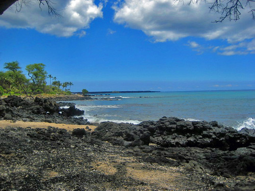


