2008
Yearly Archive
Posted by Glenn
No Comments
December 31-January 1, 2009
Air Temperatures – The following maximum temperatures were recorded across the state of Hawaii Wednesday afternoon:
Lihue, Kauai – 76
Honolulu, Oahu – 78
Kaneohe, Oahu – 77
Kahului, Maui – 80
Hilo, Hawaii – 74
Kailua-kona – 79
Air Temperatures ranged between these warmest and coolest spots near sea level, and on the highest mountains…at 4 p.m. Wednesday afternoon:
Kailua-kona– 80F
Princeville, Kauai – 72F
Haleakala Crater – 39 (near 10,000 feet on Maui)
Mauna Kea summit – missing (near 14,000 feet on the Big Island)
Precipitation Totals – The following numbers represent the largest precipitation totals (inches) during the last 24 hours on each of the major islands, as of Wednesday afternoon:
8.81 Mount Waialaele, Kauai
6.40 Poamoho 2, Oahu
0.50 Molokai
0.00 Lanai
0.15 Kahoolawe
5.80 Kaupo Gap, Maui
2.01 Pahoa, Big Island
Weather Chart – Here’s the latest (automatically updated) weather map showing a 1030 millibar high pressure system far to the northeast of the Hawaiian Islands. This trade wind producing high pressure system, along with its associated ridge, will bring trade winds back through Friday.
Satellite and Radar Images: To view the cloud conditions we have here in Hawaii, please use the following satellite links, starting off with the Infrared Satellite Image of the islands to see all the clouds around the state during the day and night. This next image is one that gives close images of the islands only during the daytime hours, and is referred to as a Close-up visible image. This next image shows a larger view of the Pacific…giving perspective to the wider ranging cloud patterns in the Pacific Ocean. To help you keep track of where any showers may be around the islands, here’s the latest animated radar image.
Hawaii’s Mountains – Here’s a link to the live webcam on the summit of near 14,000 foot Mauna Kea on the Big Island of Hawaii. The tallest peak on the island of Maui is the Haleakala Crater, which is near 10,000 feet in elevation. These two webcams are available during the daylight hours here in the islands…and when there’s a big moon rising just after sunset for an hour or two! Plus, during the nights and early mornings you will be able to see stars, and the sunrise too…depending upon weather conditions.
Aloha Paragraphs

Happy New Year!
When I read about the evils of drinking…I gave up reading
The southeast air flow made for lighter winds Wednesday, bringing up volcanic haze from the Big Island vents to Maui. These slack winds will be only briefly lighter, before they pick up into the light to moderately strong realms later Thursday or Friday. As we move into the weekend, they will increase into the moderately strong category. The computer models show our local winds becoming potentially lighter, and perhaps from the southeast again early next week…as a low pressure system moves by to the north of Hawaii. These breezes may carry some volcanic haze up over parts of the island chain, from the Big Island vents.
The weather remains unsettled and shower prone, with the chance of more heavy showers, and even a few more thunderstorms…although sunny at times too. The atmosphere remains unstable over the islands, with cold air aloft, and warm and moisture laden air, near the surface. These meteorological parameters can lead to showers, or heavy rains. As the trade winds increase some later Thursday onward, we should see an associated bias for windward showers along with them. Next week still isn’t completely clear, in terms of which way the weather will turn. It appears that our winds will become lighter, with a chance of more showers coming our way then.
It’s early Wednesday evening here in Kula, Maui, as I start writing this long last section of today’s narrative. It was actually quite sunny in some places during the day Wednesday, although cloudy in others…with locally generous showers sticking around locally. As this looping radar image shows, we aren’t out of the woods yet, with still showers, some heavy in the area. ~~~ The instability associated with the trough of low pressure near the islands, is enhancing the lower level shower clouds, which are combining forces, and keeping us locally wet in a few places. It’s not that its raining everywhere by any means, but there are some showers around. ~~~ As I drove home from Kihei, upcountry to Kula after work today, there was an amazing example of a anvil top thunderstorm, (which looked more or less like that) located right over the Haleakala Crater! At sunset, there were other areas of towering cumulus clouds, so that it wouldn’t surprise me to see more lightning after dark…along with the anticipated fireworks displays. Meanwhile, the southeast winds have brought a good amount of volcanic haze up over Maui, from the Big Island. ~~~ I got home just before 5pm, the beginning of New Years Eve. This evening I’ll be popping a bottle of Henriot Champagne, 1995 vintage, Brut Millesime…from Reims, France. I don’t often drink champagne, but when I do, I like the good stuff! I’m still not totally sure what I’ll be doing tonight, but whatever it turns out to be, it will include good music, which I love to listen to on this holiday. Will I still be up at midnight, that’s a good question!? Whatever you happen to be doing, here’s wishing you the very best Happy New Year, filled with all the things that you cherish the most in life! Aloha for now…Glenn.
A celestial show: A delightful display of planets and the moon will occur on New Year’s Eve for anyone wishing to step outside and look up just after sunset.
Venus, brighter than all other planets and stars, will dangle just below the thin crescent moon in the southwestern sky. It’ll be visible — impossible to miss, in fact — just as the sun goes down, assuming skies are cloud-free.
Soon thereafter, Mercury and Jupiter will show up hugging the south-southwestern horizon (just above where the sun went down) and extremely close to each other. Jupiter is very bright and easy to spot; Mercury is faint and harder to see, but it’ll be apparent by its location just to the left of Jupiter.
Jupiter and Mercury will set less than an hour after the sun, so timing your viewing just after sunset is crucial. You’ll also need a location with a clear view of the western horizon, unobstructed by buildings, trees or mountains.
All the planets, along with the moon and sun, traverse an arc across our sky called the ecliptic, which corresponds to the plane in space that they all roughly share. For this reason, you could draw an imaginary line from the general location of Venus and the moon, down through the other two planets, and the line would point to where the sun went down. This line could also initially help you find Jupiter and Mercury.
One last trick:
Venus is so bright you can see it during daylight if you know where to look. Given Venus’ proximity to the moon on New Year’s Eve, this would be an excellent moment — just before sunset — to use the moon to help you find Venus and gain bragging rights for being one of the few people to be able to claim seeing more than one planet during the daytime (Earth being the other one).
Interesting: Oregon may be known for the rain that feeds its rivers, but Oregonians are pessimistic there will be enough water to go around as the state’s population grows and climate change possibly makes summers even drier. That was the take-home message from five "Water Roundtables" held throughout the state in September and October as an initial step toward developing a strategy for how the state will meet rising demand on its limited water supplies. Two-thirds of those surveyed at the roundtables — held in cities from the rain-drenched coast to the high eastern deserts — do not think that Oregon in 2028 will have enough water to cover all its needs, including the needs of wildlife.
Oregon State University’s Institute for Water and Watersheds, which helped coordinate the roundtables, has released a report on the meetings and surveys of those attending. Oregon is one of only two Western states — Alaska is the other — without a water-supply plan outlining how it will meet future water demands. Oregonians may have assumed water wasn’t a limiting factor, but that’s likely to change, said Brenda Ortigoza Bateman, senior policy coordinator at the Oregon Water Resources Department, who attended all the roundtables. The results of the roundtables dovetail with a forecast developed by the Water Resources Department showing that water needs are expected to grow more than 10 percent by 2050, even as supplies may shrink in a warmer climate. Agriculture, industry, cities and residences all will need more water.
Interesting2: Maybe it’s the regime change in Washington, a phone call from Mayor Bloomberg, or perhaps green is testing better with focus groups, for whatever reason corporate America is edging towards green. Coca-Cola is leading the charge to make that canyon of brain-numbing advertising, Times Square, a little more energy efficient. When that new Waterford Crystal ball (now lit by 32,000 eco-friendly LED bulbs) drops in Times Square this New Year’s Eve it will be surrounded by a collection of billboards that will soon all be lit by wind power. The “greening” of the Coca-Cola billboard (Coke’s is the first) and the billboards on three neighboring buildings will save an estimated 1,866 metric tons of carbon dioxide each year. Building management and ConEdison’s Solutions are facilitating the change.
Interesting3: Coffee grounds — currently wasted or used as garden compost — could become a cheap and environmentally friendly source of biodiesel and fuel pellets, says a study. Spent coffee grounds contain 11—20 per cent oil, depending on their type. "This is competitive with other major biodiesel feed stocks such as rapeseed oil (37—50 per cent), palm oil (20 per cent), and soybean oil (20 per cent)," say researchers writing in the Journal of Agricultural and Food Chemistry. Scientists at the US-based University of Nevada, Reno, used an inexpensive process to extract oil from the leftovers of making espressos, cappuccinos and other coffee preparations from a multinational coffeehouse chain. This oil was then converted into biodiesel, which could be used to fuel cars and trucks.The world’s coffee production is more than 7.2 million tons per year, according to US Department of Agriculture figures cited in the study.
This could yield about 340 million gallons of biodiesel, say the researchers. "It is easy and economical to extract oil from used coffee grounds compared to traditional feed stocks," said Mano Misra, an author of the study. Further, coffee oil has some antioxidants which are required for bio-fuel stability," he told SciDev.Net. After the oil extraction the remaining solid waste from processed coffee can be used as garden compost or fuel pellets. The process "would be ideal for countries where coffee is produced. A lot of defective coffee beans are discarded into the landfills every year. Processing these beans as well as coffee grounds would be an economical approach," said Misra. The researchers calculate that in the United States an annual profit of more than US$8 million could be made from biodiesel and pellets from one major coffee chain alone.
Interesting4: Next year is set to be one of the top-five warmest on record, British climate scientists said on Tuesday. The average global temperature for 2009 is expected to be more than 0.4 degrees celsius above the long-term average, despite the continued cooling of huge areas of the Pacific Ocean, a phenomenon known as La Nina. That would make it the warmest year since 2005, according to researchers at the Met Office, who say there is also a growing probability of record temperatures after next year. Currently the warmest year on record is 1998, which saw average temperatures of 14.52 degrees celsius – well above the 1961-1990 long-term average of 14 degrees celsius. Warm weather that year was strongly influenced by El Nino, an abnormal warming of surface ocean waters in the eastern tropical Pacific.
Theories abound as to what triggers the mechanisms that cause an El Nino or La Nina event but scientists agree that they are playing an increasingly important role in global weather patterns. The strength of the prevailing trade winds that blow from east to west across the equatorial Pacific is thought to be an important factor. "Further warming to record levels is likely once a moderate El Nino develops," said Professor Chris Folland at the Met Office Hadley Center. "Phenomena such as El Nino and La Nina have a significant influence on global surface temperature." Professor Phil Jones, director of the climate research unit at the University of East Anglia, said global warming had not gone away despite the fact that 2009, like the year just gone, would not break records. "What matters is the underlying rate of warming," he said. He noted the average temperature over 2001-2007 was 14.44 degrees celsius, 0.21 degrees celsius warmer than corresponding values for 1991-2000.
Interesting5: Beijing, beset by choking traffic and heavy air pollution, will take more than 350,000 high-polluting vehicles off inner city streets from Thursday, local media reported. China’s capital has banned cars from the roads on one out of five weekdays based on the number of license plates as part of a six-month trial in the wake of broader restrictions during the Olympic Games in August that cleared skies and eased congestion. Drivers of high-emissions vehicles, known as "yellow-label" cars, would be fined $15 if found to be driving within the city’s Fifth Ring Road, a highway on Beijing’s outskirts, after a three-month grace period, the Beijing News said. The measure stands to take about 10 percent of the city’s cars off the road.
Beijing currently has about 3.5 million registered cars. The government had also drafted a compensation scheme that will give drivers up to $3,600 if they proactively give up their cars during 2009, the paper said. The city would also provide preferential loans to shipping and transport companies to upgrade their vehicle fleets to meet low-emission standards, the paper said, citing the city’s traffic bureau. Beijing authorities have credited cleaner skies above the capital in recent months in part due to the traffic restrictions, as well as decreased emissions from shuttered factories in the city’s outskirts. Car ownership along with rising incomes has skyrocketed in Chinese cities in recent years, posing head-aches for town planners already struggling to build roads and public transport to meet burgeoning urban populations.
Interesting6: Broad Beach has long been a scenic backdrop to Malibu’s public access wars. The tranquil rhythm of surf has been routinely shattered by security guards and sheriff’s deputies bouncing beachgoers who spread towels on the confusing mosaic of public and private sand. Today, Broad Beach has shrunk into a narrow sliver of its former self. And like other skinny Malibu icons, its slenderness qualified the beach for a different kind of trend-setting role: How California will deal with rising sea levels. Sandwiched between the advancing sea and coastal armor built to protect multimillion-dollar homes, the strip of sand is being swept away by waves and tides. Soon, oceanographers and coastal engineers contend, the rising ocean will eclipse the clash between the beach-going public and the private property owners: There will be no dry sand left to fight over. "If the latest projections of sea level rise are right, you can kiss goodbye the idea of a white sandy beach," said Bill Patzert, a climatologist at NASA’s Jet Propulsion Laboratory in La Cañada Flintridge. "You are going to be jumping off the sea wall onto the rocks below." The rise of sea levels, which have swelled about eight inches in the last century, are projected to accelerate with global warming.
Posted by Glenn
No Comments
December 30-31 2008
Air Temperatures – The following maximum temperatures were recorded across the state of Hawaii Tuesday afternoon:
Lihue, Kauai – 76
Honolulu, Oahu – 78
Kaneohe, Oahu – 75
Kahului, Maui – 76
Hilo, Hawaii – 71
Kailua-kona – 79
Air Temperatures ranged between these warmest and coolest spots near sea level, and on the highest mountains…at 4 p.m. Tuesday afternoon
Port Allen, Kauai – 81F
Hilo, Hawaii – 66F
Haleakala Crater – 39 (near 10,000 feet on Maui)
Mauna Kea summit – missing (near 14,000 feet on the Big Island)
Precipitation Totals – The following numbers represent the largest precipitation totals (inches) during the last 24 hours on each of the major islands, as of Tuesday afternoon:
1.56 Mount Waialaele, Kauai
2.49 Poamoho 2, Oahu
0.52 Molokai
0.03 Lanai
0.00 Kahoolawe
3.67 West Wailuaiki, Maui
2.08 Waiakea Uka, Big Island
Weather Chart – Here’s the latest (automatically updated) weather map showing a high pressure system far to the east-northeast of the Hawaiian Islands. This trade wind producing high pressure system, along with its associated ridge, will keep trade winds active through Thursday.
Satellite and Radar Images: To view the cloud conditions we have here in Hawaii, please use the following satellite links, starting off with the Infrared Satellite Image of the islands to see all the clouds around the state during the day and night. This next image is one that gives close images of the islands only during the daytime hours, and is referred to as a Close-up visible image. This next image shows a larger view of the Pacific…giving perspective to the wider ranging cloud patterns in the Pacific Ocean. To help you keep track of where any showers may be around the islands, here’s the latest animated radar image.
Hawaii’s Mountains – Here’s a link to the live webcam on the summit of near 14,000 foot Mauna Kea on the Big Island of Hawaii. The tallest peak on the island of Maui is the Haleakala Crater, which is near 10,000 feet in elevation. These two webcams are available during the daylight hours here in the islands…and when there’s a big moon rising just after sunset for an hour or two! Plus, during the nights and early mornings you will be able to see stars, and the sunrise too…depending upon weather conditions.
Aloha Paragraphs

The beauty of Kauai
Photo Credit: flickr.com
Trade wind breezes will diminish a little Wednesday…then increase again New Years Day into the weekend. The trade winds will soften some now, then surge again starting Thursday, prevailing into the first weekend of the new year. The models show another wind shift occurring early next week, as they take on a south to southeast orientation…with a cold front pushing in our direction then. These breezes may carry some volcanic haze up over parts of the island chain, from the Big Island vents.
The windward sides will continue to see incoming trade wind showers, with some rain in other areas as well. The atmosphere remains unstable over the islands, so that a few of these showers may be locally quite heavy. The leeward sides will find some high clouds blocking the daytime sunshine…with a few showers falling there too. As the trade winds increase Thursday, we should see an associated increase in windward showers along with them. Looking further ahead, we may see a cold front bring showers to the state early next week.
It’s early Tuesday evening here in Kihei, Maui, as I start writing this long last paragraph. Tuesday was a mostly cloudy day, with showers falling in many areas, including some leeward beaches. Looking at the latest looping radar image, we find the most frequent, and heaviest showers taking aim on the Big Island, Maui, and Oahu. There are still some high cirrus clouds being carried overhead too, arriving from the deeper tropics to our south…as shown on this looping satellite image – although now having temporarily cleared Kauai. ~~~ The instability associated with the trough of low pressure near the islands, is enhancing the lower level shower clouds, especially over those eastern most islands of Maui and the Big Island, where it has been quite heavy at times. The Koolau Mountains on Oahu are finding numerous showers too. ~~~ Despite the best hopes that our local weather would clear in time for New Years Eve, it doesn’t appear likely at this point. As a matter of fact, it looks like our weather will remain quite cloudy, with the continued threat of showers in the forecast. Looking at that looping satellite image above, it seems as if we may get another batch of high and middle level clouds, to our west, heading our way too at some point soon. ~~~ The long and short of this situation is that it’s winter, and even here in the tropics, we get our fair share of cloudy and wet weather, although at least its not cold. Not cold that is, down near sea level, although at the higher elevations, we are find very chilly weather, with snow falling atop the two mountain peaks on the Big Island. Once again, I will leave this link, so that you can see those snowy conditions, that is when the lens clears at times, and before it gets dark. ~~~ I’m about ready to take the drive from here in Kihei, up the 3,000+ feet…to my home in Kula. It looks to be cloudy in every direction, and if I run into some note worthy rain showers, between here and up there, I’ll come back online and let you know. ~~~ As it turned out, I ran into more than heavy rain, I crossed through the most vivid double rainbow just above Pukalani, and then ran into a major thunderstorm just up the slopes of the Haleakala Crater, with bright lightning and loud thunder too! When I got home it was pouring, and as soon as I walked into the house, there was an amazing flash of lightning, followed almost instantly, by a loud crack of thunder…it was great! I’ll be back with your next new weather narrative early Wednesday morning, New Years Eve morning! I hope you have a great Tuesday night wherever you happen to be spending it! Aloha for now…Glenn.
Interesting: More than 15,000 people in southern India protested against the extension of a new tiger reserve Tuesday, despite official assurances that they will not lose their homes to the sanctuary. Representatives from all parties in Tamil Nadu state, including the state’s ruling party, took part in what is the third such protest since November against the extension of the Mudumalai wildlife sanctuary, police said. The state government declared Mudumalai as a tiger reserve earlier this year as part of a federal government initiative, called "Project Tiger," to boost the country’s dwindling numbers of big cats. There were about 40,000 tigers in India a century ago. A government census report published this year says the tiger population has fallen to 1,411, down from 3,642 in 2002, largely due to dwindling habitat and poaching. A special panel set up by Prime Minister Manmohan Singh said in 2006 that thousands of poor villagers inside India’s tiger reserves would have to be relocated to protect the endangered animals from poachers and smugglers.
Some experts have put the number at around 300,000. Poachers and smugglers exploit the grinding poverty of forest villagers to keep them on their side. Authorities have tried educating the villagers, handing out monetary incentives and drafting them as informants. Tuesday’s demonstrators were not against the declaration of a 125 sq mile core area but against the creation of a buffer zone, Rajeev Srivastava, a field director for Project Tiger said. Around 350 families living in the core area have been given a 1 million rupee ($20,800) payout, but those in the buffer areas fear they will be evicted, Srivastava said. "We have no intention to dislodge anyone from the buffer zone. In fact, people in this zone will be involved in the project as trackers and guides for eco-tourists to enhance their means of livelihood." The Mudumalai wildlife sanctuary is part of the larger Nilgiri Biosphere Reserve on a mountain range that spans three Indian states. There are 48 tigers in the Nilgiri Reserve across which the tigers are free to roam, Srivastava added.
Interesting2: The scent of fast money in Washington has all manner of corporate interests scrambling to show they can create jobs, especially green ones. The prize is a slice of the Obama Administration’s stimulus package, expected to range from $675 billion to $775 billion in scale. But the President-elect’s transition team is warning interest groups that they won’t see any of the money unless their pet projects meet strict criteria.
First, the projects must be "shovel-ready"—that is, ready to go immediately. "They told us that for business to get anything, we have to prove there’s a short-term job impact—within six months," explains Brent Erickson, vice-president of the Biotechnology Industry Assn., which is pushing for biofuels production incentives. But the projects can’t put Uncle Sam on the hook to spend money for more than a year or two. "They have to be temporary, not creating a permanent need for funding," says Dow Chemical lobbyist Peter Molinaro.
Hiring ditch diggers would get shovels in the ground fast, of course. But Obama’s team is most interested in projects that will speed America toward a greener, cleaner future, reducing both energy dependence and the emissions that cause global warming. That has touched off a "feeding frenzy," says Steven Nadel, executive director of the nonprofit American Council for an Energy-Efficient Economy. "Everyone and his mother is saying why their pet projects deserve to be invested in."
The nuclear industry, for instance, wants more help not just building new power plants but also jump-starting homegrown suppliers of components. "If you think of an industry that has created the most green jobs over the past 40 years, it is the nuclear industry," argues Marvin S. Fertel, acting president of the Nuclear Energy Institute. Dow Chemical figures its water supply business fits the bill. "What’s not green about retrofitting and repairing water systems that leak thousands of gallons a day?" Molinaro asks.
Interesting3: Contact with nature has long been suspected to increase positive feelings, reduce stress, and provide distraction from the pain associated with recovery from surgery. Now, research has confirmed the beneficial effects of plants and flowers for patients recovering from abdominal surgery. A recent study by Seong-Hyun Park and Richard H. Mattson, researchers from the Department of Horticulture, Recreation and Forestry at Kansas State University, provides strong evidence that contact with plants is directly beneficial to a hospital patient’s health. Using various medical and psychological measurements, the study set out to evaluate if plants in hospital rooms have therapeutic influences. Studies show that when patients have great stress associated with surgery, they typically experience more severe pain and a slower recovery period. Some of these problems are treated through the use of anesthetics and analgesics, but, if not properly administered, the drugs can have side effects ranging from vomiting and headaches to drug dependency or even fatality. It is therefore beneficial to patients and care providers to develop approaches that improve the overall patient experience but don’t rely on pharmaceuticals.
Interesting4: Facial expressions of emotion are hardwired into our genes, according to a new study. The research suggests that facial expressions of emotion are innate rather than a product of cultural learning. The study is the first of its kind to demonstrate that sighted and blind individuals use the same facial expressions, producing the same facial muscle movements in response to specific emotional stimuli. The study also provides new insight into how humans manage emotional displays according to social context, suggesting that the ability to regulate emotional expressions is not learned through observation. San Francisco State University Psychology Professor David Matsumoto compared the facial expressions of sighted and blind judo athletes at the 2004 Summer Olympics and Paralympic Games.
More than 4,800 photographs were captured and analyzed, including images of athletes from 23 countries. "The statistical correlation between the facial expressions of sighted and blind individuals was almost perfect," Matsumoto said. "This suggests something genetically resident within us is the source of facial expressions of emotion." Matsumoto found that sighted and blind individuals manage their expressions of emotion in the same way according to social context. For example, because of the social nature of the Olympic medal ceremonies, 85 percent of silver medalists who lost their medal matches produced "social smiles" during the ceremony. Social smiles use only the mouth muscles whereas true smiles, known as Duchenne smiles, cause the eyes to twinkle and narrow and the cheeks to rise.
Interesting5: Climate change can have significant impacts on high-elevation lakes and imperiled Sierra Nevada Yellow-legged frogs that depend upon them, according to U.S. Forest Service and University of California, Berkeley, scientists. Their findings show how a combination of the shallow lakes drying up in summer and predation by introduced trout in larger lakes severely limits the amphibian’s breeding habitat, and can cause its extinction. "Environmental factors that increase summer drying of small lakes are likely to bring further population decline because the larger lakes are off limits to breeding," said Kathleen Matthews a Forest Service scientist at the Pacific Southwest Research Station and one of the studies authors.
Matthews co-authored the 10-year study with Igor Lacan, of the U.C. Berkeley Department of Environmental Science, Policy and Management, and Krishna Feldman, another Pacific Southwest Research Station scientist. The Forest Service funded the study. The Sierra Nevada Yellow-legged frog was common in Sierra Nevada high-elevation lakes and slow-moving streams at altitudes ranging from 4,500 to 12,000 feet. But, its range has decreased more than 80 percent in the last 90 years. These lakes and streams were historically fishless, until hybrid trout were introduced. The researchers studied lakes in Kings Canyon National Park’s Dusy Basin that are mostly fed by snowmelt. Climate change models suggest one of the principal effects of climate change on Sierra Nevada water balance will be a decreased snow pack, with more than half of the current snow water equivalent gone by 2090.
Interesting6: It’s Wall Street’s version of an early warning system. We’re talking about January, seasonally one of the best months for stocks. How stocks fare in the first month of the year could offer a clue as to whether the battered market will rebound in 2009, whether investors have regained their confidence, and whether cash sitting safely on the sidelines is put back to work in stocks. Historically, stock performance in the first five days of a new year, and January overall, has been a good predictor of how the full year will go. Since 1950, an up January has led to annual gains more than 90% of the time, the Stock Trader’s Almanac says. But every down January has "preceded a new or extended bear market, or flat market." So it’s no surprise that with the stock market down 40.6% and on track for its worst year since 1931, investors will be scrutinizing stocks more closely than usual this January, says Kevin Lane, director of research at Fusioninvest.com. "January has always been important for setting the tone for the year," Lane says.
"A strong month would suggest that investors have come to the conclusion that the bailout plans and stimulus programs are working. A bad month would suggest they don’t believe enough has been done." It would be "disheartening if stocks start 2009 like they did in January 2008, when the S&P 500 index slid 6.1%, says Paul Hickey of Bespoke Investment Group. "From a psychological standpoint, investors will start thinking, ‘Uh oh, more of the same.’ "But because so many unprecedented forces are in play that can affect stocks, it will be hard to pin a losing year on a weak January, Hickey says. Wall Street expects the recession to end in mid-2009 and stocks to rebound. Investors aren’t particularly scared or aggressive now, and that could mean they could be easily swayed by how stocks perform early in the year, says Richard Bernstein, chief investment strategist at Merrill Lynch. How stocks fare in the first five trading days of January is key. The last 36 times stocks rose at the start of the month, they were higher at year’s end 31 times, the Almanac says. "If the seasonally bullish pattern doesn’t occur, it would be a red flag."
Interesting7: Natural disasters killed more than 220,000 people in 2008, making it one of the most devastating years on record. The world’s number two insurer, says the figure confirms a global climate deal is badly needed. Although the number of natural disasters was lower than in 2007, the catastrophes in 2008 were more destructive in terms of the number of victims and the financial cost of the damage caused, Germany-based Munich Re said in its annual assessment. Most devastating was Cyclone Nargis, which battered Burma in May to kill more than 135,000 people, and the earthquake that shook China’s Sichuan province the same month which left 70,000 dead, 18,000 missing and almost five million homeless, Munich Re said. "This continues the long-term trend we have been observing," Munich Re board member Torsten Jeworrek said. "Climate change has already started and is very probably contributing to increasingly frequent weather extremes and ensuing natural catastrophes. The world needed "effective and binding rules on CO2 emissions, so that climate change is curbed and future generations do not have to live with weather scenarios that are difficult to control."
Posted by Glenn
No Comments
December 29-30 2008
Air Temperatures – The following maximum temperatures were recorded across the state of Hawaii Monday afternoon:
Lihue, Kauai – 77
Honolulu, Oahu – 80
Kaneohe, Oahu – 77
Kahului, Maui – 81
Hilo, Hawaii – 76
Kailua-kona – 80
Air Temperatures ranged between these warmest and coolest spots near sea level, and on the highest mountains…at 4 p.m. Monday afternoon:
Port Allen, Kauai – 79F
Hilo, Hawaii – 72F
Haleakala Crater – 45 (near 10,000 feet on Maui)
Mauna Kea summit – missing (near 14,000 feet on the Big Island)
Precipitation Totals – The following numbers represent the largest precipitation totals (inches) during the last 24 hours on each of the major islands, as of Monday afternoon
0.90 Mount Waialaele, Kauai
1.35 Poamoho 2, Oahu
0.00 Molokai
0.00 Lanai
0.00 Kahoolawe
1.47 West Wailuaiki, Maui
4.57 Hilo airport, Big Island
Weather Chart – Here’s the latest (automatically updated) weather map showing a high pressure system far to the east-northeast of the Hawaiian Islands. This trade wind producing high pressure system, along with its associated ridge, will keep trade winds active through Wednesday.
Satellite and Radar Images: To view the cloud conditions we have here in Hawaii, please use the following satellite links, starting off with the Infrared Satellite Image of the islands to see all the clouds around the state during the day and night. This next image is one that gives close images of the islands only during the daytime hours, and is referred to as a Close-up visible image. This next image shows a larger view of the Pacific…giving perspective to the wider ranging cloud patterns in the Pacific Ocean. To help you keep track of where any showers may be around the islands, here’s the latest animated radar image.
Hawaii’s Mountains – Here’s a link to the live webcam on the summit of near 14,000 foot Mauna Kea on the Big Island of Hawaii. The tallest peak on the island of Maui is the Haleakala Crater, which is near 10,000 feet in elevation. These two webcams are available during the daylight hours here in the islands…and when there’s a big moon rising just after sunset for an hour or two! Plus, during the nights and early mornings you will be able to see stars, and the sunrise too…depending upon weather conditions.
Aloha Paragraphs

The Kona coast…a great sunset
Photo Credit: flickr.com
The trade winds will blow in the light to moderately strong realms through most of the rest of this week…although stronger at times locally. The trade winds may very well continue for quite some time, which is something we haven’t experienced lately. The winds became strong enough locally Monday afternoon, that a NWS issued small craft advisory went up across Hawaiian waters, stretching from the Molokai Channel down across the Big Island leeward side. The models show another wind shift occurring early next week, as they take on a south to southeast orientation…as a cold front pushes in our direction then.
The trade winds will continue to carry some moisture in our direction, although less than we’ve seen lately…almost certainly. The windward sides have been wet for the last several days, very wet at times, and will continue to find a few passing showers arriving at times. There’s still some areas of low pressure aloft hanging around, so it wouldn’t be out of the question to have a few more downpours. The leeward sides will find some high clouds filtering the daytime sunshine, although will remain quite dry…if not totally dry in many areas.
It’s early Monday evening here in Kihei, Maui, as I start writing this last paragraph. The Hawaiian Islands finally got a break from the recent rain showers. Looking at the latest looping radar image, we find less showers falling everywhere. Most of the showers seem to be active over the waters offshore from the islands. The atmosphere is still not stable enough, to rule out a few heavier showers here and there. The other situation seems to be the high clouds that streamed over the islands during the day Monday, as shown on this looping satellite image. ~~~ Looking further ahead, including the upcoming holiday celebrations, the trade winds will prevail. These early winter trade winds will remain active through the rest of this week, carrying some showers towards the windward coasts and slopes periodically. ~~~ The fact that our ventilating trade winds will extend through the week, bodes well for ventilating away any fireworks smoke. We aren’t moving back into perfect conditions, but at least it will be better in general, especially along the leeward beaches. ~~~ Looking out the window here in Kihei, there are quite a few gray clouds around, although they don’t appear to be dropping rain, at least in my view. There are those high level clouds too, which have dimmed our sunshine as well. I expect a few showers, here and there, but at the same time, will be looking for relatively clear skies returning overnight, into the day Tuesday. ~~~ I must admit, that I am enjoying the extra time in the mornings, when I would usually be up getting ready to do the tv weather show…although at the same time, I miss doing it! I’ve taken to meditating early in the mornings now, which I’m savoring. I’ll be back early Tuesday morning with your next new weather narrative from paradise, I hope you greatly enjoy your Monday night! Aloha for now…Glenn.
Interesting: The federal government is taking steps that may open California’s fabled coast to oil drilling in as few as three years, an action that could place dozens of platforms off the Sonoma, Mendocino and Humboldt coasts, and raises the specter of spills, air pollution and increased ship traffic into San Francisco Bay. Millions of acres of oil deposits, mapped in the 1980s when then-Interior Secretary James Watt and Energy Secretary Donald Hodel pushed for California exploration, lie a few miles from the forested North Coast and near the mouth of the Russian River, as well as off Malibu, Santa Monica and La Jolla in Southern California. "These are the targets," said Richard Charter, a lobbyist for the Defenders of Wildlife Action Fund who worked for three decades to win congressional bans on offshore drilling.
"You couldn’t design a better formula to create adverse impacts on California’s coastal-dependent economy." The bans that protected both of the nation’s coasts beginning in 1981, from California to the Pacific Northwest to the Atlantic Coast and the Straits of Florida, ended this year when Congress let the moratorium lapse. President-elect Barack Obama hasn’t said whether he would overturn President Bush’s lifting last summer of the ban on drilling, as gas prices reached a historic high. Sen. Ken Salazar, D-Col., Obama’s pick as interior secretary and head of the nation’s ocean-drilling agency, hasn’t said what he would do in coastal waters.
Interesting2: A team of scientists has come up with a new definition of seawater which is set to boost the accuracy of projections for oceans and climate. Oceans help regulate the planet’s weather by shifting heat from the equator to the poles. Changes in salinity and temperature are major forces driving global currents as well as circulation patterns from the surface to the seabed. Understanding exactly how much heat the ocean can absorb and accounting for tiny differences in salinity are crucial for scientists to figure how oceans affect climate and how that interaction could change because of global warming. "Getting these circulations right is central to the task of quantifying the ocean’s role in climate change," said Trevor McDougall of Australia’s state-backed research body the CSIRO, who is part of the international team that updated the methods to define sea water. He said the new definition allows for the first time to accurately calculate ocean heat content and take into account small differences in salinity. Previous methods assumed the composition of seawater was the same around the globe.
Seawater is a mixture of 96.5 percent pure water with the remainder comprising salts, dissolved gases and other matter. McDougall said data from about 1,000 seawater samples showed global variations. There were small but significant differences in the composition of seawater between the North Pacific and North Atlantic, for example. "We’ve got along quite well for 30 years without delving deeper into what the sea salt is composed of," said McDougall, of the CSIRO’s Wealth from Oceans Flagship in Hobart in the southern Australian state of Tasmania. But ever more complex computer models and greater demands to project how oceans and climate will behave in a warmer world mean an increasing need for more precise data. McDougall said salinity affects ocean density, and changes in density help drive huge vertical ocean circulation patterns. "Water sinks to the bottom and rises to the top in a very slow circulation that accounts for about half of the heat that the globe needs to transport from the equator to the poles." The constant circulation of heat by the oceans and atmosphere keeps the planet livable.
Interesting3: Anti-whaling group Sea Shepherd Conservation Society has said it achieved its aim of forcing Japan’s whaling fleet out of Antarctic waters claimed by Australia. In a statement on its website, the U.S.-based group said its ship, the Steve Irwin, had forced the fleet into waters off the Ross Dependency, which is a New Zealand possession. Australia has declared an ‘economic exclusion zone’, known by the letters "EEZ," in waters off the coast of its Antarctic territories, and an Australian court order bans whaling there. Sea Shepherd has said it is enforcing that order by pursuing Japan’s whaling fleet, which is in the area for an annual hunt to kill around 900 whales. However, Japan does not recognize the zone and says its whaling fleet is in international waters.
In the statement, dated Saturday, Sea Shepherd founder Paul Watson promised his organization would continue its pursuit of the Japanese fleet. "The good news is that they are no longer whaling in Australian waters and they only managed to hunt in the waters of the Australian Antarctic Territory for about a week before being forced to flee the Australian EEZ," the statement said. "They are now in the waters of the Ross dependency and the Steve Irwin is in pursuit." Watson said this was "bad news" for whales in waters south of New Zealand. Japan’s Institute of Cetacean Research, which runs the hunt, has accused Sea Shepherd of "eco-terrorism" and of ramming its vessel the Kaiko Maru during a protest action last Friday. Sea Shepherd has blamed the Japanese for the collision.
Interesting4: The frequency of extremely high clouds in Earth’s tropics — the type associated with severe storms and rainfall — is increasing as a result of global warming, according to a study by scientists at NASA’s Jet Propulsion Laboratory, Pasadena, California. In a presentation today to the fall meeting of the American Geophysical Union in San Francisco, JPL Senior Research Scientist Hartmut Aumann outlined the results of a study based on five years of data from the Atmospheric Infrared Sounder (AIRS) instrument on NASA’s Aqua spacecraft. The AIRS data were used to observe certain types of tropical clouds linked with severe storms, torrential rain and hail. The instrument typically detects about 6,000 of these clouds each day. Aumann and his team found a strong correlation between the frequency of these clouds and seasonal variations in the average sea surface temperature of the tropical oceans.
For every 1.8 degrees Fahrenheit increase in average ocean surface temperature, the team observed a 45-percent increase in the frequency of the very high clouds. At the present rate of global warming of 0.23 degrees Fahrenheit per decade, the team inferred the frequency of these storms can be expected to increase by six percent per decade. Climate modelers have long speculated that the frequency and intensity of severe storms may or may not increase with global warming. Aumann said results of the study will help improve their models. "Clouds and rain have been the weakest link in climate prediction," said Aumann. "The interaction between daytime warming of the sea surface under clear-sky conditions and increases in the formation of low clouds, high clouds and, ultimately, rain is very complicated. The high clouds in our observations—typically at altitudes of 12 miles and higher—present the greatest difficulties for current climate models, which aren’t able to resolve cloud structures smaller than about 155 miles in size."
Interesting5: It’s no simple matter to figure out how regional changes in precipitation, expected to result from global climate change, may affect water supplies. Now, a new analysis led by MIT researchers has found that the changes in groundwater may actually be much greater than the precipitation changes themselves. For example, in places where annual rainfall may increase by 20 percent as a result of climate change, the groundwater might increase as much as 40 percent. Conversely, the analysis showed in some cases just a 20 percent decrease in rainfall could lead to a 70 percent decrease in the recharging of local aquifers — a potentially devastating blow in semi-arid and arid regions.
The exact effects depend on a complex mix of factors, the study found — including soil type, vegetation, and the exact timing and duration of rainfall events — so detailed studies will be required for each local region in order to predict the possible range of outcomes. The research was conducted by Gene-Hua Crystal Ng, now a postdoctoral researcher in MIT’s Department of Civil and Environmental Engineering (CEE), along with King Bhumipol Professor Dennis McLaughlin and Bacardi Stockholm Water Foundations Professor Dara Entekhabi, both of CEE, and Bridget Scanlon, a senior researcher at the University of Texas.
Interesting6: It’s Wall Street’s version of an early warning system. We’re talking about January, seasonally one of the best months for stocks. How stocks fare in the first month of the year could offer a clue as to whether the battered market will rebound in 2009, whether investors have regained their confidence, and whether cash sitting safely on the sidelines is put back to work in stocks. Historically, stock performance in the first five days of a new year, and January overall, has been a good predictor of how the full year will go. Since 1950, an up January has led to annual gains more than 90% of the time, the Stock Trader’s Almanac says. But every down January has "preceded a new or extended bear market, or flat market." So it’s no surprise that with the stock market down 40.6% and on track for its worst year since 1931, investors will be scrutinizing stocks more closely than usual this January, says Kevin Lane, director of research at Fusioninvest.com. "January has always been important for setting the tone for the year," Lane says.
"A strong month would suggest that investors have come to the conclusion that the bailout plans and stimulus programs are working. A bad month would suggest they don’t believe enough has been done." It would be "disheartening if stocks start 2009 like they did in January 2008, when the S&P 500 index slid 6.1%, says Paul Hickey of Bespoke Investment Group. "From a psychological standpoint, investors will start thinking, ‘Uh oh, more of the same.’ "But because so many unprecedented forces are in play that can affect stocks, it will be hard to pin a losing year on a weak January, Hickey says. Wall Street expects the recession to end in mid-2009 and stocks to rebound. Investors aren’t particularly scared or aggressive now, and that could mean they could be easily swayed by how stocks perform early in the year, says Richard Bernstein, chief investment strategist at Merrill Lynch. How stocks fare in the first five trading days of January is key. The last 36 times stocks rose at the start of the month, they were higher at year’s end 31 times, the Almanac says. "If the seasonally bullish pattern doesn’t occur, it would be a red flag."
Interesting7: Natural disasters killed more than 220,000 people in 2008, making it one of the most devastating years on record. The world’s number two insurer, says the figure confirms a global climate deal is badly needed. Although the number of natural disasters was lower than in 2007, the catastrophes in 2008 were more destructive in terms of the number of victims and the financial cost of the damage caused, Germany-based Munich Re said in its annual assessment. Most devastating was Cyclone Nargis, which battered Burma in May to kill more than 135,000 people, and the earthquake that shook China’s Sichuan province the same month which left 70,000 dead, 18,000 missing and almost five million homeless, Munich Re said. "This continues the long-term trend we have been observing," Munich Re board member Torsten Jeworrek said. "Climate change has already started and is very probably contributing to increasingly frequent weather extremes and ensuing natural catastrophes. The world needed "effective and binding rules on CO2 emissions, so that climate change is curbed and future generations do not have to live with weather scenarios that are difficult to control."
Posted by Glenn
No Comments
December 28-29 2008
Air Temperatures – The following maximum temperatures were recorded across the state of Hawaii Sunday afternoon:
Lihue, Kauai – 77
Honolulu, Oahu – 78
Kaneohe, Oahu – 77
Kahului, Maui – 80
Hilo, Hawaii – 76
Kailua-kona – 81
Air Temperatures ranged between these warmest and coolest spots near sea level, and on the highest mountains…at 4 p.m. Sunday afternoon:
Barking Sands, Kauai – 80F
Hilo, Hawaii – 70F
Haleakala Crater – 41 (near 10,000 feet on Maui)
Mauna Kea summit – 27 (near 14,000 feet on the Big Island)
Precipitation Totals – The following numbers represent the largest precipitation totals (inches) during the last 24 hours on each of the major islands, as of Sunday afternoon:
2.02 Mount Waialaele, Kauai
2.00 Manoa Valley, Oahu
0.08 Molokai
0.00 Lanai
0.00 Kahoolawe
8.08 West Wailuaiki, Maui
4.67 Laupahoehoe, Big Island
Weather Chart – Here’s the latest (automatically updated) weather map showing high pressure systems to the north-northeast, and far to the northeast of the Hawaiian Islands. These trade wind producing high pressure systems, along with their associated ridges, will keep trade winds through Tuesday.
Satellite and Radar Images: To view the cloud conditions we have here in Hawaii, please use the following satellite links, starting off with the Infrared Satellite Image of the islands to see all the clouds around the state during the day and night. This next image is one that gives close images of the islands only during the daytime hours, and is referred to as a Close-up visible image. This next image shows a larger view of the Pacific…giving perspective to the wider ranging cloud patterns in the Pacific Ocean. To help you keep track of where any showers may be around the islands, here’s the latest animated radar image.
Hawaii’s Mountains – Here’s a link to the live webcam on the summit of near 14,000 foot Mauna Kea on the Big Island of Hawaii. The tallest peak on the island of Maui is the Haleakala Crater, which is near 10,000 feet in elevation. These two webcams are available during the daylight hours here in the islands…and when there’s a big moon rising just after sunset for an hour or two! Plus, during the nights and early mornings you will be able to see stars, and the sunrise too…depending upon weather conditions.
Aloha Paragraphs

The islands are showery…on the windward sides
Photo Credit: flickr.com
The trade winds remain a part of our Hawaiian Islands weather picture Sunday. A 1031 millibar high pressure system, is located far to the northeast or east-northeast of Hawaii Sunday evening. This is keeping our local wind speeds locally gusty. The trade winds will continue into the new work week, then veer to the southeast later Tuesday into Wednesday. Southeast winds may carry volcanic haze from the Big Island, over the smaller islands New Years Eve…along with whatever smoke is around then too.
The windward sides will remain showery into Monday. The moisture riding in on these trade winds is keeping our windward sides wet. At higher altitudes of the atmosphere, we have upper level low pressure systems, with their cold air aloft. These lows are keeping our atmosphere unstable, enhancing the incoming showers. These low pressure systems will lose some influence Monday, with less of a threat of heavy rains then. A new low will form to the west or northwest later Tuesday into Wednesday…which may make for rainy weather New Years Eve, and New Years Day.
It’s early Sunday evening here in Kula, Maui, as I start writing this last paragraph. The weather dynamics remain in place for off and on wet conditions over the windward sides of all the islands. The cold air associated with the long lasting upper low pressure systems, should be losing some influence Monday. Here’s a looping radar image, so you can see where all these showers are falling. The summits on the Big Island have been snowy. This webcam link shows the summit of Mauna Kea covered with snow. ~~~ Sunday saw the numerous passing showers falling along the windward sides, which will continue into Monday. Here in Kula, it began lightly raining at around 2pm, and is just now easing up around 5pm. There is the most incredible double rainbow outside at the moment, really very vivid! I’m sure that there are many more rainbows across the island chain at the moment, which are beautiful. Actually, things are changing fast, as now a cloud bank has moved in, making for foggy conditions! ~~~ I went over to my neighbors for lunch, and ended up staying over there for a couple of hours, as we watched the rains fall out the window, which was very enjoyable. I’ll be back early Monday morning with your next weather narrative. I hope you have a great Sunday night until then! Aloha for now…Glenn.
Interesting: An ancient underground water basin the size of Libya holds the key to Australia avoiding a water crisis as climate change bites the drought-hit nation. Australia’s Great Artesian Basin is one of the largest artesian groundwater basins in the world, covering 656,370 sq miles and lying beneath one-fifth of Australia. The basin holds 65 million giga-liters of water, about 820 times the amount of surface water in Australia, and enough to cover the Earth’s land mass under half a meter of water, says the Great Artesian Basin Coordinating Committee. And it is slowly topped up with 1 million mega-liters a year as rain filters through porous sandstone rock, becoming trapped in the underground basin. "There is probably enough water in there to last Australia’s needs for 1,500 years, if we wanted to use it all," says John Hillier, a hydro-geologist who has just completed the Great Artesian Basin Resource Study. But he and other experts warn that access to the basin’s water supply is under threat from declining artesian pressure, which forces the water to the surface via bores and springs.
If artesian pressure falls too far, due to excessive extraction of water, the ancient water source will be unreachable, except through costly pumping. Lying as much as 1.2 miles below ground, some parts of the basin are 1.8 miles from top to bottom. The basin was formed between 100 and 250 million years ago and consists of alternating layers of water bearing sandstone aquifers and non-water bearing siltstones and mudstones. Basin water is extracted through bores and is the only source of water for mining, tourism and grazing in Queensland, New South Wales and South Australia states, and the Northern Territory. The underground water spawns $2.4 billion worth of production a year from farming, mining and tourism, says the Great Artesian Basin Coordinating Committee.
Interesting2: A plan to build the United States’ first offshore wind farm took another step, after the Massachusetts Department of Environmental Protection approved its proposed undersea cables to transmit power to the mainland. The Cape Wind project, which would place 130 turbines about 4.7 miles off upscale Cape Cod, would provide "greater public benefit than detriment," the state review found. The proposed wind farm, opposed by beachfront homeowners who complain the 247-foot towers would spoil their views, would provide enough power for about 400,000 homes. Developers of the $1 billion project are still waiting on a composite state and local permit, as well as federal approvals by the U.S. Coast Guard, Department of the Interior and the Federal Aviation Administration, said Mark Rogers, a spokesman for privately held Cape Wind Associates LLC. Rogers said Cape Wind expects the permitting process to be complete by March.
Interesting3: Climate change, whaling, wild weather and water were the environmental issues dominating headlines this year. Australia mourned the loss of a conservation giant, University of Canberra freshwater ecologist and self-described political ”shit stirrer” Peter Cullen, who died in March. His funeral service was attended by more than 900 people, who came to Canberra from all over Australia to pay their respects to a courageous, outspoken champion of national water reform. In its annual summary of world weather trends, the World Meteorological Organization described 2008 as a year ”marked by weather extremes”. Australia had its share of wild weather, including record heat waves in Adelaide, worsening drought across the Murray-Darling Basin and violent storms unleashing floods across northern NSW and Queensland.
The year began with torrential rains causing the worst floods in 20 years across south-east Queensland and the NSW North Coast. More than 3000 people were stranded in NSW, with flood damage exceeding $250 million. Climate scientists, including Brisbane-based Professor Ian Lowe, have warned that Queensland can expect an increase in severe storms as global temperatures warm. This year, the Sunshine State bore the brunt of weather extremes, with 70 per cent of the state declared a disaster area due to storms, high winds and floods by the end of February. Premier Anna Bligh’s state Government subsequently announced a review of Queensland’s climate change strategy.
Interesting4: After weeks of waiting, mountain residents awoke to their first glimpse of winter on Dec. 13th, a few fluffy inches of powder that clung to the tops of boulders like chefs’ hats. More fell over the past two weeks, enough to bury the camel-colored meadow grass and wine-red willows in a deepening blanket of white. The magic, though, came late, just days before Christmas — one of the tardiest winter debuts ever. How much more snow will fall is anyone’s guess. A winter storm just hit Thursday, dumping several feet of snow, to the relief of snow-starved resorts.
But in the late arrival of this year’s snow season — and increasingly early spring snowmelt from the mountains — scientists and state officials are finding more than the signature of a natural drought. They believe they detect the fingerprint of climate change. The implications could be enormous. After all, the snowcapped Sierra is more than a skier’s paradise. It is a giant water faucet in the sky, a 400-mile-long, 60-mile-wide reservoir held in cold storage that supplies California with more than 60 percent of its water, much of it when it’s needed most: over the hot, dry summer months.
Interesting5: Wildlife satellite studies could lead to a radical re-thinking about how the snowy owl fits into the Northern ecosystem. "Six of the adult females that we followed in a satellite study spent most of last winter far out on the Arctic sea ice," said Université Laval doctoral student Jean-Francois Therrien, who is working with Professor Gilles Gauthier as part of an International Polar Year (IPY) research project to better understand key indicator species of Canadian northern ecosystems. The finding flabbergasted the biologists who are now curious to find out if Inuit seal hunters ever encounter the large white birds on the ice in winter darkness. "As for what the birds were doing there, they were possibly preying on seabirds," said Gauthier.
"Bird researchers at coastal field sites have observed snowy owls attacking eiders in winter. This hypothesis will be strengthened if we can match up the locations of our birds with the position of open water leads in the ice as recorded by other satellite data." The researchers find it intriguing that the top Arctic bird predator, like the top mammal – the polar bear, is also part of the marine ecosystem. The possible implications for the species will be discussed by Therrien this Wednesday in Quebec City at the Arctic Change Conference, one of the largest international research conferences ever held on the challenges facing the north. It was very surprising, said Therrien, how far the individual birds migrated from where they were banded on their nesting grounds on Bylot Island, north of Baffin Island.
Interesting6: Gabriela Escalante stalks the rumbling streets alongside newspaper, peanut and candy vendors, wading deep into traffic at red lights across town. Her eyes are fixed on tailpipes. A member of Mexico City’s "ecoguarda," or environmental police, she and some 50 colleagues are on the lookout for white clouds of toxic exhaust, stopping hundreds of offending motorists each day, issuing $100 fines and confiscating license plates — a small but urgent army fighting the capital’s infamous air pollution. "We detect, we detain and we fine," said Escalante, 27. "This is the air we all breathe." Not long ago, air in this throbbing capital was so bad that cyclists wore surgical masks. Birds fell dead in mid-flight, and children used brown crayons to draw the sky. Ozone exceeded safe levels on 97 percent of days in the year. But the metropolis ranked the world’s most polluted by a 1992 U.N. report has since slashed some of its worst emissions by more than three-quarters and has become a model for improving urban air quality.
Capitals such as Beijing, Cairo, New Delhi and Lima are now more contaminated, according to the World Bank, while air in at least 30 other cities contains more toxic particles, including Barcelona and Prague. When Latin American leaders met here last month to discuss the environment, many looked to Mexico as an example of progress, said Sergio Jellinek, a World Bank spokesman who attended the forum. Still, a nagging cloud of ozone has been harder to reduce — a sign of the secondary air pollution problems that cities can expect even after cutting their most visible contaminants. With the onset of winter, the worst time of year for pollution, Mexico City has said it plans to spend $3 billion by 2012 to expand public transit and further slash emissions. "There has been a large improvement, and it’s important to show it could be done," said Mario Molina, a Nobel Prize-winning Mexican chemist now advising President-elect Barack Obama’s transition team on environmental issues. "But there’s still a long way to go to get really satisfactory air." Ringed by volcanoes and nearly a half-mile higher than Denver, the city’s geography and population make it a "perfect factory" for pollution, said Adrian Fernandez, head of the National Institute of Ecology, Mexico’s version of the EPA.
Interesting7: Scientists said an earthquake felt by some New Hampshire towns during this last weekend was likely an aftershock from a tremor 281 years ago. Dr. John Ebel of the Weston Observatory in Massachusetts said the quake reported by some New Hampshire residents at about 4:35 p.m. Sunday was likely an aftershock from a 1727 earthquake in the Merrimack, N.H., area, WMUR-TV, Manchester, N.H., reported Tuesday. Ebel said the original 5.6 magnitude quake caused numerous aftershocks in the area that have continued for nearly three centuries. He said the most recent confirmed aftershock took place in October 2007 and measured a 1.3 magnitude on the Richter scale.
Posted by Glenn
No Comments
December 27-28 2008
Air Temperatures – The following maximum temperatures were recorded across the state of Hawaii Saturday afternoon:
Lihue, Kauai – 77
Honolulu, Oahu – 79
Kaneohe, Oahu – 76
Kahului, Maui – 79
Hilo, Hawaii – 76
Kailua-kona – 81
Air Temperatures ranged between these warmest and coolest spots near sea level, and on the highest mountains…at 4 p.m. Saturday afternoon:
Port Allen, Kauai – 79F
Kahului, Maui – 73F
Haleakala Crater – 41 (near 10,000 feet on Maui)
Mauna Kea summit – 30 (near 14,000 feet on the Big Island)
Precipitation Totals – The following numbers represent the largest precipitation totals (inches) during the last 24 hours on each of the major islands, as of Saturday afternoon:
2.86 Mount Waialaele, Kauai
4.64 Poamoho 2, Oahu
0.70 Molokai
0.00 Lanai
0.01 Kahoolawe
4.03 West Wailuaiki, Maui
5.00 Hilo airport, Big Island
Weather Chart – Here’s the latest (automatically updated) weather map showing a strong 1033 millibar high pressure system to far to the northeast of the Hawaiian Islands. This trade wind producing high pressure system will cause locally gusty trade winds through Sunday.
Satellite and Radar Images: To view the cloud conditions we have here in Hawaii, please use the following satellite links, starting off with the Infrared Satellite Image of the islands to see all the clouds around the state during the day and night. This next image is one that gives close images of the islands only during the daytime hours, and is referred to as a Close-up visible image. This next image shows a larger view of the Pacific…giving perspective to the wider ranging cloud patterns in the Pacific Ocean. To help you keep track of where any showers may be around the islands, here’s the latest animated radar image.
Hawaii’s Mountains – Here’s a link to the live webcam on the summit of near 14,000 foot Mauna Kea on the Big Island of Hawaii. The tallest peak on the island of Maui is the Haleakala Crater, which is near 10,000 feet in elevation. These two webcams are available during the daylight hours here in the islands…and when there’s a big moon rising just after sunset for an hour or two! Plus, during the nights and early mornings you will be able to see stars, and the sunrise too…depending upon weather conditions.
Aloha Paragraphs

Rain showers…with beautiful rainbows
Photo Credit: flickr.com
Fresh trade wind breezes, with some gusty winds associated with isolated thunderstorms. A 1033 millibar high pressure system, is located to the northeast of Hawaii Saturday evening. This is keeping our local wind speeds rather gusty, with a small craft wind advisory active across almost all coastal waters. The gusty trade winds will give way to lighter winds during the new week ahead. A high surf advisory for the east facing shores of all the islands remains active, due to the fresh trade winds, generating wind swell along the windward sides. The trade winds will carry forth into the new week, then veer to the southwest around mid-week.
The trade winds continue to carry moisture onto the windward sides, which is being enhanced by an upper low pressure system in the vicinity of our islands. The moisture riding in on these trade winds is keeping our windward sides soggy. At higher altitudes of the atmosphere, we have an upper level low pressure system, with its cold air aloft. This low is keeping our atmosphere unstable, enhancing the incoming showers. We will find localized heavy showers, with even a chance of a random thunderstorms. The low pressure system will move away starting Monday, with improving weather conditions. A new low will form to the west or northwest Wednesday…which may, or may not be close enough to bring more rain.
It’s early Saturday evening here in Kula, Maui, as I start writing this last paragraph. We’ve had off and on showers over the main Hawaiian Islands today, some of which have been locally quite generous. There has been some towering cumulus clouds around too, which may build into isolated thunderstorms at times. Speaking of thunderstorms, there were some of those on the island of Oahu, which knocked out power, including the area where President elect Obama was staying! Here’s a looping radar image, so you can see where all these showers are falling. As we continue through Sunday, there will be more windward biased showers…some of which will stretch over to the leeward sides at times too. The summits on the Big Island have been snowy. This webcam link shows the summit of Mauna Kea covered with snow…unless it is after dark when you look. ~~~ Last evening after work I went to see the new film called Valkyrie (2008), starring Tom Cruise and Kenneth Branagh, among many others. The film is based on actual events, a plot to assassinate Hitler is unfurled during the height of WWII. The large theater was totally packed, with not one empty seat. I enjoyed the film, and was touched by how it all turned out in the end. The performances were quite good, with the leading men carrying the film forward in a big way. Here’s a trailer in case you’re interested in getting a sneak peek. ~~~ I spent the day in Kula, except when I drove over to Paia for shopping at the health food store. I hardly ever see it so crowded, with so many people on the roads and along the streets. We must have tons of visitors around now, who look like they’re enjoying themselves, despite the occasional showers…most frequent on the windward sides. It’s still showering up here in Kula at the moment, as it has done periodically during the day. I’ve been invited for dinner here in Kula this evening, and I’m bringing a bottle of White Star champagne as my contribution. I’ll be back Sunday morning with your next new weather narrative. I hope you have a great Saturday night wherever you happen to be spending it! Aloha for now…Glenn.
Interesting: An ancient underground water basin the size of Libya holds the key to Australia avoiding a water crisis as climate change bites the drought-hit nation. Australia’s Great Artesian Basin is one of the largest artesian groundwater basins in the world, covering 656,370 sq miles and lying beneath one-fifth of Australia. The basin holds 65 million giga-liters of water, about 820 times the amount of surface water in Australia, and enough to cover the Earth’s land mass under half a meter of water, says the Great Artesian Basin Coordinating Committee. And it is slowly topped up with 1 million mega-liters a year as rain filters through porous sandstone rock, becoming trapped in the underground basin. "There is probably enough water in there to last Australia’s needs for 1,500 years, if we wanted to use it all," says John Hillier, a hydro-geologist who has just completed the Great Artesian Basin Resource Study. But he and other experts warn that access to the basin’s water supply is under threat from declining artesian pressure, which forces the water to the surface via bores and springs.
If artesian pressure falls too far, due to excessive extraction of water, the ancient water source will be unreachable, except through costly pumping. Lying as much as 1.2 miles below ground, some parts of the basin are 1.8 miles from top to bottom. The basin was formed between 100 and 250 million years ago and consists of alternating layers of water bearing sandstone aquifers and non-water bearing siltstones and mudstones. Basin water is extracted through bores and is the only source of water for mining, tourism and grazing in Queensland, New South Wales and South Australia states, and the Northern Territory. The underground water spawns $2.4 billion worth of production a year from farming, mining and tourism, says the Great Artesian Basin Coordinating Committee.
Interesting2: A plan to build the United States’ first offshore wind farm took another step, after the Massachusetts Department of Environmental Protection approved its proposed undersea cables to transmit power to the mainland. The Cape Wind project, which would place 130 turbines about 4.7 miles off upscale Cape Cod, would provide "greater public benefit than detriment," the state review found. The proposed wind farm, opposed by beachfront homeowners who complain the 247-foot towers would spoil their views, would provide enough power for about 400,000 homes. Developers of the $1 billion project are still waiting on a composite state and local permit, as well as federal approvals by the U.S. Coast Guard, Department of the Interior and the Federal Aviation Administration, said Mark Rogers, a spokesman for privately held Cape Wind Associates LLC. Rogers said Cape Wind expects the permitting process to be complete by March.
Interesting3: Climate change, whaling, wild weather and water were the environmental issues dominating headlines this year. Australia mourned the loss of a conservation giant, University of Canberra freshwater ecologist and self-described political ”shit stirrer” Peter Cullen, who died in March. His funeral service was attended by more than 900 people, who came to Canberra from all over Australia to pay their respects to a courageous, outspoken champion of national water reform. In its annual summary of world weather trends, the World Meteorological Organization described 2008 as a year ”marked by weather extremes”. Australia had its share of wild weather, including record heat waves in Adelaide, worsening drought across the Murray-Darling Basin and violent storms unleashing floods across northern NSW and Queensland.
The year began with torrential rains causing the worst floods in 20 years across south-east Queensland and the NSW North Coast. More than 3000 people were stranded in NSW, with flood damage exceeding $250 million. Climate scientists, including Brisbane-based Professor Ian Lowe, have warned that Queensland can expect an increase in severe storms as global temperatures warm. This year, the Sunshine State bore the brunt of weather extremes, with 70 per cent of the state declared a disaster area due to storms, high winds and floods by the end of February. Premier Anna Bligh’s state Government subsequently announced a review of Queensland’s climate change strategy.
Interesting4: After weeks of waiting, mountain residents awoke to their first glimpse of winter on Dec. 13th, a few fluffy inches of powder that clung to the tops of boulders like chefs’ hats. More fell over the past two weeks, enough to bury the camel-colored meadow grass and wine-red willows in a deepening blanket of white. The magic, though, came late, just days before Christmas — one of the tardiest winter debuts ever. How much more snow will fall is anyone’s guess. A winter storm just hit Thursday, dumping several feet of snow, to the relief of snow-starved resorts.
But in the late arrival of this year’s snow season — and increasingly early spring snowmelt from the mountains — scientists and state officials are finding more than the signature of a natural drought. They believe they detect the fingerprint of climate change. The implications could be enormous. After all, the snowcapped Sierra is more than a skier’s paradise. It is a giant water faucet in the sky, a 400-mile-long, 60-mile-wide reservoir held in cold storage that supplies California with more than 60 percent of its water, much of it when it’s needed most: over the hot, dry summer months.
Interesting5: Wildlife satellite studies could lead to a radical re-thinking about how the snowy owl fits into the Northern ecosystem. "Six of the adult females that we followed in a satellite study spent most of last winter far out on the Arctic sea ice," said Université Laval doctoral student Jean-Francois Therrien, who is working with Professor Gilles Gauthier as part of an International Polar Year (IPY) research project to better understand key indicator species of Canadian northern ecosystems. The finding flabbergasted the biologists who are now curious to find out if Inuit seal hunters ever encounter the large white birds on the ice in winter darkness. "As for what the birds were doing there, they were possibly preying on seabirds," said Gauthier.
"Bird researchers at coastal field sites have observed snowy owls attacking eiders in winter. This hypothesis will be strengthened if we can match up the locations of our birds with the position of open water leads in the ice as recorded by other satellite data." The researchers find it intriguing that the top Arctic bird predator, like the top mammal – the polar bear, is also part of the marine ecosystem. The possible implications for the species will be discussed by Therrien this Wednesday in Quebec City at the Arctic Change Conference, one of the largest international research conferences ever held on the challenges facing the north. It was very surprising, said Therrien, how far the individual birds migrated from where they were banded on their nesting grounds on Bylot Island, north of Baffin Island.
Interesting6: Gabriela Escalante stalks the rumbling streets alongside newspaper, peanut and candy vendors, wading deep into traffic at red lights across town. Her eyes are fixed on tailpipes. A member of Mexico City’s "ecoguarda," or environmental police, she and some 50 colleagues are on the lookout for white clouds of toxic exhaust, stopping hundreds of offending motorists each day, issuing $100 fines and confiscating license plates — a small but urgent army fighting the capital’s infamous air pollution. "We detect, we detain and we fine," said Escalante, 27. "This is the air we all breathe." Not long ago, air in this throbbing capital was so bad that cyclists wore surgical masks. Birds fell dead in mid-flight, and children used brown crayons to draw the sky. Ozone exceeded safe levels on 97 percent of days in the year. But the metropolis ranked the world’s most polluted by a 1992 U.N. report has since slashed some of its worst emissions by more than three-quarters and has become a model for improving urban air quality.
Capitals such as Beijing, Cairo, New Delhi and Lima are now more contaminated, according to the World Bank, while air in at least 30 other cities contains more toxic particles, including Barcelona and Prague. When Latin American leaders met here last month to discuss the environment, many looked to Mexico as an example of progress, said Sergio Jellinek, a World Bank spokesman who attended the forum. Still, a nagging cloud of ozone has been harder to reduce — a sign of the secondary air pollution problems that cities can expect even after cutting their most visible contaminants. With the onset of winter, the worst time of year for pollution, Mexico City has said it plans to spend $3 billion by 2012 to expand public transit and further slash emissions. "There has been a large improvement, and it’s important to show it could be done," said Mario Molina, a Nobel Prize-winning Mexican chemist now advising President-elect Barack Obama’s transition team on environmental issues. "But there’s still a long way to go to get really satisfactory air." Ringed by volcanoes and nearly a half-mile higher than Denver, the city’s geography and population make it a "perfect factory" for pollution, said Adrian Fernandez, head of the National Institute of Ecology, Mexico’s version of the EPA.
Interesting7: Scientists said an earthquake felt by some New Hampshire towns during this last weekend was likely an aftershock from a tremor 281 years ago. Dr. John Ebel of the Weston Observatory in Massachusetts said the quake reported by some New Hampshire residents at about 4:35 p.m. Sunday was likely an aftershock from a 1727 earthquake in the Merrimack, N.H., area, WMUR-TV, Manchester, N.H., reported Tuesday. Ebel said the original 5.6 magnitude quake caused numerous aftershocks in the area that have continued for nearly three centuries. He said the most recent confirmed aftershock took place in October 2007 and measured a 1.3 magnitude on the Richter scale.
Interesting8: A 4.5 magnitude earthquake struck northern California on Friday, the US Geological Survey said, revising an earlier report of a stronger earthquake. The tremor occurred at 4:19 am with the epicenter two miles northeast of the small town of East Quincy, and 102 miles northeast of the state capital Sacramento, according to the USGS. An earlier report from the USGS said the earthquake was 5.0 in magnitude. There were no immediate reports of casualties or major damage.
Posted by Glenn
No Comments
December 26-27 2008
Air Temperatures – The following maximum temperatures were recorded across the state of Hawaii Friday afternoon:
Lihue, Kauai – 77
Honolulu, Oahu – 82
Kaneohe, Oahu – 77
Kahului, Maui – 76
Hilo, Hawaii – 70
Kailua-kona – 80
Air Temperatures ranged between these warmest and coolest spots near sea level, and on the highest mountains…at 4 p.m. Friday afternoon:
Barking Sands, Kauai – 81F
Hilo, Hawaii – 68F
Haleakala Crater – 37 (near 10,000 feet on Maui)
Mauna Kea summit – 27 (near 14,000 feet on the Big Island)
Precipitation Totals – The following numbers represent the largest precipitation totals (inches) during the last 24 hours on each of the major islands, as of Friday afternoon:
1.64 Mohihi Crossing, Kauai
1.25 Waiawa, Oahu
0.38 Molokai
0.02 Lanai
0.26 Kahoolawe
7.73 Kaupo Gap, Maui
11.90 Waiakea Uka, Big Island
Weather Chart – Here’s the latest (automatically updated) weather map showing a strong 1034 millibar high pressure system to far to the northeast of the Hawaiian Islands. This trade wind producing high pressure system will cause locally gusty trade winds, although a bit lighter this weekend.
Satellite and Radar Images: To view the cloud conditions we have here in Hawaii, please use the following satellite links, starting off with the Infrared Satellite Image of the islands to see all the clouds around the state during the day and night. This next image is one that gives close images of the islands only during the daytime hours, and is referred to as a Close-up visible image. This next image shows a larger view of the Pacific…giving perspective to the wider ranging cloud patterns in the Pacific Ocean. To help you keep track of where any showers may be around the islands, here’s the latest animated radar image.
Hawaii’s Mountains – Here’s a link to the live webcam on the summit of near 14,000 foot Mauna Kea on the Big Island of Hawaii. The tallest peak on the island of Maui is the Haleakala Crater, which is near 10,000 feet in elevation. These two webcams are available during the daylight hours here in the islands…and when there’s a big moon rising just after sunset for an hour or two! Plus, during the nights and early mornings you will be able to see stars, and the sunrise too…depending upon weather conditions.
Aloha Paragraphs
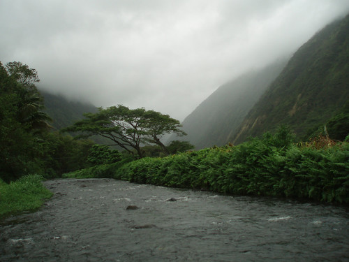
Rainy weather in Hawaii
Photo Credit: flickr.com
The trade winds are moving right along, and will continue right on into the weekend. A 1034 millibar high pressure system, is located to the northeast of Hawaii Friday night. This is keeping our local wind speeds rather gusty, with a small craft wind advisory active across most coastal waters from Oahu to the Big Island. A winter weather advisory remains in force over the two tall summits on the Big Island, where snow has been falling. The gusty trade winds will give way to somewhat lighter winds this weekend into early next week. A high surf advisory for the east facing shores of all the islands remains active as well, due to the fresh trade wind born wind swell along the windward sides.
An upper level low pressure system, combining with moisture bearing trade winds…are keeping the islands wet. The moisture riding in on these trade winds is keeping our windward sides soggy. At the upper altitudes, we have an upper level low pressure system, which has moved over the eastern side of the Hawaiian Islands. This low is enhancing the incoming showers, which will spread over into some leeward areas at times. We will find localized heavy showers occurring from the Big Island to Maui and beyond. These generally windward biased showers will stretch-up to Oahu and Kauai going into the weekend. The low pressure system will move away starting Monday, with improving weather conditions. A new low will form to the northwest around Wednesday…which will likely be too far away to influence our local weather then.
It’s early Friday evening here in Kihei, Maui, as I start writing this last paragraph. It was a rainy day here in the islands, although the bulk of it fell along the windward sides of the islands. At the time of this writing, the NWS issued flash flood warning remained in effect over the windward side of the Big Island. The other islands have seen showers too, with pretty much totally cloudy skies blocking our famous Hawaiian sunshine. Here’s a looping radar image, so you can keep track of where all those showers (some of which will be locally heavy) are falling…and there’s no lack of water falling from the sky now! As we head into the weekend, there will be more windward biased showers, some of which may stretch over to the leeward sides at times too. Meanwhile, up on the summits on the Big Island, snow has been falling. The webcam lens is covered with snow, and it will be getting dark soon, but here’s a link to that camera in case it shows the snow Saturday morning. ~~~ I’m about ready to head over to the Kahului side, to take in a new film. This film is called Valkyrie (2008), starring John Cruise and Kenneth Branagh, among many others. The film is based on actual events, a plot to assassinate Hilter is unfurled during the height of WWII. Here’s a trailer in case you are interested in seeing what I’ll be taking in this evening. ~~~ I’ll be back early Saturday morning with my response to this film, and of course with your next new weather narrative from the moisture laden Hawaiian Islands. I hope you have a great Friday night until then! Aloha for now…Glenn.
Interesting: An ancient underground water basin the size of Libya holds the key to Australia avoiding a water crisis as climate change bites the drought-hit nation. Australia’s Great Artesian Basin is one of the largest artesian groundwater basins in the world, covering 656,370 sq miles and lying beneath one-fifth of Australia. The basin holds 65 million giga-liters of water, about 820 times the amount of surface water in Australia, and enough to cover the Earth’s land mass under half a meter of water, says the Great Artesian Basin Coordinating Committee. And it is slowly topped up with 1 million mega-liters a year as rain filters through porous sandstone rock, becoming trapped in the underground basin. "There is probably enough water in there to last Australia’s needs for 1,500 years, if we wanted to use it all," says John Hillier, a hydro-geologist who has just completed the Great Artesian Basin Resource Study. But he and other experts warn that access to the basin’s water supply is under threat from declining artesian pressure, which forces the water to the surface via bores and springs.
If artesian pressure falls too far, due to excessive extraction of water, the ancient water source will be unreachable, except through costly pumping. Lying as much as 1.2 miles below ground, some parts of the basin are 1.8 miles from top to bottom. The basin was formed between 100 and 250 million years ago and consists of alternating layers of water bearing sandstone aquifers and non-water bearing siltstones and mudstones. Basin water is extracted through bores and is the only source of water for mining, tourism and grazing in Queensland, New South Wales and South Australia states, and the Northern Territory. The underground water spawns $2.4 billion worth of production a year from farming, mining and tourism, says the Great Artesian Basin Coordinating Committee.
Interesting2: A plan to build the United States’ first offshore wind farm took another step, after the Massachusetts Department of Environmental Protection approved its proposed undersea cables to transmit power to the mainland. The Cape Wind project, which would place 130 turbines about 4.7 miles off upscale Cape Cod, would provide "greater public benefit than detriment," the state review found. The proposed wind farm, opposed by beachfront homeowners who complain the 247-foot towers would spoil their views, would provide enough power for about 400,000 homes. Developers of the $1 billion project are still waiting on a composite state and local permit, as well as federal approvals by the U.S. Coast Guard, Department of the Interior and the Federal Aviation Administration, said Mark Rogers, a spokesman for privately held Cape Wind Associates LLC. Rogers said Cape Wind expects the permitting process to be complete by March.
Interesting3: Climate change, whaling, wild weather and water were the environmental issues dominating headlines this year. Australia mourned the loss of a conservation giant, University of Canberra freshwater ecologist and self-described political ”shit stirrer” Peter Cullen, who died in March. His funeral service was attended by more than 900 people, who came to Canberra from all over Australia to pay their respects to a courageous, outspoken champion of national water reform. In its annual summary of world weather trends, the World Meteorological Organization described 2008 as a year ”marked by weather extremes”. Australia had its share of wild weather, including record heat waves in Adelaide, worsening drought across the Murray-Darling Basin and violent storms unleashing floods across northern NSW and Queensland.
The year began with torrential rains causing the worst floods in 20 years across south-east Queensland and the NSW North Coast. More than 3000 people were stranded in NSW, with flood damage exceeding $250 million. Climate scientists, including Brisbane-based Professor Ian Lowe, have warned that Queensland can expect an increase in severe storms as global temperatures warm. This year, the Sunshine State bore the brunt of weather extremes, with 70 per cent of the state declared a disaster area due to storms, high winds and floods by the end of February. Premier Anna Bligh’s state Government subsequently announced a review of Queensland’s climate change strategy.
Interesting4: After weeks of waiting, mountain residents awoke to their first glimpse of winter on Dec. 13th, a few fluffy inches of powder that clung to the tops of boulders like chefs’ hats. More fell over the past two weeks, enough to bury the camel-colored meadow grass and wine-red willows in a deepening blanket of white. The magic, though, came late, just days before Christmas — one of the tardiest winter debuts ever. How much more snow will fall is anyone’s guess. A winter storm just hit Thursday, dumping several feet of snow, to the relief of snow-starved resorts.
But in the late arrival of this year’s snow season — and increasingly early spring snowmelt from the mountains — scientists and state officials are finding more than the signature of a natural drought. They believe they detect the fingerprint of climate change. The implications could be enormous. After all, the snowcapped Sierra is more than a skier’s paradise. It is a giant water faucet in the sky, a 400-mile-long, 60-mile-wide reservoir held in cold storage that supplies California with more than 60 percent of its water, much of it when it’s needed most: over the hot, dry summer months.
Interesting5: Wildlife satellite studies could lead to a radical re-thinking about how the snowy owl fits into the Northern ecosystem. "Six of the adult females that we followed in a satellite study spent most of last winter far out on the Arctic sea ice," said Université Laval doctoral student Jean-Francois Therrien, who is working with Professor Gilles Gauthier as part of an International Polar Year (IPY) research project to better understand key indicator species of Canadian northern ecosystems. The finding flabbergasted the biologists who are now curious to find out if Inuit seal hunters ever encounter the large white birds on the ice in winter darkness. "As for what the birds were doing there, they were possibly preying on seabirds," said Gauthier.
"Bird researchers at coastal field sites have observed snowy owls attacking eiders in winter. This hypothesis will be strengthened if we can match up the locations of our birds with the position of open water leads in the ice as recorded by other satellite data." The researchers find it intriguing that the top Arctic bird predator, like the top mammal – the polar bear, is also part of the marine ecosystem. The possible implications for the species will be discussed by Therrien this Wednesday in Quebec City at the Arctic Change Conference, one of the largest international research conferences ever held on the challenges facing the north. It was very surprising, said Therrien, how far the individual birds migrated from where they were banded on their nesting grounds on Bylot Island, north of Baffin Island.
Interesting6: Gabriela Escalante stalks the rumbling streets alongside newspaper, peanut and candy vendors, wading deep into traffic at red lights across town. Her eyes are fixed on tailpipes. A member of Mexico City’s "ecoguarda," or environmental police, she and some 50 colleagues are on the lookout for white clouds of toxic exhaust, stopping hundreds of offending motorists each day, issuing $100 fines and confiscating license plates — a small but urgent army fighting the capital’s infamous air pollution. "We detect, we detain and we fine," said Escalante, 27. "This is the air we all breathe." Not long ago, air in this throbbing capital was so bad that cyclists wore surgical masks. Birds fell dead in mid-flight, and children used brown crayons to draw the sky. Ozone exceeded safe levels on 97 percent of days in the year. But the metropolis ranked the world’s most polluted by a 1992 U.N. report has since slashed some of its worst emissions by more than three-quarters and has become a model for improving urban air quality.
Capitals such as Beijing, Cairo, New Delhi and Lima are now more contaminated, according to the World Bank, while air in at least 30 other cities contains more toxic particles, including Barcelona and Prague. When Latin American leaders met here last month to discuss the environment, many looked to Mexico as an example of progress, said Sergio Jellinek, a World Bank spokesman who attended the forum. Still, a nagging cloud of ozone has been harder to reduce — a sign of the secondary air pollution problems that cities can expect even after cutting their most visible contaminants. With the onset of winter, the worst time of year for pollution, Mexico City has said it plans to spend $3 billion by 2012 to expand public transit and further slash emissions. "There has been a large improvement, and it’s important to show it could be done," said Mario Molina, a Nobel Prize-winning Mexican chemist now advising President-elect Barack Obama’s transition team on environmental issues. "But there’s still a long way to go to get really satisfactory air." Ringed by volcanoes and nearly a half-mile higher than Denver, the city’s geography and population make it a "perfect factory" for pollution, said Adrian Fernandez, head of the National Institute of Ecology, Mexico’s version of the EPA.
Interesting7: Scientists said an earthquake felt by some New Hampshire towns during this last weekend was likely an aftershock from a tremor 281 years ago. Dr. John Ebel of the Weston Observatory in Massachusetts said the quake reported by some New Hampshire residents at about 4:35 p.m. Sunday was likely an aftershock from a 1727 earthquake in the Merrimack, N.H., area, WMUR-TV, Manchester, N.H., reported Tuesday. Ebel said the original 5.6 magnitude quake caused numerous aftershocks in the area that have continued for nearly three centuries. He said the most recent confirmed aftershock took place in October 2007 and measured a 1.3 magnitude on the Richter scale.
Interesting8: A 4.5 magnitude earthquake struck northern California on Friday, the US Geological Survey said, revising an earlier report of a stronger earthquake. The tremor occurred at 4:19 am with the epicenter two miles northeast of the small town of East Quincy, and 102 miles northeast of the state capital Sacramento, according to the USGS. An earlier report from the USGS said the earthquake was 5.0 in magnitude. There were no immediate reports of casualties or major damage.
Posted by Glenn
No Comments
December 25-26 2008
Air Temperatures – The following maximum temperatures were recorded across the state of Hawaii Thursday afternoon:
Lihue, Kauai – 78
Honolulu, Oahu – 82
Kaneohe, Oahu – 78
Kahului, Maui – 80
Hilo, Hawaii – 78
Kailua-kona – 81
Air Temperatures ranged between these warmest and coolest spots near sea level, and on the highest mountains…at 4 p.m. Thursday afternoon:
Barking Sands, Kauai – 82F
Hilo, Hawaii – 68F
Haleakala Crater – 39 (near 10,000 feet on Maui)
Mauna Kea summit – 27 (near 14,000 feet on the Big Island)
Precipitation Totals – The following numbers represent the largest precipitation totals (inches) during the last 24 hours on each of the major islands, as of Thursday afternoon:
0.58 Mount Waialaele, Kauai
0.76 South Fork Kaukonahua, Oahu
0.11 Molokai
0.00 Lanai
0.00 Kahoolawe
1.72 Kaupo Gap, Maui
1.37 Glenwood, Big Island
Weather Chart – Here’s the latest (automatically updated) weather map showing a strong 1035 millibar high pressure system to far to the north-northeast of the Hawaiian Islands. This trade wind producing high pressure system will cause locally strong and gusty trade winds through Friday…then a bit lighter Saturday.
Satellite and Radar Images: To view the cloud conditions we have here in Hawaii, please use the following satellite links, starting off with the Infrared Satellite Image of the islands to see all the clouds around the state during the day and night. This next image is one that gives close images of the islands only during the daytime hours, and is referred to as a Close-up visible image. This next image shows a larger view of the Pacific…giving perspective to the wider ranging cloud patterns in the Pacific Ocean. To help you keep track of where any showers may be around the islands, here’s the latest animated radar image.
Hawaii’s Mountains – Here’s a link to the live webcam on the summit of near 14,000 foot Mauna Kea on the Big Island of Hawaii. The tallest peak on the island of Maui is the Haleakala Crater, which is near 10,000 feet in elevation. These two webcams are available during the daylight hours here in the islands…and when there’s a big moon rising just after sunset for an hour or two! Plus, during the nights and early mornings you will be able to see stars, and the sunrise too…depending upon weather conditions.
Aloha Paragraphs

Merry Christmas…Glenn
Photo Credit: Pacific Disaster Center
The trade winds will remain blustery through Friday…before calming down some over the weekend. A 1035 millibar high pressure system, is located to the north-northeast of Hawaii Thursday evening. This is keeping our local wind speeds stronger than normal, with small craft wind advisories active most all Hawaiian waters. Meanwhile, the winds are gusty atop the summit of Maui, where a wind advisory remains in effect. The gusty trade winds will persist through Friday, then give way to lighter winds this weekend into early next week.
We’ve moved into a wet weather pattern, with increased windward showers, becoming potentially heavy at times..especially over the islands of Maui County and the Big Island. As the trade winds have increased, we’re seeing showery clouds being carried our way, bringing an increase in rainfall along our windward sides over the next couple of days. Then, an upper level low pressure system will move into our Hawaiian Island weather picture. This low will enhance the incoming showers, which may spread over into some leeward areas at times. As the low pressure cell gets very near, or over our islands, our gusty winds will calm down. We may find localized heavy showers into the weekend, with a possible thunderstorm forming near Maui and the Big Island.
It’s Christmas evening here in Kula, Maui, as I start writing this last long paragraph. The trade winds will remain wet over the next several days, along with being locally blustery through Friday. As a low pressure system, still to our east, moves closer, those windward showers will be further enhanced. If the low gets right over us, as some of the models suggest, we will see off and on heavy rains Friday into the weekend…with potential for flooding precipitation on the Big Island and Maui. This period of unsettled weather will continue into the weekend. ~~~ Christmas Day was wet on both Maui and the Big Island, especially along the windward sides. This looping radar image shows the areas of rain coming towards those two islands. The bulk of these showers will fall over the windward sides, in an off and on manner for the most part. There will be locally heavy showers on the Big Island and some parts of Maui, with even a thunderstorm here and there. This unsettled weather pattern will remain active through the upcoming weekend, perhaps even into early next week. ~~~ I hope everyone had a comfortable Christmas Day! I was fortunate to spend my time with old friends, and had a chance to have a long chat with my parents in Long Beach, California, where it was raining. I know that many parts of the country were having cold weather, with various forms of preciptation falling. My friends and I had a great breakfast together, then took a long walk, before returning home for sitting around, listening to Christmas music, and just being cozy, as it began to rain here in Kula during the afternoon hours too. I have been experiencing many emotions the last several days, some of them I’m sure attached to letting go of the TV weather show. I’ve received so much in the way of positive feedback, I want to thank everyone who has enjoyed this show over the last 18 years! ~~~ The next batch of showers look like they’re heading this way at the moment, which I will enjoy watching. I will be back early Friday morning with your next new weather narrative, again the best of a Merry Christmas to each of you! Aloha for now…Glenn.
Interesting: All that chocolate might actually help finish the bumper Christmas crossword over the seasonal period. According to Oxford researchers working with colleagues in Norway, chocolate, wine and tea enhance cognitive performance. The team from Oxford’s Department of Physiology, Anatomy and Genetics and Norway examined the relation between cognitive performance and the intake of three common foodstuffs that contain flavonoids (chocolate, wine, and tea) in 2,031 older people (aged between 70 and 74). Participants filled in information about their habitual food intake and underwent a battery of cognitive tests. Those who consumed chocolate, wine, or tea had significantly better mean test scores and lower prevalence of poor cognitive performance than those who did not.
The team reported their findings in the Journal of Nutrition. The role of micronutrients in age-related cognitive decline is being increasingly studied. Fruits and beverages such as tea, red wine, cocoa, and coffee are major dietary sources of polyphenols, micronutrients found in plant-derived foods. The largest subclass of dietary polyphenols is flavonoids, and it has been reported in the past that those who consume lots of flavonoids have a lower incidence of dementia. The latest findings seem to support the theory, although the researchers caution that more research would be needed to prove that it was flavonoids, rather than some other aspect of the foods studied, that made the difference. The effect was most pronounced for wine.
Interesting2: Extremes are exciting. Does anyone really think dinosaurs would capture our imagination the way they do if they hadn’t been so huge? You don’t see natural history museums vying for fossil skeletons of prehistoric rodents. It’s the Tyrannosaurus rex fossils they salivate and squabble over. And would the Hollywood glitterati cart around those little teacup pups if they weren’t so dang tiny and cute? Not likely. Earth’s creatures come in all sizes, yet they (and we) all sprang from the same single-celled organisms that first populated the planet. So how on Earth did life go from bacteria to the blue whale? "It happened primarily in two great leaps, and each time, the maximum size of life jumped up by a factor of about a million," said Jonathan Payne, assistant professor of geological and environmental science at Stanford.
Payne, along with a dozen other paleontologists and ecologists at 10 different research institutions, pooled their existing databases, combed the scientific literature and consulted with taxonomic experts in a quest to determine the maximum size of life over all of geological time. That might sound like a rather large undertaking, but, fortunately, the quest was made easier because even the professionals have a fascination with the size of the fossilized. "The nice thing about maximum size is that people tend to remark on very large fossils, so they are much easier to track down in the geologic literature than anything else," Payne said. In addition to quantifying the enormity of the two leaps in maximum size, the researchers also pinned down when those leaps took place. Both leaps coincided with periods when there was a major increase in the amount of oxygen in the atmosphere.
Interesting3: Retailers have blamed the global financial crisis for a litany of ills over the past year: slumping sales, mass layoffs and bankruptcy filings. Now, they are looking to the economy to explain recent spikes in shoplifting from their stores. Though individual retailers do not publicly report crime data, a survey of 52 national chain stores released this month by the Retail Industry Leaders Association (RILA), a trade group, showed that 84 percent reported an increase in shoplifting since the recession began. About 80 percent said organized retail crime had also jumped, and more than half said robberies and burglaries have risen, as well. "Bad guys are smart. People do not give them credit," said Brad Brekke, vice president of assets protection at Target. "They understand odds are either for or against them, and if they see the odds swing in their favor, they will take advantage of it." In the Washington area, Alexandria police said there have been more shoplifting reports nearly every month this year compared with last year, though they expect December to slacken.
In Tysons Corner, Lt. Josh Laitinen said his officers arrested 40 people over the past three weeks on shoplifting charges. And in Montgomery County, Detective David Hill, who oversees the county’s retail crime division, said many stores have told him that crime is up. "I’m sure it’s a major concern for all of them," Hill said. "No one wants to just give anything away." Retail crime typically increases during the holiday season as customers flood stores staffed with temporary — and often untested — employees. Doorbuster holiday discounts and aggressive merchandising, such as stocking more products near entryways, also provide ne’er-do-wells with more opportunities. But retailers and law enforcement officials say the economic downturn is resulting in more frequent and more aggressive crimes. Fighting these trends is an expensive proposition for retailers. According to the Center for Retail Research, a British organization that did a global survey, U.S. stores spent about $12 billion last year to combat retail crime. Many employ security officers to monitor surveillance cameras throughout the store.
Interesting4: Caribou, aka reindeer in North America, could soon become endangered by threats such as oil exploration and climate change, according to a new book. The animals are revered by many cultures and are also central to the health and vitality of the Far North, the authors of "Caribou and the North: A Shared Future" (Dundurn Press Toronto) state. Wild reindeer are widespread in Alaska, Canada, Siberia and Greenland. The book highlights the caribou in terms of its natural history; ecological importance in boreal, mountain, and Arctic ecosystems; and steps that conservationists, wildlife managers, and governments can take in protecting the future of this unique deer species. "The caribou is central to the normal function of northern ecosystems," said Justina Ray, executive director of Wildlife Conservation Society-Canada and a co-author of the book.
"With their huge range requirements and need for intact landscapes, these animals are serving as the litmus test for whether we will succeed in taking care of their needs in an area that is under intensifying pressure." Caribou are the only deer species where males and females both possess antlers. And they are superbly adapted to a cold weather existence (they even have hair on the bottoms of their feet), Ray said. They are the most abundant large land-dwelling animal of the Far North and have learned to exploit a number of ecosystems: tundra, boreal forests, mountains and polar deserts. Some populations, such as the famous Porcupine Herd of the Yukon and eastern Alaska embark on epic migrations, whereas the Narrow Lake population of British Columbia’s boreal forest remains in the same habitat year-round. Caribou are vulnerable to a number of threats, including deforestation, natural resource extraction and accompanying road networks, and climate change. In North America, caribou have lost about one-third of their southern range.
Interesting5: Honeybees are important to plants for reasons that go beyond pollination, according to a new study published in the December 23rd issue of Current Biology. The insects’ buzz also defends plants against the caterpillars that would otherwise munch on them undisturbed. The researchers, led by Jürgen Tautz of Biozentrum Universität Würzburg, Germany, earlier found that many caterpillars possess fine sensory hairs on the front portions of their bodies that enable them to detect air vibrations, such as the sound of an approaching predatory wasp or honeybee. "These sensory hairs are not fine-tuned," Tautz said. "Therefore, caterpillars cannot distinguish between hunting wasps and harmless bees." If an "unidentified flying object" approaches, generating air vibrations in the proper range, caterpillars stop moving or drop from the plant.
If caterpillars are constantly stressed by buzzing bees, as they likely are in fruiting trees heavily laden with blossoms, they will feed a lot less, he said. In the study, the researchers found that bell pepper plants without fruit suffered 60 to almost 70 percent less damage to their leaves when confined in a tent with bees and caterpillars in comparison to those in a tent with caterpillars alone. The amount of leaf damage was less on fruit-bearing plants as the beet armyworm caterpillars moved into the maturing peppers, they report. "Our findings indicate for the first time that visiting honeybees provide plants with a totally unexpected advantage," the researchers said. "They not only transport pollen from flower to flower, but in addition also reduce plant destruction by herbivores."
Posted by Glenn
No Comments
December 25 2008
Air Temperatures – The following maximum temperatures were recorded across the state of Hawaii Wednesday afternoon:
Lihue, Kauai – 77
Honolulu, Oahu – 81
Kaneohe, Oahu – 78
Kahului, Maui – 80
Hilo, Hawaii – 78
Kailua-kona – 81
Air Temperatures ranged between these warmest and coolest spots near sea level, and on the highest mountains…at 4 p.m. Wednesday afternoon:
Barking Sands, Kauai – 81F
Hilo, Hawaii – 72F
Haleakala Crater – 41 (near 10,000 feet on Maui)
Mauna Kea summit – 27 (near 14,000 feet on the Big Island)
Precipitation Totals – The following numbers represent the largest precipitation totals (inches) during the last 24 hours on each of the major islands, as of Wednesday afternoon:
1.37 Mount Waialaele, Kauai
0.60 Manoa Valley, Oahu
0.10 Molokai
0.00 Lanai
0.00 Kahoolawe
4.85 Puu Kukui, Maui
0.66 Pahoa, Big Island
Weather Chart – Here’s the latest (automatically updated) weather map showing a strong 1035 millibar high pressure system far to the north-northeast of the Hawaiian Islands. This trade wind producing high pressure system will cause locally strong and gusty trade winds through Christmas Day.
Satellite and Radar Images: To view the cloud conditions we have here in Hawaii, please use the following satellite links, starting off with the Infrared Satellite Image of the islands to see all the clouds around the state during the day and night. This next image is one that gives close images of the islands only during the daytime hours, and is referred to as a Close-up visible image. This next image shows a larger view of the Pacific…giving perspective to the wider ranging cloud patterns in the Pacific Ocean. To help you keep track of where any showers may be around the islands, here’s the latest animated radar image.
Hawaii’s Mountains – Here’s a link to the live webcam on the summit of near 14,000 foot Mauna Kea on the Big Island of Hawaii. The tallest peak on the island of Maui is the Haleakala Crater, which is near 10,000 feet in elevation. These two webcams are available during the daylight hours here in the islands…and when there’s a big moon rising just after sunset for an hour or two! Plus, during the nights and early mornings you will be able to see stars, and the sunrise too…depending upon weather conditions.
Aloha Paragraphs
Merry Christmas…Glenn
Photo Credit: Pacific Disaster Center
The trade winds are getting stronger now, and will remain blustery through Friday…before calming down over the weekend. A strong 1035 millibar high pressure system, has moved into the area north-northeast of Hawaii. This has increased our local wind speeds at the surface, with small craft wind advisories active from Kauai right down to the Big Island. Meanwhile, the winds are gusty atop the summits of Maui and the Big Island too, where a wind advisory remains in effect…gusting up to 40-50 mph at times. The gusty trade winds will persist through Friday, then give way to lighter winds this weekend into early next week.
We’ve moved into a wetter weather pattern now, with increased windward showers, then becoming potentially heavier…especially over the islands of Maui County and the Big Island Friday. As the trade winds have increased, we’re seeing showery clouds being carried our way, bringing an increase in rainfall along our windward sides over the next couple of days. Then, an upper level low pressure system, now to our east, will get closer, or over us. This low will enhance the incoming showers, which may spread over into some leeward areas Friday into the weekend. As the low pressure cell gets very near, or over our islands, our gusty winds will calm down. We may find localized heavy showers Friday into the weekend, with a possible thunderstorm forming near Maui and the Big Island.
It’s Wednesday evening here in Kula, Maui, as I start writing this last paragraph. As we move into our Christmas holiday period, we will also be grading into windy and wetter weather circumstances. The trade winds will remain wet over the next few days, along with being locally blustery. As a low pressure system, still to our east, moves closer, those windward showers will be enhanced. If the low gets right over us, as some of the computer models suggest, we could see off and on heavy rains Friday into the weekend…with potential for flooding precipitation then. We will have to keep a close eye on this situation. This wet period will continue on into Monday, with a break occurring then. ~~~ I left Kihei a bit early today, and found some showers falling as I drove up the Haleakala Highway through Pukalani. These showers fell behind me as I got up to Kula, where it was partly sunny, warm and dry. Looking over towards the windward side though, those showers seem to be heading our way. My wind chimes are sounding off all the sudden, with the gusty trade winds trying to stretch over here as well. ~~~ I have a friend who just flew in, arriving from Marin County, just north of San Francisco. She will join my neighbors and I, when we start off our Christmas Eve festivities with a nice walk before sunset. We will likely have a glass of red wine, and then begin slowly eating some really great food that we have prepared. I hope that you have a great Christmas wherever you happen to be reading from. Either in some snowy area on the Mainland, or in the windward showers here in Hawaii, or along the still nice weather conditions on our leeward sides. I will come back online Christmas Day with the next new weather narrative from paradise. Again, Merry Christmas! That picture of me above was taken today, sending you my famous flying shaka, the same one that I’ve ended my TV weather show with all these years. Aloha for now…Glenn.
Interesting: All that chocolate might actually help finish the bumper Christmas crossword over the seasonal period. According to Oxford researchers working with colleagues in Norway, chocolate, wine and tea enhance cognitive performance. The team from Oxford’s Department of Physiology, Anatomy and Genetics and Norway examined the relation between cognitive performance and the intake of three common foodstuffs that contain flavonoids (chocolate, wine, and tea) in 2,031 older people (aged between 70 and 74). Participants filled in information about their habitual food intake and underwent a battery of cognitive tests. Those who consumed chocolate, wine, or tea had significantly better mean test scores and lower prevalence of poor cognitive performance than those who did not.
The team reported their findings in the Journal of Nutrition. The role of micronutrients in age-related cognitive decline is being increasingly studied. Fruits and beverages such as tea, red wine, cocoa, and coffee are major dietary sources of polyphenols, micronutrients found in plant-derived foods. The largest subclass of dietary polyphenols is flavonoids, and it has been reported in the past that those who consume lots of flavonoids have a lower incidence of dementia. The latest findings seem to support the theory, although the researchers caution that more research would be needed to prove that it was flavonoids, rather than some other aspect of the foods studied, that made the difference. The effect was most pronounced for wine.
Interesting2: Extremes are exciting. Does anyone really think dinosaurs would capture our imagination the way they do if they hadn’t been so huge? You don’t see natural history museums vying for fossil skeletons of prehistoric rodents. It’s the Tyrannosaurus rex fossils they salivate and squabble over. And would the Hollywood glitterati cart around those little teacup pups if they weren’t so dang tiny and cute? Not likely. Earth’s creatures come in all sizes, yet they (and we) all sprang from the same single-celled organisms that first populated the planet. So how on Earth did life go from bacteria to the blue whale? "It happened primarily in two great leaps, and each time, the maximum size of life jumped up by a factor of about a million," said Jonathan Payne, assistant professor of geological and environmental science at Stanford.
Payne, along with a dozen other paleontologists and ecologists at 10 different research institutions, pooled their existing databases, combed the scientific literature and consulted with taxonomic experts in a quest to determine the maximum size of life over all of geological time. That might sound like a rather large undertaking, but, fortunately, the quest was made easier because even the professionals have a fascination with the size of the fossilized. "The nice thing about maximum size is that people tend to remark on very large fossils, so they are much easier to track down in the geologic literature than anything else," Payne said. In addition to quantifying the enormity of the two leaps in maximum size, the researchers also pinned down when those leaps took place. Both leaps coincided with periods when there was a major increase in the amount of oxygen in the atmosphere.
Interesting3: Retailers have blamed the global financial crisis for a litany of ills over the past year: slumping sales, mass layoffs and bankruptcy filings. Now, they are looking to the economy to explain recent spikes in shoplifting from their stores. Though individual retailers do not publicly report crime data, a survey of 52 national chain stores released this month by the Retail Industry Leaders Association (RILA), a trade group, showed that 84 percent reported an increase in shoplifting since the recession began. About 80 percent said organized retail crime had also jumped, and more than half said robberies and burglaries have risen, as well. "Bad guys are smart. People do not give them credit," said Brad Brekke, vice president of assets protection at Target. "They understand odds are either for or against them, and if they see the odds swing in their favor, they will take advantage of it." In the Washington area, Alexandria police said there have been more shoplifting reports nearly every month this year compared with last year, though they expect December to slacken.
In Tysons Corner, Lt. Josh Laitinen said his officers arrested 40 people over the past three weeks on shoplifting charges. And in Montgomery County, Detective David Hill, who oversees the county’s retail crime division, said many stores have told him that crime is up. "I’m sure it’s a major concern for all of them," Hill said. "No one wants to just give anything away." Retail crime typically increases during the holiday season as customers flood stores staffed with temporary — and often untested — employees. Doorbuster holiday discounts and aggressive merchandising, such as stocking more products near entryways, also provide ne’er-do-wells with more opportunities. But retailers and law enforcement officials say the economic downturn is resulting in more frequent and more aggressive crimes. Fighting these trends is an expensive proposition for retailers. According to the Center for Retail Research, a British organization that did a global survey, U.S. stores spent about $12 billion last year to combat retail crime. Many employ security officers to monitor surveillance cameras throughout the store.
Interesting4: Caribou, aka reindeer in North America, could soon become endangered by threats such as oil exploration and climate change, according to a new book. The animals are revered by many cultures and are also central to the health and vitality of the Far North, the authors of "Caribou and the North: A Shared Future" (Dundurn Press Toronto) state. Wild reindeer are widespread in Alaska, Canada, Siberia and Greenland. The book highlights the caribou in terms of its natural history; ecological importance in boreal, mountain, and Arctic ecosystems; and steps that conservationists, wildlife managers, and governments can take in protecting the future of this unique deer species. "The caribou is central to the normal function of northern ecosystems," said Justina Ray, executive director of Wildlife Conservation Society-Canada and a co-author of the book.
"With their huge range requirements and need for intact landscapes, these animals are serving as the litmus test for whether we will succeed in taking care of their needs in an area that is under intensifying pressure." Caribou are the only deer species where males and females both possess antlers. And they are superbly adapted to a cold weather existence (they even have hair on the bottoms of their feet), Ray said. They are the most abundant large land-dwelling animal of the Far North and have learned to exploit a number of ecosystems: tundra, boreal forests, mountains and polar deserts. Some populations, such as the famous Porcupine Herd of the Yukon and eastern Alaska embark on epic migrations, whereas the Narrow Lake population of British Columbia’s boreal forest remains in the same habitat year-round. Caribou are vulnerable to a number of threats, including deforestation, natural resource extraction and accompanying road networks, and climate change. In North America, caribou have lost about one-third of their southern range.
Interesting5: Honeybees are important to plants for reasons that go beyond pollination, according to a new study published in the December 23rd issue of Current Biology. The insects’ buzz also defends plants against the caterpillars that would otherwise munch on them undisturbed. The researchers, led by Jürgen Tautz of Biozentrum Universität Würzburg, Germany, earlier found that many caterpillars possess fine sensory hairs on the front portions of their bodies that enable them to detect air vibrations, such as the sound of an approaching predatory wasp or honeybee. "These sensory hairs are not fine-tuned," Tautz said. "Therefore, caterpillars cannot distinguish between hunting wasps and harmless bees." If an "unidentified flying object" approaches, generating air vibrations in the proper range, caterpillars stop moving or drop from the plant.
If caterpillars are constantly stressed by buzzing bees, as they likely are in fruiting trees heavily laden with blossoms, they will feed a lot less, he said. In the study, the researchers found that bell pepper plants without fruit suffered 60 to almost 70 percent less damage to their leaves when confined in a tent with bees and caterpillars in comparison to those in a tent with caterpillars alone. The amount of leaf damage was less on fruit-bearing plants as the beet armyworm caterpillars moved into the maturing peppers, they report. "Our findings indicate for the first time that visiting honeybees provide plants with a totally unexpected advantage," the researchers said. "They not only transport pollen from flower to flower, but in addition also reduce plant destruction by herbivores."
Posted by Glenn
No Comments
December 23-24 2008
Air Temperatures – The following maximum temperatures were recorded across the state of Hawaii Tuesday afternoon:
Lihue, Kauai – 76
Honolulu, Oahu – 81
Kaneohe, Oahu – 79
Kahului, Maui – 81
Hilo, Hawaii – 78
Kailua-kona – 80
Air Temperatures ranged between these warmest and coolest spots near sea level, and on the highest mountains…at 4 p.m. Tuesday afternoon:
Kawaihae, Big Island – 82F
Molokai airport – 75F
Haleakala Crater – 48 (near 10,000 feet on Maui)
Mauna Kea summit – 32 (near 14,000 feet on the Big Island)
Precipitation Totals – The following numbers represent the largest precipitation totals (inches) during the last 24 hours on each of the major islands, as of Tuesday afternoon:
1.42 Mount Waialaele, Kauai
0.38 Poamoho 2, Oahu
0.04 Molokai
0.00 Lanai
0.00 Kahoolawe
0.49 West Wailuaiki, Maui
0.09 Pahoa, Big Island
Weather Chart – Here’s the latest (automatically updated) weather map showing a strong 1038 millibar high pressure system to far to the north of the Hawaiian Islands. This trade wind producing high pressure system will cause locally strong and gusty trade winds through Christmas Day.
Satellite and Radar Images: To view the cloud conditions we have here in Hawaii, please use the following satellite links, starting off with the Infrared Satellite Image of the islands to see all the clouds around the state during the day and night. This next image is one that gives close images of the islands only during the daytime hours, and is referred to as a Close-up visible image. This next image shows a larger view of the Pacific…giving perspective to the wider ranging cloud patterns in the Pacific Ocean. To help you keep track of where any showers may be around the islands, here’s the latest animated radar image.
Hawaii’s Mountains – Here’s a link to the live webcam on the summit of near 14,000 foot Mauna Kea on the Big Island of Hawaii. The tallest peak on the island of Maui is the Haleakala Crater, which is near 10,000 feet in elevation. These two webcams are available during the daylight hours here in the islands…and when there’s a big moon rising just after sunset for an hour or two! Plus, during the nights and early mornings you will be able to see stars, and the sunrise too…depending upon weather conditions.
Aloha Paragraphs

A nice beach on the windward side of Oahu
Photo Credit: Flikr.com
We’ll find strong and gusty trade winds as we move into the Christmas holiday…calming back down this weekend. A new moderately strong high pressure system is moving into the area north of Hawaii now. This has increased our local wind speeds a couple of notches. We find a small craft wind advisory active now between Oahu and Molokai, plus around Maui and the Big Island…which may be expanded towards Kauai with time. Meanwhile, the winds will be gusty atop the summits of Maui and the Big Island to, where a wind advisory is now in effect…gusting to near 50 mph in the extreme. The gusty trade winds will persist through Friday, then give way to lighter winds this weekend, into early next week, as a trough of low pressure gets closest to the islands.
Besides the gusty trade winds, and an increase in windward biased showers, our weather will remain pretty good for the time being. As the trade winds increase, we’ll see showery clouds being carried our way, bringing an increase in rainfall along our windward sides. Then, an upper level low pressure system, now to our east, will be approaching. This low will enhance the incoming showers, which may spread over into some leeward areas eventually. The latest model runs show the area of low pressure getting closest to our islands Friday. This will begin the process of our winds calming down. We may find localized heavy showers then too, with a possible thunderstorm forming over and around the Big Island.
It’s early Tuesday evening here in Kihei, Maui, as I start writing this last paragraph. As noted above, we’re moving into a windy Christmas holiday. The winds will become rather blustery soon, lasting through Christmas Day into Friday. All this wind will carry in a more substantial amount of showers along our north and east facing windward coasts and slopes over the next couple of days. Then, a little later in the week, from about Friday into the weekend, an upper level low pressure system will arrive near the Big Island, helping to wring-out addition showers. These showers may end up being quite heavy around the Big Island, with a good chance of snowy conditions atop the summits there. This coming weekend will find lighter winds, with still the chance of showers around. The latest computer forecast models suggest that our winds will veer around to the southeast early next week, ahead of a possible cold front approaching from the northwest then. ~~~ On another note, Wednesday will be the last day, the very last day, for my TV weather show on cable television. It’s rather an emotional time, letting go of something that has been so fun, and if I may say so, entertaining for the last near 18 years! ~~~ Looking out the window here in Kihei, before I take the drive home to Kula, it’s mostly clear out there. It’s a very pretty end of the day, and as been my habit lately, I get out for an evening walk. This makes for two walks per day, which is doubly healthy, and more than that, feels good! ~~~ I’ll be back very early Wednesday morning, which of course is Christmas Eve morning. Oh my gosh, it’s going to finally be here, after all this long wait, since about Halloween, when I began anticipating this major holiday. I hope you have a great Tuesday night, and if you find yourself up early on Wednesday, check out that fabulous crescent moon. Aloha for now…Glenn.
Interesting: Shin Abe doesn’t find it odd that the picturesque little Japanese town of Kuzumaki, where he has lived all his life, generates some of its electricity with cow dung. Nor is the 15-year-old middle school student blown away by the vista of a dozen wind turbines spinning atop the forested peak of nearby Mt. Kamisodegawa. And it’s old news to Abe that his school gets 25% of its power from an array of 420 solar panels located near the campus. "That’s the way it’s been," he shrugs. "It’s natural." To Abe, it is. But the blase teen has grown up in an alternative universe — one that might be envisioned by Al Gore. That’s because Kuzumaki (population 8,000) has over the past decade transformed itself into a living laboratory for the development of sustainable and diversified energy sources.
"When I was growing up, all we had [to generate power] was oil," says Kazunori Fukasawaguchi, a Kuzumaki native who now serves in local government. "I never imagined this kind of change." In resource-poor Japan, which imports 90% of its fuel, Kuzumaki is a marvel of energy self-sufficiency. Signs of the town’s comprehensive focus on environmental sustainability are visible from its mountaintops to the pens of the dairy cows that once were the bedrock of local commerce. Atop Mt. Kamisodegawa, the 12 wind turbines, each 305 feet tall, have the capacity to convert mountain gusts into 21,000 KW of electricity — more than enough to meet the needs of the town’s residents. The excess is sold to neighboring communities.
Interesting2: Inhabitants of the tropics can expect to see more severe storms if sea-surface temperatures in the region continue to rise as Earth’s climate changes. The growth of “thunderheads” — the massive and extremely tall clouds that generate the most severe thunderstorms — is driven by the rise of warm, moist air. A NASA satellite designed to monitor such deep convective clouds detects about 6,000 of them each day, says George Aumann, a climate scientist at the Jet Propulsion Laboratory in Pasadena, California. He and JPL colleague Joao Teixeira have analyzed five years’ worth of data from the satellite. They reported December 19 in San Francisco at the annual meeting of the American Geophysical Union that such rainfall-producing clouds are more frequent over areas where ocean temperatures are warm — a finding that bolsters a previous study that showed an increase in global rainfall as climate has warmed in recent decades.
Interesting3: President-elect Barack Obama’s new "green dream team" is committed to battling climate change and ready to push for big policy reforms, in stark contrast with the Bush administration, environmental advocates said on Monday. "If this team can’t advance strong national policy on global warming, then no one can," said Kevin Knobloch, president of the Union of Concerned Scientists, referring to Obama’s picks for the top energy and environment jobs in his administration, which takes office on January 20. "This caliber of scientists in any administration would be a major headline," Knobloch said by telephone on Monday. "But in contrast to the eight years of the Bush administration, where political appointees ran roughshod over science at a terrible cost to the truth, they stand out even more." Last week, Obama picked a Nobel physics laureate, Stephen Chu, to head the Energy Department; former environmental lawyer and U.S. Sen. Ken Salazar as Interior secretary; former New Jersey environment chief Lisa Jackson to head the U.S. Environmental Protection Agency; Nancy Sutley, deputy mayor of Los Angeles, to run the White House Council on Environmental Quality. The president-elect tapped Carol Browner, who headed the Clinton administration’s EPA, to take a new White House position coordinating policy on energy, environment and climate change. For White House science adviser, Obama chose John Holdren, a Harvard University expert on climate change. For the National Oceanic and Atmospheric Administration, which deals with weather and climate among other matters, Obama named Jane Lubchenco, a marine biologist who has been sharply critical of that agency for allowing overfishing.
Interesting4: A study headed by researchers from the University of Barcelona (UB) shows that caffeine has a greater effect on men than women, and that these effects start just 10 minutes after it is drunk. In addition, contrary to what was previously thought, it has also been shown that decaffeinated coffee also produces an increased state of alertness. “Numerous studies have demonstrated the stimulant effects of caffeine, but none of these have looked at their effects in terms of the consumer’s gender,” Ana Adan, lead author of the study and a researcher in the Psychiatry and Clinical Psychobiology Department of the UB, tells SINC. Research into the effects of caffeine tends to be carried out using preparations in which the caffeine level is much higher than normal intake. According to Adan, the novelty of this study lies in “the difference seen in the effects on men and women, based on the quantities of caffeine people take in 99% of cases (espresso coffee and decaffeinated espresso coffee, containing 100mg and 5mg of caffeine, respectively)”. In order to measure the effects, the scientists used a sample of 668 university students (238 male and 450 female) with an average age of 22 years.
Measurements were taken before and after the caffeine was ingested (10, 20 and 30 minutes) and were carried out at mid-day (11am to 1pm) and in the afternoon (4pm to 6pm), to act as a control in case of possible differences caused by the time. “Although both the men and women saw an improvement in their activity levels with the coffee, which increased in later measurements, we observed a greater impact among the males,” the Catalan researcher tells SINC. When the decaffeinated version was introduced into the study, the authors also found a small subjective improvement in the participants’ state of alertness, which did not rise so strikingly in the later measurements. “Although we can’t say it is a placebo, we did note an effect resulting from drinking a decaffeinated coffee (at a quantity insufficient to actually affect mood),” adds Adan. The results showed a small impact among both men and women who drank the decaffeinated coffee, although this time the effect was slightly more noticeable among the women. The effect of decaffeinated drinks on alertness had not been previously studied.
Interesting5: Honeybees are important to plants for reasons that go beyond pollination, according to a new study published in the December 23rd issue of Current Biology. The insects’ buzz also defends plants against the caterpillars that would otherwise munch on them undisturbed. The researchers, led by Jürgen Tautz of Biozentrum Universität Würzburg, Germany, earlier found that many caterpillars possess fine sensory hairs on the front portions of their bodies that enable them to detect air vibrations, such as the sound of an approaching predatory wasp or honeybee. "These sensory hairs are not fine-tuned," Tautz said. "Therefore, caterpillars cannot distinguish between hunting wasps and harmless bees." If an "unidentified flying object" approaches, generating air vibrations in the proper range, caterpillars stop moving or drop from the plant.
If caterpillars are constantly stressed by buzzing bees, as they likely are in fruiting trees heavily laden with blossoms, they will feed a lot less, he said. In the study, the researchers found that bell pepper plants without fruit suffered 60 to almost 70 percent less damage to their leaves when confined in a tent with bees and caterpillars in comparison to those in a tent with caterpillars alone. The amount of leaf damage was less on fruit-bearing plants as the beet armyworm caterpillars moved into the maturing peppers, they report. "Our findings indicate for the first time that visiting honeybees provide plants with a totally unexpected advantage," the researchers said. "They not only transport pollen from flower to flower, but in addition also reduce plant destruction by herbivores."
Interesting6: Canada has been blanketed in snow from coast to coast after severe winter storms hit transport and left tens of thousands of homes without electricity. Strong winds and snowfall have hampered relief efforts, with meteorologists forecasting more bad weather to come. Storm warnings have been issued for coastal areas of Nova Scotia and Vancouver, Quebec and Ontario were also braced for more wintry weather. Weathermen say Canada may see its first countrywide white Christmas since 1971. Several areas in the US have also been settling in from an extended cold snap, with storm warnings in place across a number of states after a weekend of hurricane-force winds and heavy snowfall. Meteorologists with Environment Canada have issued snowfall warnings across the country.
In eastern Canada, Nova Scotia Power reported that tens of thousands of customers were without electricity, with more snow forecast to fall. "It’s a widespread and severe winter storm and it’s not over yet, with these high winds expected to continue for some time," a Nova Scotia Power spokeswoman told the Canadian Press news agency. Some ferry services to the south-eastern province have been cancelled, while cross-country rail networks have also been affected. Several bridges, ferries and parts of the Trans-Canada Highway were closed to traffic. Air travel delays have been reported in Toronto and Charlottetown, while flights were cancelled at Fredericton Airport in the south-east after it was covered in more than 1ft of snow. Sub-zero temperatures also gripped parts of British Columbia as meteorologists warned of blizzards up and down Canada’s west coast. In the north-western territory of Yukon the temperature reportedly dropped as low as -49F.
Interesting7: Evidence that a massive meteorite shower had an impact on Earth on a global scale 470 million years ago have been found on a Highlands beach. Researchers from the University of Aberdeen (England) uncovered tiny remnants of meteorites, smaller than a grain of sand, within rocks in Sutherland. The find is linked to others made in China, the US and Australia. The scientists think the meteorites – a result of a collision in space – triggered earthquakes and tsunamis. The university said the find near Durness confirmed previous scientific speculation that the meteorite shower – which followed a "catastrophic event" in an asteroid belt between Mars and Jupiter – was so vast in size that it affected locations across the globe. The study, led by Professor John Parnell from the School of Geosciences at the University of Aberdeen and published in Nature Geoscience, found the Sutherland meteorites were linked to those found elsewhere in the world.
Prof. Parnell said these findings would help scientists to investigate further if there was any connection between the meteorites falling and changes to underwater species which took place around the same period of time. He said: "We tested the piece of rock in Durness by dissolving the limestone in acid which allowed us to detect meteorites, smaller than can be seen by the naked eye. "This confirmed that 470 million years ago these enormous meteorites fell in a wide span of locations across the globe – including Scotland. "This is the first time we have been able to prove the mammoth scale of the event and just how many geographical locations felt its impact." The scientist added: "Our research has also pinpointed that the meteorites falling caused earthquakes and tidal waves to take place at the edge of many continents. "Records show that the underwater life which existed on earth at this time became a lot more diverse directly after this major event. Any connection between these occurrences is not clear, but our findings will help us to investigate and potentially pinpoint how it happened."
Interesting8: The world’s population on New Year’s Day is set to reach 6.75 billion, a German group that encourages birth control said Tuesday. The World Population Foundation of Germany said the planet’s human population rose by 82 million this year. Its best estimate from its own data was that world population on January 1 would reach 6,751,643,600. The Hanover-based group said almost all the growth in numbers was in developing nations, where women faced multiple pregnancies whether they wanted them or not because contraception was not available. Resources, education and health care were in short supply in those nations because of rising population, the foundation said. A child born today in Germany can expect to live 79 years on average, but an African can only expect 54 years. "If we want to tackle poverty at the source, we have to help women avoid unwanted pregnancy," said Renate Baehr, the secretary of the foundation. "We have to spend more on sex education and contraception."
Posted by Glenn
[3] Comments
December 22-23 2008
Air Temperatures – The following maximum temperatures were recorded across the state of Hawaii Monday afternoon:
Lihue, Kauai – 77
Honolulu, Oahu – 81
Kaneohe, Oahu – 78
Kahului, Maui – 81
Hilo, Hawaii – 79
Kailua-kona – 81
Air Temperatures ranged between these warmest and coolest spots near sea level, and on the highest mountains…at 4 p.m. Monday afternoon:
Barking Sands, Kauai – 82F
Hilo, Hawaii – 74F
Haleakala Crater – 54 (near 10,000 feet on Maui)
Mauna Kea summit – 39 (near 14,000 feet on the Big Island)
Precipitation Totals – The following numbers represent the largest precipitation totals (inches) during the last 24 hours on each of the major islands, as of Monday afternoon:
0.02 Poipu, Kauai
0.40 Poamoho 2, Oahu
0.00 Molokai
0.00 Lanai
0.00 Kahoolawe
0.12 West Wailuaiki, Maui
0.22 Glenwood, Big Island
Weather Chart – Here’s the latest (automatically updated) weather map showing a 1027 millibar high pressure system to the northeast, iwth its associated ridge extending down to near the islands. As a low to the NW moves away, the ridge will migrate northward…allowing trade winds to flow across the entire island chain.
Satellite and Radar Images: To view the cloud conditions we have here in Hawaii, please use the following satellite links, starting off with the Infrared Satellite Image of the islands to see all the clouds around the state during the day and night. This next image is one that gives close images of the islands only during the daytime hours, and is referred to as a Close-up visible image. This next image shows a larger view of the Pacific…giving perspective to the wider ranging cloud patterns in the Pacific Ocean. To help you keep track of where any showers may be around the islands, here’s the latest animated radar image.
Hawaii’s Mountains – Here’s a link to the live webcam on the summit of near 14,000 foot Mauna Kea on the Big Island of Hawaii. The tallest peak on the island of Maui is the Haleakala Crater, which is near 10,000 feet in elevation. These two webcams are available during the daylight hours here in the islands…and when there’s a big moon rising just after sunset for an hour or two! Plus, during the nights and early mornings you will be able to see stars, and the sunrise too…depending upon weather conditions.
Aloha Paragraphs

Waimanalo Beach…on the island of Oahu
Photo Credit: Flikr.com
An early winter trade wind weather pattern will remain in place through the remainder of this work week. These trade winds will blow in the light to moderately srong realms…although stronger and gusty locally. We find a small craft wind advisory now active across the Alenuihaha Channel, and down along the leeward coasts of the Big Island. The gusty trade winds will persist through Saturday, then may give way to lighter southeasterlies again Sunday into early next week, as a new cold front approaches the state then.
Generally dry conditions will prevail through most of Christmas Day. Weather dynamics should stay rather static, so that we’ll not see many showers for the time being. The leeward sides will find dry conditions, with generally sunny to partly cloudy conditions. The latest models show a trough of low pressure arriving over the state from the east by later Christmas Day, with an increase in windward showers then…through the following several days. The next chance for cold front precipitation will hold off until early next week.
It’s early Monday evening here in Kihei, Maui, as I start writing this last paragraph. Monday was a great day, the trade winds aren’t particularly strong yet, which made for good conditions for our local beaches…especially on the leeward sides. I see little in the way of change as we move through the next several days. We may even sneak through most of Christmas Day, with good early winter conditions. Later Christmas Day, and then through the following several days, we’ll see a surge of moisture flooding into the state from the east…taking aim on the windward sides. ~~~ This was the first full day of winter in the northern hemisphere, of course which includes the Hawaiian Islands. Here in the tropics, the latter part of autumn, and early winter period are typically quite similar. As the trade winds are back with us now, we should see pleasant weather conditions for another several days. ~~~ Monday’s TV weather show started the new week, which will finish on Wednesday…which is the end of an era, as many of my viewers are describing it. It lasted almost two decades, and has been a great experience in my life! Fortunately, this website will take its place, although I know that it won’t be the same for those long term viewers. ~~~ Looking out the window here in Kihei before driving upcountry to Kula, I see lots of clear blue skies, with just some clouds surrounding the Haleakala Crater, and the West Maui Mountains. Look for a nice night, with generally clear to partly cloudy skies taking over again on Tuesday. By the way, the picture above is more or less where President elect Barack Obama is staying on the island of Oahu, for his family Christmas holiday. Speaking of Tuesday, I’ll be back online very early Tuesday morning with your next new weather narrative. I hope you have a great Monday night! Aloha for now…Glenn.
Interesting: Weather fronts originating from Siberia and Mongolia swept south across China over the weekend, sending temperatures plummeting and bringing heavy snow falls across parts of the country. On Saturday the China Meteorological Administration (CMA) issued orange warnings for the cold weather, advising residents to prepare for a sharp drop in temperature, heavy snow falls and gale force northerly winds. This extreme cold weather warning was the country’s second this winter. The first was issued early in the month when heavy snow brought widespread disruption to travel services. Northern and eastern parts of China bore the brunt of the current cold weather. Shandong province was hit by heavy snow falls which closed major highways and delayed flights at Jinan International Airport. In Beijing, snow, strong winds and temperature falls of 8 to 10 degrees Celsius gave the city a real taste of winter. The CMA states that while this cold front was not as severe as the first in early December, it arrived suddenly and brought with it a very sharp fall in temperature. The extreme weather continues to affect central and southern parts of China on Monday though conditions will improve during the day.
Interesting2: A Taiwanese plane arrived in the Chinese city of Chengdu on Monday to pick up a pair of giant pandas, a goodwill gift from Beijing and the latest sign of improving ties between the political rivals. Tuan Tuan and Yuan Yuan, whose names said together mean "unite," will be flown to Taiwan on Tuesday with steamed corn buns and fresh bamboo in their luggage and a standby supply of air-sickness pills. China had offered the pandas as a goodwill gift in 2006 as part of a charm offensive after decades of saber rattling. Taiwan’s then anti-China president declined the gift. Beijing has given pandas to nine countries, including Japan, North Korea, the United States and the former Soviet Union, since 1957. China-Taiwan ties have improved vastly in recent months after the election of China-friendly Taiwan President Ma Ying-jeou. "It’s clearly part of the longer rapprochement, a nice symbol," Brad Glosserman, executive director of the U.S.-based think tank Pacific Forum CSIS, said of the pandas.
Last week Taiwan and China launched direct daily passenger flights, new shipping routes and postal links for the first time in six decades. China has also offered Taiwan investors on the mainland $19 billion in financing over the next three years amid the global economic downturn. But many Taiwan citizens would prefer China remove missiles aimed at the island and let it join international organizations such as the United Nations instead of offering money or animals, experts say. "It’s not a milestone, not a breakthrough, just a continuation," said Lin Chong-pin, a strategic studies professor at Tamkang University in Taiwan. China has claimed sovereignty over self-ruled Taiwan since 1949, when Mao Zedong’s Communists won the Chinese civil war and Chiang Kai-shek’s Nationalists (KMT) fled to the island. Beijing has vowed to bring Taiwan under its rule, by force if necessary. China claims Taiwan as part of "one China," a notion many in Taiwan resist, especially the opposition Democratic Progressive Party that favors the island’s formal declaration of independence from China.
Interesting3: The United States could suffer the effects of abrupt climate changes within decades—sooner than some previously thought–says a new government report. It contends that seas could rise rapidly if melting of polar ice continues to outrun recent projections, and that an ongoing drought in the U.S. west could be the start of permanent drying for the region. Commissioned by the U.S. Climate Change Science Program, the report was authored by experts from the U.S. Geological Survey, Columbia University’s Lamont-Doherty Earth Observatory and other leading institutions. It was released at this week’s meeting of the American Geophysical Union. Many scientists are now raising the possibility that abrupt, catastrophic switches in natural systems may punctuate the steady rise in global temperatures now underway. However, the likelihood and timing of such "tipping points," where large systems move into radically new states, has been controversial. The new report synthesizes the latest published evidence on four specific threats for the 21st century. It uses studies not available to the Intergovernmental Panel on Climate Change (IPCC), whose widely cited 2007 report explored similar questions.
"This is the most up to date, as it includes research that came out after IPCC assembled its data," said Edward Cook, a climatologist at Lamont-Doherty and a lead author of the new study. The researchers say the IPCC’s maximum estimate of two feet of sea level rise by 2100 may be exceeded, because new data shows that melting of polar ice sheets is accelerating. Among other things, there is now good evidence that the Antarctic ice cap is losing overall mass. At the time of the IPCC report, scientists were uncertain whether collapses of ice shelves into the ocean off the western Antarctica were being offset by snow accumulation in the continent’s interior. But one coauthor, remote-sensing specialist Eric Rignot of the Jet Propulsion Laboratory, told a press conference at the meeting: "There is a new consensus that Antarctica is losing mass." Seaward flow of ice from Greenland is also accelerating. However, projections of how far sea levels might rise are "highly uncertain," says the report, as researchers cannot say whether such losses will continue at the same rates.
In the interior United States, a widespread drought that began in the Southwest about 6 years ago could be the leading edge of a new climate regime for a wider region. Cook, who heads Lamont’s Tree Ring Lab, says that periodic droughts over the past 1,000 years have been driven by natural cycles in air circulation, and that these cycles appear to be made more intense and persistent by warming. Among the new research cited is a 2007 Science paper by Lamont climate modeler Richard Seager, showing how changes in temperature over the Pacific have driven large-scale droughts across western North America. "We have no smoking gun saying that humans are causing the current changes. But the past is a cautionary tale," Cook told the press conference. "What this tells us is that the system has the ability to lock into periods of profound, long-lasting aridity. And there is the suggestion that these changes are related to warmer climate." Cook added: "If the system tips over, that would have catastrophic effects no human activities and populations over wide areas."
Interesting4: President-elect Barack Obama underscored on Saturday his intent to push initiatives on climate change by naming John Holdren, an energy and climate specialist, as the new White House science adviser. Holdren is a Harvard University physicist who has focused on the causes and consequences of climate change and advocated policies aimed at sustainable development. He has also done extensive research on the dangers of nuclear weapons. Obama pledged to put a priority on encouraging scientific breakthroughs in areas such as alternative energy solutions and finding cures to diseases, as he announced the pick of Holdren and other top science advisers in the Democratic weekly radio and video address. "Today, more than ever before, science holds the key to our survival as a planet and our security and prosperity as a nation," Obama said.
"It’s time we once again put science at the top of our agenda and worked to restore America’s place as the world leader in science and technology." "From landing on the moon, to sequencing the human genome, to inventing the Internet, America has been the first to cross that new frontier," Obama said. Obama said that government has played an important role in encouraging those breakthroughs and could do so in the future. The Bush administration has had a rocky relationship with the scientific community and was at times accused by critics of ignoring scientific evidence in its efforts to make political points on issues such as global warming. Holdren, who teaches at Harvard’s Kennedy School of Government, will head the White House Office of Science and Technology Policy. He is a former president of the American Association for the Advancement of Science.
Next Page »


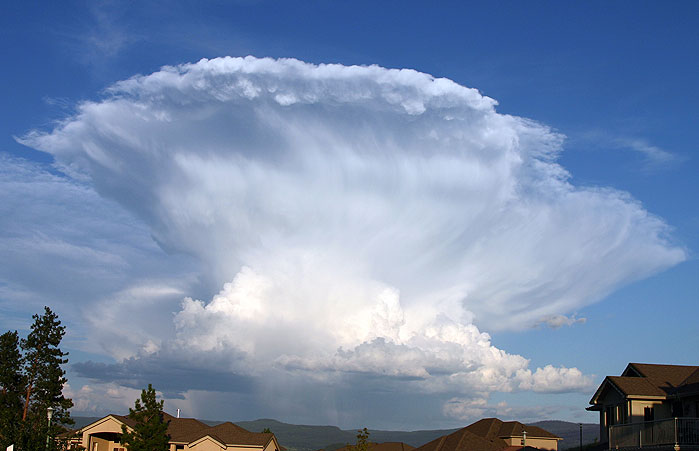