


Hawaiian Islands weather details & Aloha paragraphs
Posted by GlennMay 7-8 2008
Air Temperatures – The following maximum temperatures were recorded across the state of Hawaii Wednesday:
Lihue, Kauai – 81
Honolulu, Oahu – 85
Kaneohe, Oahu – 80
Kahului, Maui – 85
Hilo, Hawaii – 80
Kailua-Kona, Hawaii – 82
Air Temperatures ranged between these warmest and coolest spots near sea level at 4 p.m. Wednesday afternoon:
Honolulu, Oahu – 83F
Hilo, Hawaii – 77
Precipitation Totals – The following numbers represent the largest precipitation totals (inches) during the last 24 hours on each of the major islands, as of Wednesday afternoon:
0.80 MOUNT WAIALEALE, KAUAI
0.35 POAMOHO 2, OAHU
0.06 MOLOKAI
0.01 LANAI
0.00 KAHOOLAWE
0.45 PUU KUKUI, MAUI
0.49 PAHOA, BIG ISLAND
Weather Chart – Here’s the latest (automatically updated) weather map showing a large 1031 milliar high pressure center far to the NE of the state. This high pressure system will keep moderately strong to fresh trade winds blowing across our islands Thursday and Friday…locally strong and gusty.
Satellite and Radar Images: To view the cloud conditions we have here in Hawaii, please use the following satellite links, starting off with the Infrared Satellite Image of the islands to see all the clouds around the state during the day and night. This next image is one that gives close images of the islands only during the daytime hours, and is referred to as a Close-up visible image. This next image shows a larger view of the Pacific…giving perspective to the wider ranging cloud patterns in the Pacific Ocean…out from the islands. To help you keep track of where any showers may be around the islands, here’s the latest animated radar image.
Hawaii’s Mountains – Here’s a link to the live webcam on the summit of near 14,000 foot Mauna Kea on the Big Island of Hawaii. The tallest peak on the island of Maui is the Haleakala Crater, which is near 10,000 feet in elevation. These two webcams are available during the daylight hours here in the islands…and when there’s a big moon rising just after sunset for an hour or two! Plus, during the nights and early mornings you will be able to see stars, and the sunrise too…depending upon cloud conditions.
Aloha Paragraphs
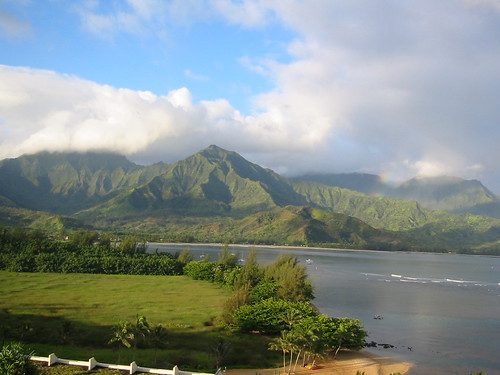
Princeville, Kauai
The trade winds have picked up in strength now, becoming rather blustery in some places. We’ll see the trade winds increase another notch Thursday through the rest of the week. A small craft wind advisory is now active in Hawaii’s coastal and channel waters around Maui and the Big Island, which may be expanded a bit further up the chain into the weekend. These trade will blow through next Tuesday, at which point they will likely slow down, and perhaps become southeast…remaining light for several days thereafter.
Despite the stronger trade winds, we won’t see much of an increase in showers. The windward areas as usual will find the most generous rainfall. The leeward beaches will be generally quite dry, although a few showers could fall along the Kona slopes of the Big Island during the afternoon or early evening hours. It appears that there will be little change in this favorably inclined trade wind weather pattern this week. We may see some changes occurring around the middle of next week.
It’s Wednesday evening as I begin writing this last section of today’s narrative. In the last sentence in the paragraph above, I intimated that there may be some changes starting around next Wednesday. The computer models want to have our winds getting much lighter then, and turn to the southeast. It’s still too early to totally accept this future possibility. If on the other hand, it were to occur as the models are pointing out, we would see the return of potentially thick vog, along with an increase in afternoon convective cloudiness and showers for a few days then.
~~~ It’s always risky to talk about what will be happening a week out into the future. The accuracy of weather forecasts is usually pretty good for that day, or perhaps even a day or two ahead. When you try and project out seven days however, well, that can bring weathermen and women, back to the drawing boards several times…back to their chalk boards, doing some pretty heavy erasing! So, we’ll hold this prospect lightly for the time being, and just keep a wary eye on it through the rest of this week. The models have even gone so far as to suggest an active cold front moving down through the state, which would be unusual this time of year. Stranger things have happened, but if we use climatology as a measuring stick, it would be unlikely to see a frontal cloud band moving down through the island chain during the middle of May.
~~~ Wednesday the weather followed the forecast script pretty well, staying nice for almost all outdoor activities. At the moment, as demonstrated with this looping satellite image, we’re mostly clear of the persistent high cirrus cloudiness of late. There are a few wisps moving by, with a couple of potential new areas moving our way on the upper winds aloft. The trade winds were the most notable weather element today, pushing our tropical vegetation around, and chalking-up our coastal waters with lots of white caps. Speaking of the ocean, without very much surf breaking on our local beaches now, this is an excellent time to be snorkeling, swimming, and just generally being in the ocean…although watch out for the gusty winds if you’re out in kayaks.
~~~ I will be back very early Thursday morning with your next new Hawaiian Island weather narrative. I hope you have a great Wednesday night, whether you’re here in the Islands, or in Seattle, Portland, San Francisco, LA or San Diego…or elsewhere of course! Aloha for now…Glenn
Note: I have not mentioned the devastating cyclone, named Nargis, which slammed into the river delta region in Myanmar (Burma). I was tracking the storm a week before it made landfall, as part of my duties at the Pacific Disaster Center here in Kihei, Maui, where I’m the senior weather analyst. So I have been very aware of the horrendous after-effects of this major storm…up to 100,000 deaths expected! There is certainly no lack of news, from various sources, which is the reason that I’m not including information about it on this website. I send my very best wishes to everyone involved in that area! Glenn
Interesting: China’s Huge Self-Sustaining Soar LED Wall, alled the GreenPix Zero Energy Media Wall, and with 2,292 individual color LEDs, comparable to a 24,000 sq. ft. monitor screen, it’s said to be the largest color LED display in the world. The wall is solar-powered too — photovoltaics are integrated into the wall’s glass curtain, and it harvests power during the day, to illuminate the display at night. Designed by, Simone Giostra & Partners Architects, the GreenPix wall is part of the Xicui Entertainment Complex in
Interesting2: Scientists have suggested that due to the adverse effects of Arctic ice melting, the hybrid of a polar bear and grizzly bear – dubbed the ‘grolar bear’, might rise in numbers. According to a report in The Sun , the effects of climate change means that the hybrid bears could become more common as their habitats increasingly overlap due to global warming. "One of the real things that is happening is that grizzlies are moving north, at the same time the polar bears are forced to be on the beach and we have found a number of grizzly bear polar bear hybrids," said biologist Dr George Divoky, who has worked in the Arctic region for over three decades. "Essentially that could mean that it would save the polar bear genes in the grizzly population," he added. Biologists have already spotted the hybrid species.
Interesting3: Polar bears may have it relatively easy. It’s the tropical creatures that could really struggle if the climate warms even a few degrees in places that are already hot, scientists reported on Monday. That doesn’t mean polar bears and other wildlife in the polar regions won’t feel the impact of climate change. They probably will, because that is where the warming is expected to be most extreme, as much as 18 degrees F (10 degrees C) by the end of this century. But there are far fewer species living in the Arctic and Antarctic and in the temperate zones than in the tropics, said Curtis Deutsch of the
Interesting4: Climate change is harder on women in poor countries, where mothers stay in areas hit by drought, deforestation or crop failure as men move to literally greener pastures, a Nobel Peace laureate said on Tuesday. "Many destructive activities against the environment disproportionately affect women, because most women in the world, and especially in the developing world, are very dependent on primary natural resources: land, forests, waters," said Wangari Maathai of