


August 31-September 1, 2009
Air Temperatures – The following maximum temperatures were recorded across the state of Hawaii Monday afternoon:
Lihue, Kauai – 84
Honolulu, Oahu – 89
Kaneohe, Oahu – 85
Kahului, Maui – 88
Hilo, Hawaii – 84
Kailua-kona – 90
Air Temperatures ranged between these warmest and coolest spots near sea level – and on the highest mountains…at 5 p.m. Monday evening:
Barking Sands, Kauai – 87F
Lihue, Kauaii – 80
Haleakala Crater – 55 (near 10,000 feet on Maui)
Mauna Kea summit – 55 (near 14,000 feet on the Big Island)
Precipitation Totals – The following numbers represent the largest precipitation totals (inches) during the last 24 hours on each of the major islands, as of Monday afternoon:
0.14 Mount Waialaele, Kauai
0.11 Manoa Valley, Oahu
0.04 Molokai
0.00 Lanai
0.00 Kahoolawe
1.18 Puu Kukui, Maui
0.16 Honaunau, Big Island
Marine Winds – Here’s the latest (automatically updated) weather map showing high pressure systems far to the north of the islands. Trade winds will be active through Monday and Tuesday.
Satellite and Radar Images: To view the cloud conditions we have here in Hawaii, please use the following satellite links, starting off with this Infrared Satellite Image of the islands to see all the clouds around the state during the day and night. This next image is one that gives close images of the islands only during the daytime hours, and is referred to as a Close-up visible image. This next image shows a larger view of the Pacific…giving perspective to the wider ranging cloud patterns in the Pacific Ocean. Finally, here’s a Looping IR satellite image, making viewable the clouds around the islands 24 hours a day. To help you keep track of where any showers may be around the islands, here’s the latest animated radar image.
Hawaii’s Mountains – Here’s a link to the live webcam on the summit of near 14,000 foot Mauna Kea on the Big Island of Hawaii. The tallest peak on the island of Maui is the Haleakala Crater, which is near 10,000 feet in elevation. These two webcams are available during the daylight hours here in the islands…and when there’s a big moon rising just after sunset for an hour or two! Plus, during the nights and early mornings you will be able to see stars, and the sunrise too…depending upon weather conditions.
Tropical Cyclone activity in the eastern and central Pacific – Here’s the latest weather information coming out of the National Hurricane Center, covering the eastern north Pacific. You can find the latest tropical cyclone information for the central north Pacific (where Hawaii is located) by clicking on this link to the Central Pacific Hurricane Center. Here’s a tracking map covering both the eastern and central Pacific Ocean. A satellite image, which shows the entire ocean area between Hawaii and the Mexican coast…can be found here.
Aloha Paragraphs
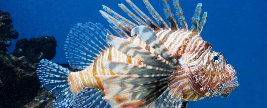
Interesting Hawaiian fish
There appears to be little change in the favorably inclined trade wind weather pattern, through the middle of the week. The trade winds are strong enough Monday evening, to keep small craft wind advisories active in the channel between Maui and Molokai, in the windy Maalaea Bay on Maui, across the Alenuihaha Channel between Maui and the Big Island…and around those windiest areas on the Big Island. Trade wind speeds will range generally between 15 and 25 mph, with stronger gusts locally through Wednesday, and then become a little stronger.
The first half of this new work week will have rather limited shower activity, focused most intently along the windward sides…increasing some Thursday and Friday. The leeward sides will remain mostly dry, with lots of sunshine during the days. The increase in windward showers later in the work week, will occur due to the arrival of an upper level low pressure system. The computer models then show another ridge overhead this coming holiday weekend…which will bring us back around to drier weather then.
Major category 4 hurricane Jimena, will bring very heavy weather conditions to the Baja, California peninsula on Tuesday! Jimena, at the last advisory from the National Hurricane Center, had 155 mph sustained winds…with top gusts to 190 mph! Tropical depression Kevin, also in the eastern Pacific, is weakening further out to sea from Mexico. The Atlantic, and the Gulf of Mexico are quiet at the moment…although there is a new storm trying to take form now…which could move into the Caribbean area over the next couple of days. Here in the central Pacific, there are no active tropical cyclones.
It’s Monday evening here in Kihei, Maui, as I begin writing this last section of this morning’s narrative update. Sunny, sunny, sunny weather here in the islands Monday. The trade winds are the main thing, which were pretty strong and gusty in some areas. At 5pm Monday evening, the strongest gust was being reported at Maalaea Bay, Maui…with 37 mph. These trade winds, along with the great weather, will continue through mid-week. I’m about ready to head back upcountry now, where it looks like nice weather prevailing up there too. I’ll be back early Tuesday morning with your next new weather narrative from paradise, literally! Aloha for now…Glenn.
Extra: The Ross Sisters, very flexible to say the least…back in 1944!
Interesting: A breakthrough discovery from Sandia National Laboratories could help keep a lid on the rising cost of chemical water treatment and make clean drinking water more affordable in "water challenged" areas of the world. Working with researchers at the University of California, the Sandia team substituted one atom in aluminum oxide, a common chemical used to coagulate impurities in water.
The new compound promises a more sustainable way to decontaminate wastewater as well as purify drinking water. Next step: Sandia has partnered with the award-winning water technology company Kemira to bring the new compound into commercial production.
The Sandia development could help provide some much-needed breathing room for water suppliers, which have been struggling for resources to purchase water treatment chemicals during a period of price and supply instability.
Alongside improvements in the efficiency of chemical processes, the water treatment industry is also rapidly developing non-chemical water treatments including UV disinfection, new high-tech membranes, and ultrasound.
Interesting2: The future of wind farms and hybrid cars may well hinge on what happens to a 55-acre hole in the ground at the edge of California’s high desert. The open-pit mine at Mountain Pass, California, holds the world’s richest proven reserve of "rare earth" metals, a family of minerals vital to producing the powerful, lightweight magnets used in the engines of Toyota Motor Corp’s Prius and other hybrid vehicles as well as generators in wind turbines.
Seeking to replace China as the leading supplier of these scarce materials, Colorado-based Molycorp Minerals LLC plans to reopen its long-idled quarry to resume extracting and refining thousands of tons of rare earth ore in the next few years.
Last month, Molycorp reached a joint venture deal with Arnold Magnetic Technologies Corp. of Rochester, New York, to make "permanent" magnets from rare metals at Mountain Pass.
Interesting3: Bluegrass hybrids ideal for pasture and for lawns could be developed faster using genetic markers developed by an Agricultural Research Service (ARS) scientist. ARS geneticist Jason Goldman at the agency’s Southern Plains Range Research Station in Woodward, Okla., identified nine DNA primers that produce markers that can verify successful bluegrass hybrids from DNA samples.
This saves time because breeders currently have to wait for the plant to mature before they can verify a hybrid by physical characteristics. The markers can be used on seedlings. Goldman’s goal is a Kentucky bluegrass-like lawn or pasture grass that is highly tolerant to drought.
The research is part of the laboratory’s program for breeding perennial cool-season forage grasses for the southern Great Plains as alternatives to wheat and other annual crops. Texas bluegrass is native to southern Kansas, Oklahoma, western Arkansas and most of Texas.
It tolerates heat and drought, but produces seed that is difficult to harvest and re-plant. It also lacks the turf quality of Kentucky bluegrass. Kentucky bluegrass is not tolerant to heat and drought, but has excellent turf characteristics and produces seed that is easy to harvest and clean.
Goldman’s goal is to combine them into one variety with a broader geographic range than Kentucky bluegrass, while retaining Kentucky bluegrass’ good qualities. The hybrid must also retain Kentucky bluegrass’ ability to produce seed that breeds true, ensuring identical progeny.
Goldman plans further tests to cross Texas bluegrass with other bluegrass species in addition to Kentucky bluegrass, and to see if the markers can be used for other purposes, such as identifying markers linked to desirable or undesirable plant
Interesting4: Persistent winds and a weakened current in the Mid-Atlantic contributed to higher than normal sea levels along the Eastern Seaboard in June and July, according to a new NOAA technical report. After observing water levels six inches to two feet higher than originally predicted, NOAA scientists began analyzing data from select tide stations and buoys from Maine to Florida and found that a weakening of the Florida Current Transport—an oceanic current that feeds into the Gulf Stream—in addition to steady and persistent Northeast winds, contributed to this anomaly.
“The ocean is dynamic and it’s not uncommon to have anomalies,” said Mike Szabados, director of NOAA’s Center for Operational Oceanographic Products and Services. “What made this event unique was its breadth, intensity and duration.” The highest atypical sea levels occurred closer to where the anomaly formed in the Mid-Atlantic, where cities like Baltimore, Md., at times experienced extreme high tides as much as two feet higher than normal.
Data from NOAA’s National Water Level Observation Network tide stations, Atlantic Oceanographic and Meteorological Laboratory, and National Data Buoy Center, are published in the report. Impacts of the event were amplified by the occurrence of a perigean-spring tide, the natural timing of the season and month when the moon is closest to the Earth and its gravitational pull heightens the elevation of the water.
The combined effects of this tide with the sea level anomaly produced minor flooding on the coast. “The report is a good first assessment,” said NOAA Oceanographer William Sweet, Ph.D. “However, NOAA, with our academic partners, should continue to investigate the broader causes behind the event. Further analysis is needed to fully understand what is driving the patterns we observed."
Interesting5: The search for the best observatory site in the world has lead to the discovery of what is thought to be the coldest, driest, calmest place on Earth — a place where no human is thought to have ever set foot. To search for the perfect site to take pictures of the heavens, a U.S.-Australian research team combined data from satellites, ground stations and climate models in a study to assess the many factors that affect astronomy — cloud cover, temperature, sky-brightness, water vapor, wind speeds and atmospheric turbulence.
The researchers pinpointed a site, known simply as Ridge A, which is 13,297 feet high up on the Antarctic Plateau on the continent at the bottom of the world. The study revealed that Ridge A has an average winter temperature of minus 94 degrees Fahrenheit and an extremely low amount of water in the air. The site is also extremely calm, which means that there is very little of the atmospheric turbulence that elsewhere makes stars appear to twinkle.
"It’s so calm that there’s almost no wind or weather there at all," said study leader Will Saunders, of the Anglo-Australian Observatory in Australia. All these elements combine to make the perfect recipe for an astronomical observation post: "The astronomical images taken at Ridge A should be at least three times sharper than at the best sites currently used by astronomers," Saunders said.
"Because the sky there is so much darker and drier, it means that a modestly sized telescope there would be as powerful as the largest telescopes anywhere else on earth." The site would even be superior to the best existing observatories on high mountain tops in Hawaii and Chile, Saunders said. Researchers assert that a telescope at the site could take images nearly as good as those from the space-based Hubble telescope. Located within the Australian Antarctic Territory, the site is 89 miles from an international robotic observatory and the proposed new Chinese ‘Kunlun’ base at Dome A, a higher point on the Antarctic Plateau.